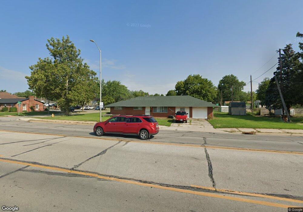
3509 E State Blvd Fort Wayne, IN 46805
Brentwood Park NeighborhoodEstimated Value: $179,000 - $181,102
3
Beds
1
Bath
3,348
Sq Ft
$54/Sq Ft
Est. Value
About This Home
This home is located at 3509 E State Blvd, Fort Wayne, IN 46805 and is currently estimated at $180,276, approximately $53 per square foot. 3509 E State Blvd is a home located in Allen County with nearby schools including Brentwood Elementary School, Lakeside Middle School, and North Side High School.
Ownership History
Date
Name
Owned For
Owner Type
Purchase Details
Closed on
Jan 22, 2003
Sold by
Kimmel Marceil
Bought by
Thong Peter and Thong Linda
Current Estimated Value
Home Financials for this Owner
Home Financials are based on the most recent Mortgage that was taken out on this home.
Original Mortgage
$74,100
Outstanding Balance
$30,998
Interest Rate
6.13%
Estimated Equity
$149,278
Purchase Details
Closed on
Apr 11, 2001
Sold by
National City Bank Of Indiana
Bought by
Kimmel Marceil
Create a Home Valuation Report for This Property
The Home Valuation Report is an in-depth analysis detailing your home's value as well as a comparison with similar homes in the area
Home Values in the Area
Average Home Value in this Area
Purchase History
| Date | Buyer | Sale Price | Title Company |
|---|---|---|---|
| Thong Peter | -- | -- | |
| Kimmel Marceil | -- | -- |
Source: Public Records
Mortgage History
| Date | Status | Borrower | Loan Amount |
|---|---|---|---|
| Open | Thong Peter | $74,100 |
Source: Public Records
Tax History
| Year | Tax Paid | Tax Assessment Tax Assessment Total Assessment is a certain percentage of the fair market value that is determined by local assessors to be the total taxable value of land and additions on the property. | Land | Improvement |
|---|---|---|---|---|
| 2025 | $2,618 | $121,200 | $21,000 | $100,200 |
| 2024 | $2,202 | $114,500 | $21,600 | $92,900 |
| 2022 | $1,724 | $76,700 | $12,200 | $64,500 |
| 2021 | $1,278 | $57,400 | $8,000 | $49,400 |
| 2020 | $1,473 | $55,200 | $8,300 | $46,900 |
| 2019 | $1,142 | $52,700 | $8,600 | $44,100 |
| 2018 | $1,134 | $52,000 | $9,500 | $42,500 |
| 2017 | $1,133 | $51,500 | $10,600 | $40,900 |
| 2016 | $1,115 | $51,400 | $11,200 | $40,200 |
| 2014 | $1,062 | $51,200 | $10,700 | $40,500 |
| 2013 | $1,040 | $50,200 | $11,000 | $39,200 |
Source: Public Records
Map
Nearby Homes
- 2426 White Oak Ave
- 3410 Charlotte Ave
- 3226 Vance Ave
- 2521 Dodge Ave
- 2435 Dodge Ave
- 2429 Dodge Ave
- 2517 Charlotte Ave
- 2141 Dodge Ave
- 2319 Kenwood Ave
- 2315 Kenwood Ave
- 3614 Kirkfield Dr
- 2301 Vance Ave
- 2818 1/2 Reed Rd
- 4420 Highwood Dr
- 2029 Glenwood Ave
- 5110 Eastwick Dr
- 723 Pinehurst Dr
- 3517 Kirkwood Dr
- 4550 Trier Rd
- 2915 N Anthony Blvd
- 2316 Barnhart Ave
- 3523 E State Blvd
- 2320 Barnhart Ave
- 2309 Sherborne Blvd
- 2315 Sherborne Blvd
- 2332 Barnhart Ave
- 2323 Barnhart Ave
- 2321 Sherborne Blvd
- 2329 Barnhart Ave
- 2404 Barnhart Ave
- 3417 E State Blvd
- 2327 Sherborne Blvd
- 3605 E State Blvd
- 2310 Sherborne Blvd
- 2335 Barnhart Ave
- 2316 Sherborne Blvd
- 2412 Barnhart Ave
- 2405 Barnhart Ave
- 2401 Sherborne Blvd
- 2324 Nordholme Ave