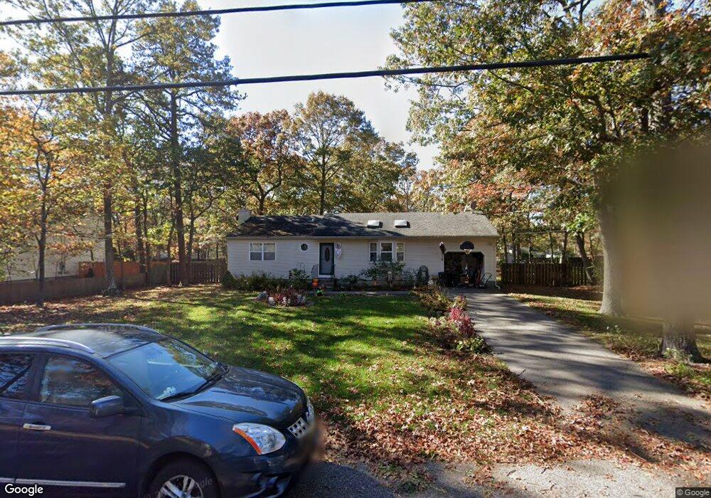
351 Auborn Ave Shirley, NY 11967
Estimated Value: $511,000 - $538,000
3
Beds
1
Bath
1,144
Sq Ft
$455/Sq Ft
Est. Value
About This Home
This home is located at 351 Auborn Ave, Shirley, NY 11967 and is currently estimated at $520,736, approximately $455 per square foot. 351 Auborn Ave is a home located in Suffolk County with nearby schools including Longwood Junior High School, Longwood Middle School, and Longwood Senior High School.
Ownership History
Date
Name
Owned For
Owner Type
Purchase Details
Closed on
Oct 5, 2001
Sold by
Menu Of Homes Inc
Bought by
Pallino George and Pallino Nancy
Current Estimated Value
Home Financials for this Owner
Home Financials are based on the most recent Mortgage that was taken out on this home.
Original Mortgage
$161,400
Outstanding Balance
$63,316
Interest Rate
6.92%
Estimated Equity
$457,420
Purchase Details
Closed on
Dec 20, 2000
Sold by
Korol Antoni
Bought by
Menu Of Homes Inc
Create a Home Valuation Report for This Property
The Home Valuation Report is an in-depth analysis detailing your home's value as well as a comparison with similar homes in the area
Home Values in the Area
Average Home Value in this Area
Purchase History
| Date | Buyer | Sale Price | Title Company |
|---|---|---|---|
| Pallino George | $169,939 | Fidelity National Title Ins | |
| Menu Of Homes Inc | $145,000 | Fidelity National Title Ins |
Source: Public Records
Mortgage History
| Date | Status | Borrower | Loan Amount |
|---|---|---|---|
| Open | Pallino George | $161,400 |
Source: Public Records
Tax History Compared to Growth
Tax History
| Year | Tax Paid | Tax Assessment Tax Assessment Total Assessment is a certain percentage of the fair market value that is determined by local assessors to be the total taxable value of land and additions on the property. | Land | Improvement |
|---|---|---|---|---|
| 2024 | $7,155 | $1,800 | $200 | $1,600 |
| 2023 | $7,155 | $1,800 | $200 | $1,600 |
| 2022 | $6,395 | $1,800 | $200 | $1,600 |
| 2021 | $6,395 | $1,800 | $200 | $1,600 |
| 2020 | $6,568 | $1,800 | $200 | $1,600 |
| 2019 | $6,568 | $0 | $0 | $0 |
| 2018 | $6,222 | $1,800 | $200 | $1,600 |
| 2017 | $6,222 | $1,800 | $200 | $1,600 |
| 2016 | $6,149 | $1,800 | $200 | $1,600 |
| 2015 | -- | $1,800 | $200 | $1,600 |
| 2014 | -- | $1,800 | $200 | $1,600 |
Source: Public Records
Map
Nearby Homes
- 336 Auborn Ave
- 283 W End Ave
- 1330 William Floyd Pkwy
- 313 Decatur Ave
- 334 Carnation Dr
- 34 Belmont Dr
- 84 Ridgewood Dr
- 88 Ridgewood Dr
- 68 Crestwood Dr
- 1276 William Floyd Pkwy
- 188 W End Ave
- 173 W End Ave
- VL Glen Dr
- 380 Wellwood Dr
- 23 Monty Dr Unit 14
- 411 Glen Dr
- 101 Crestwood Dr
- 65 Colin Dr
- 114 W End Ave
- 8 & 11 William Floyd Pkwy
- 355 Auborn Ave
- 345 Auborn Ave
- 357 Auborn Ave
- 341 Auborn Ave
- 266 W End Ave
- 262 W End Ave
- 352 Auborn Ave
- 270 W End Ave
- 260 W End Ave
- 350 Auborn Ave
- 348 Auborn Ave
- 346 Auborn Ave
- 344 Auborn Ave
- 361 Auborn Ave
- 356 Auborn Ave
- 342 Auborn Ave
- 340 Auborn Ave
- 274 W End Ave
- 256 W End Ave
- 335 Auborn Ave Unit 12