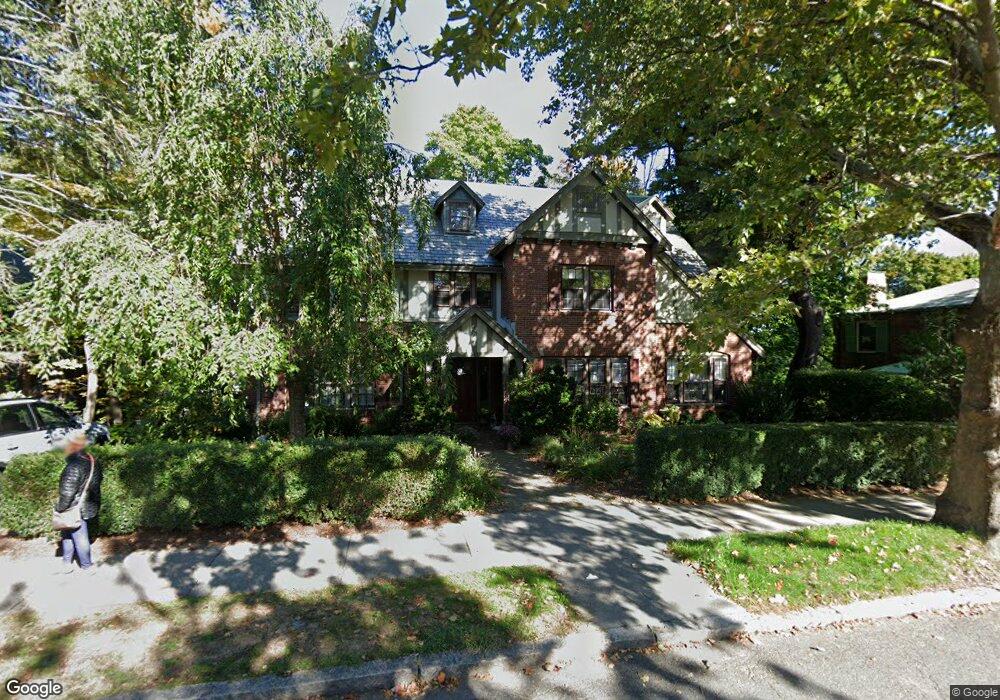
351 Clinton Rd Brookline, MA 02445
Cleveland Circle NeighborhoodEstimated Value: $2,524,000 - $2,724,000
7
Beds
4
Baths
4,256
Sq Ft
$615/Sq Ft
Est. Value
About This Home
This home is located at 351 Clinton Rd, Brookline, MA 02445 and is currently estimated at $2,615,570, approximately $614 per square foot. 351 Clinton Rd is a home located in Norfolk County with nearby schools including John D. Runkle School, Torah Academy, and Shaloh House Jewish Day School.
Ownership History
Date
Name
Owned For
Owner Type
Purchase Details
Closed on
Oct 31, 2003
Sold by
Holmes Gregory L and Holmes Colleen A
Bought by
Sopel George C and Gagan Sarah K
Current Estimated Value
Home Financials for this Owner
Home Financials are based on the most recent Mortgage that was taken out on this home.
Original Mortgage
$840,000
Interest Rate
6.05%
Mortgage Type
Purchase Money Mortgage
Purchase Details
Closed on
Apr 11, 1991
Sold by
Medearis Donald N and Medearis Mary M
Bought by
Holmes Gregory L and Holmes Colleen A
Create a Home Valuation Report for This Property
The Home Valuation Report is an in-depth analysis detailing your home's value as well as a comparison with similar homes in the area
Home Values in the Area
Average Home Value in this Area
Purchase History
| Date | Buyer | Sale Price | Title Company |
|---|---|---|---|
| Sopel George C | $1,050,000 | -- | |
| Holmes Gregory L | $495,000 | -- |
Source: Public Records
Mortgage History
| Date | Status | Borrower | Loan Amount |
|---|---|---|---|
| Open | Holmes Gregory L | $750,000 | |
| Closed | Holmes Gregory L | $840,000 |
Source: Public Records
Tax History Compared to Growth
Tax History
| Year | Tax Paid | Tax Assessment Tax Assessment Total Assessment is a certain percentage of the fair market value that is determined by local assessors to be the total taxable value of land and additions on the property. | Land | Improvement |
|---|---|---|---|---|
| 2025 | $23,136 | $2,344,100 | $1,302,500 | $1,041,600 |
| 2024 | $22,042 | $2,256,100 | $1,252,300 | $1,003,800 |
| 2023 | $20,484 | $2,054,600 | $894,700 | $1,159,900 |
| 2022 | $19,938 | $1,956,600 | $852,000 | $1,104,600 |
| 2021 | $18,438 | $1,881,400 | $819,300 | $1,062,100 |
| 2020 | $16,950 | $1,793,700 | $744,900 | $1,048,800 |
| 2019 | $16,006 | $1,708,200 | $709,400 | $998,800 |
| 2018 | $14,382 | $1,520,300 | $675,400 | $844,900 |
| 2017 | $14,120 | $1,429,100 | $637,100 | $792,000 |
| 2016 | $13,917 | $1,335,600 | $595,500 | $740,100 |
| 2015 | $13,330 | $1,248,100 | $556,400 | $691,700 |
| 2014 | $12,978 | $1,139,400 | $511,800 | $627,600 |
Source: Public Records
Map
Nearby Homes
- 9 Willard Rd
- 17 Strathmore Rd Unit 2
- 8 Strathmore Rd Unit G
- 44 Orkney Rd Unit 3
- 1880 Beacon St Unit 6
- 41 Orkney Rd
- 31 Orkney Rd Unit 54
- 6 Sutherland Rd Unit 41
- 19-21 Orkney Rd
- 2400 Beacon St Unit 112
- 1856 Beacon St Unit 2C
- 47 Englewood Ave
- 3 Englewood Ave Unit 9
- 540 Chestnut Hill Ave
- 65 Strathmore Rd Unit 49
- 37 Englewood Ave Unit 3
- 88 Strathmore Rd Unit 7
- 26 Chiswick Rd Unit 6
- 24 Selkirk Rd Unit 24-4
- 56-58 Selkirk Rd
- 345 Clinton Rd
- 452 Chestnut Hill Ave
- 338 Clinton Rd
- 335 Clinton Rd
- 370 Clinton Rd
- 439 Chestnut Hill Ave
- 459 Chestnut Hill Ave
- 330 Clinton Rd
- 376 Clinton Rd
- 375 Clinton Rd
- 327 Clinton Rd
- 462 Chestnut Hill Ave
- 462 Chestnut Hill Ave Unit 2
- 381 Clinton Rd
- 53 Willard Rd
- 266 Fisher Ave
- 319 Clinton Rd
- 25 Willard Rd
- 473 Chestnut Hill Ave Unit 3
- 8 Penniman Rd