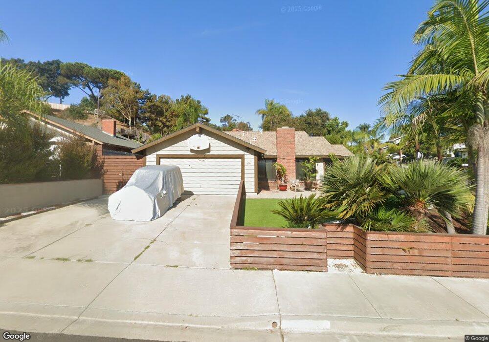
351 Compass Rd Oceanside, CA 92054
Loma Alta NeighborhoodEstimated Value: $842,810 - $1,060,000
3
Beds
2
Baths
1,356
Sq Ft
$727/Sq Ft
Est. Value
About This Home
This home is located at 351 Compass Rd, Oceanside, CA 92054 and is currently estimated at $985,703, approximately $726 per square foot. 351 Compass Rd is a home located in San Diego County with nearby schools including Lincoln Middle School, Oceanside High School, and Pacific View Charter School.
Ownership History
Date
Name
Owned For
Owner Type
Purchase Details
Closed on
Mar 6, 2001
Sold by
Dealy Larry and Dealy Rita
Bought by
Lopez Mario Martin Valdez and Newland Synthia A
Current Estimated Value
Home Financials for this Owner
Home Financials are based on the most recent Mortgage that was taken out on this home.
Original Mortgage
$167,600
Outstanding Balance
$61,211
Interest Rate
7.06%
Estimated Equity
$924,492
Create a Home Valuation Report for This Property
The Home Valuation Report is an in-depth analysis detailing your home's value as well as a comparison with similar homes in the area
Home Values in the Area
Average Home Value in this Area
Purchase History
| Date | Buyer | Sale Price | Title Company |
|---|---|---|---|
| Lopez Mario Martin Valdez | $209,500 | Fidelity National Title Co |
Source: Public Records
Mortgage History
| Date | Status | Borrower | Loan Amount |
|---|---|---|---|
| Open | Lopez Mario Martin Valdez | $167,600 | |
| Closed | Lopez Mario Martin Valdez | $20,950 |
Source: Public Records
Tax History
| Year | Tax Paid | Tax Assessment Tax Assessment Total Assessment is a certain percentage of the fair market value that is determined by local assessors to be the total taxable value of land and additions on the property. | Land | Improvement |
|---|---|---|---|---|
| 2025 | $3,433 | $315,661 | $150,673 | $164,988 |
| 2024 | $3,433 | $309,472 | $147,719 | $161,753 |
| 2023 | $3,326 | $303,405 | $144,823 | $158,582 |
| 2022 | $3,274 | $297,457 | $141,984 | $155,473 |
| 2021 | $3,285 | $291,625 | $139,200 | $152,425 |
| 2020 | $3,184 | $288,636 | $137,773 | $150,863 |
| 2019 | $3,091 | $282,977 | $135,072 | $147,905 |
| 2018 | $3,057 | $277,429 | $132,424 | $145,005 |
| 2017 | $2,999 | $271,990 | $129,828 | $142,162 |
| 2016 | $2,900 | $266,658 | $127,283 | $139,375 |
| 2015 | $2,815 | $262,654 | $125,372 | $137,282 |
| 2014 | $2,706 | $257,510 | $122,917 | $134,593 |
Source: Public Records
Map
Nearby Homes
- 223 Cottingham Ct
- 3325 Tonopah St
- 139 Ely St
- 432 Edgehill Ln Unit 169
- 432 Edgehill Ln Unit 165
- 432 Edgehill Ln Unit 95
- 432 Edgehill Ln Unit 74
- 403 Foussat Rd
- 3218 Carolyn Cir
- 128 Frontier Dr
- 3592 Boussock Ln
- 3621 Vista Campana S
- 3621 Vista Campana S Unit 92
- 3621 Vista Campana S Unit 53
- 3621 Vista Campana S Unit 45
- 3621 Vista Campana S Unit 11
- 3621 Vista Campana S Unit 102
- 3030 Oceanside Blvd Unit 56
- 3030 Oceanside Blvd Unit 44
- 3030 Oceanside Blvd Unit 10
- 355 Compass Rd
- 3545 Sea Ridge Rd
- 3548 Sea Ridge Rd
- 3544 Sea Ridge Rd
- 3541 Sea Ridge Rd
- 352 Compass Rd
- 363 Compass Rd
- 3540 Sea Ridge Rd
- 356 Compass Rd
- 3554 Sea Ridge Rd
- 3536 Sea Ridge Rd
- 3537 Sea Ridge Rd
- 367 Compass Rd
- 360 Compass Rd
- 3558 Sea Ridge Rd
- 3547 Starboard Cir
- 3543 Starboard Cir
- 3533 Sea Ridge Rd
- 3532 Sea Ridge Rd
- 371 Compass Rd
Your Personal Tour Guide
Ask me questions while you tour the home.