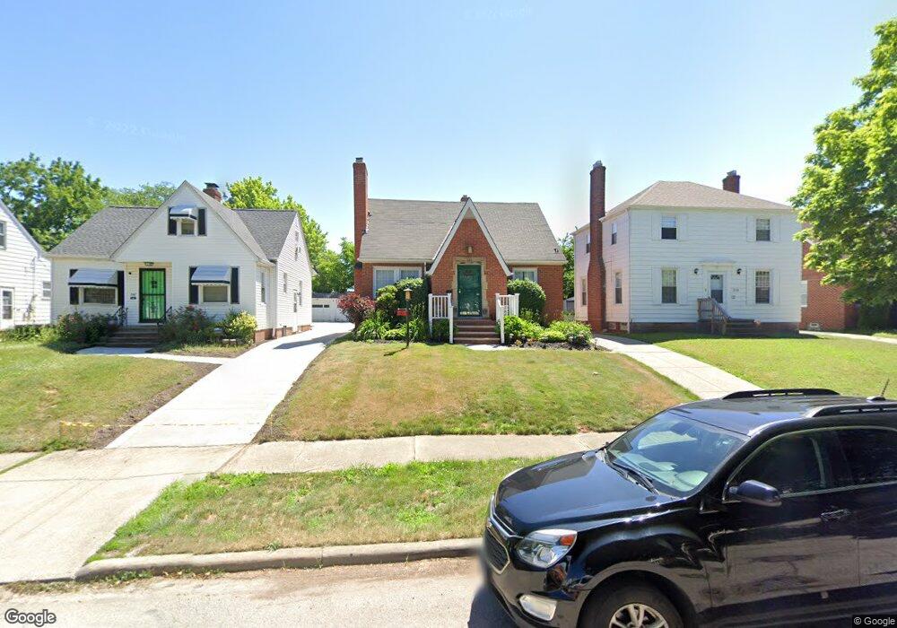
351 E 211th St Euclid, OH 44123
Estimated Value: $136,073 - $169,000
3
Beds
1
Bath
1,224
Sq Ft
$119/Sq Ft
Est. Value
About This Home
This home is located at 351 E 211th St, Euclid, OH 44123 and is currently estimated at $145,768, approximately $119 per square foot. 351 E 211th St is a home located in Cuyahoga County with nearby schools including Arbor Elementary School, Euclid Middle School, and Euclid High School.
Ownership History
Date
Name
Owned For
Owner Type
Purchase Details
Closed on
Feb 27, 1997
Sold by
Zaller Kevin
Bought by
Mason Darlene
Current Estimated Value
Home Financials for this Owner
Home Financials are based on the most recent Mortgage that was taken out on this home.
Original Mortgage
$97,035
Outstanding Balance
$8,134
Interest Rate
7.93%
Mortgage Type
FHA
Estimated Equity
$137,634
Purchase Details
Closed on
Jun 2, 1994
Sold by
Kisley James A
Bought by
Zaller Kevin and Zaller Marilyn
Home Financials for this Owner
Home Financials are based on the most recent Mortgage that was taken out on this home.
Original Mortgage
$85,992
Interest Rate
8.48%
Mortgage Type
New Conventional
Purchase Details
Closed on
Apr 8, 1982
Sold by
Shrout Barbara A
Bought by
Kisley James A
Purchase Details
Closed on
Dec 15, 1981
Sold by
Natto Alice
Bought by
Shrout Barbara A
Purchase Details
Closed on
Jan 1, 1975
Bought by
Natto Alice
Create a Home Valuation Report for This Property
The Home Valuation Report is an in-depth analysis detailing your home's value as well as a comparison with similar homes in the area
Home Values in the Area
Average Home Value in this Area
Purchase History
| Date | Buyer | Sale Price | Title Company |
|---|---|---|---|
| Mason Darlene | $97,000 | -- | |
| Zaller Kevin | $85,900 | -- | |
| Kisley James A | $51,000 | -- | |
| Shrout Barbara A | -- | -- | |
| Natto Alice | -- | -- |
Source: Public Records
Mortgage History
| Date | Status | Borrower | Loan Amount |
|---|---|---|---|
| Open | Mason Darlene | $97,035 | |
| Previous Owner | Zaller Kevin | $85,992 |
Source: Public Records
Tax History
| Year | Tax Paid | Tax Assessment Tax Assessment Total Assessment is a certain percentage of the fair market value that is determined by local assessors to be the total taxable value of land and additions on the property. | Land | Improvement |
|---|---|---|---|---|
| 2025 | $3,200 | $48,055 | $9,450 | $38,605 |
| 2024 | $3,302 | $48,055 | $9,450 | $38,605 |
| 2023 | $2,817 | $32,520 | $6,790 | $25,730 |
| 2022 | $2,753 | $32,515 | $6,790 | $25,725 |
| 2021 | $3,069 | $32,520 | $6,790 | $25,730 |
| 2020 | $3,116 | $30,140 | $6,300 | $23,840 |
| 2019 | $2,802 | $86,100 | $18,000 | $68,100 |
| 2018 | $2,830 | $30,140 | $6,300 | $23,840 |
| 2017 | $3,008 | $26,780 | $5,250 | $21,530 |
| 2016 | $3,015 | $26,780 | $5,250 | $21,530 |
| 2015 | $2,743 | $26,780 | $5,250 | $21,530 |
| 2014 | $2,743 | $26,780 | $5,250 | $21,530 |
Source: Public Records
Map
Nearby Homes
- 21051 S Lake Shore Blvd
- 273 E 208th St
- 324 E 215th St
- 21000 Crystal Ave
- 20931 Priday Ave
- 21670 Crystal Ave
- 285 E 216th St
- 20900 Priday Ave
- 20700 Crystal Ave
- 21971 Crystal Ave
- 144 E 208th St
- 21181 Ball Ave
- 21481 Ball Ave
- 20330 S Lake Shore Blvd
- 226 E 216th St
- 422 Clearview Dr Unit J10
- 21051 Westport Ave
- 115 E 211th St
- 336 E 222nd St
- 421 Kenwood Dr Unit G
Your Personal Tour Guide
Ask me questions while you tour the home.