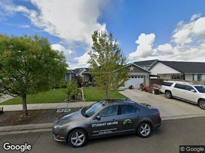
351 Isabel Dr Medford, OR 97501
Northwest Medford NeighborhoodEstimated Value: $368,503 - $381,000
3
Beds
2
Baths
1,768
Sq Ft
$211/Sq Ft
Est. Value
About This Home
This home is located at 351 Isabel Dr, Medford, OR 97501 and is currently estimated at $373,876, approximately $211 per square foot. 351 Isabel Dr is a home with nearby schools including Howard Elementary School, McLoughlin Middle School, and North Medford High School.
Ownership History
Date
Name
Owned For
Owner Type
Purchase Details
Closed on
Sep 8, 2016
Sold by
Anthony Lallo Construction Inc
Bought by
Blesse Joshua D and Blesse Lindsey T
Current Estimated Value
Home Financials for this Owner
Home Financials are based on the most recent Mortgage that was taken out on this home.
Original Mortgage
$203,348
Interest Rate
3.5%
Mortgage Type
FHA
Create a Home Valuation Report for This Property
The Home Valuation Report is an in-depth analysis detailing your home's value as well as a comparison with similar homes in the area
Home Values in the Area
Average Home Value in this Area
Purchase History
| Date | Buyer | Sale Price | Title Company |
|---|---|---|---|
| Blesse Joshua D | $207,100 | Ticor Title Company Of Or |
Source: Public Records
Mortgage History
| Date | Status | Borrower | Loan Amount |
|---|---|---|---|
| Open | Blesse Joshua D | $193,750 | |
| Closed | Blesse Joshua D | $211,200 | |
| Closed | Blesse Joshua D | $203,348 |
Source: Public Records
Tax History Compared to Growth
Tax History
| Year | Tax Paid | Tax Assessment Tax Assessment Total Assessment is a certain percentage of the fair market value that is determined by local assessors to be the total taxable value of land and additions on the property. | Land | Improvement |
|---|---|---|---|---|
| 2024 | $3,293 | $220,430 | $90,120 | $130,310 |
| 2023 | $3,192 | $214,010 | $87,490 | $126,520 |
| 2022 | $3,114 | $214,010 | $87,490 | $126,520 |
| 2021 | $3,033 | $207,780 | $84,940 | $122,840 |
| 2020 | $2,969 | $201,730 | $82,470 | $119,260 |
| 2019 | $2,957 | $190,160 | $77,740 | $112,420 |
| 2018 | $2,825 | $184,630 | $75,480 | $109,150 |
| 2017 | $2,774 | $184,630 | $75,480 | $109,150 |
| 2016 | $750 | $46,940 | $46,940 | $0 |
| 2015 | $443 | $43,430 | $43,430 | $0 |
| 2014 | $407 | $25,460 | $25,460 | $0 |
Source: Public Records
Map
Nearby Homes
- 217 Reanna Way
- 2684 Cummings Ln
- 209 Reanna Way
- 2810 Bear Cub Dr
- 519 Mace Rd
- 2586 Merriman Rd
- 2621 Merriman Rd Unit 3000
- 2587 Merriman Rd Unit 3200
- 2573 Merriman Rd Unit 3300
- 2252 Table Rock Rd Unit SPC 151
- 2252 Table Rock Rd Unit SPC 220
- 2252 Table Rock Rd Unit SPC 228
- 2252 Table Rock Rd Unit SPC 102
- 2252 Table Rock Rd Unit 97
- 2772 Merriman Rd
- 2605 Merriman Rd Unit 3101
- 2336 Table Rock Rd
- 2385 Table Rock Rd Unit 70
- 2385 Table Rock Rd Unit SPC 3
- 2385 Table Rock Rd Unit SPC 81
- 351 Isabel Dr
- 341 Isabell Dr
- 274 Reanna Way
- 266 Reanna Way Unit Lot 9
- 258 Reanna Way
- 331 Isabel Dr
- 331 Isabell Dr
- 240 Reanna Way
- 735 Midway Rd
- 252 Reanna Way
- 321 Isabell Dr
- 321 Isabel Dr
- 236 Reanna Way
- 350 Isabel Dr
- 340 Isabell Dr
- 340 Isabel Dr
- 362 Isabel Dr
- 246 Reanna Way
- 368 Isabel Dr
- 330 Isabell Dr