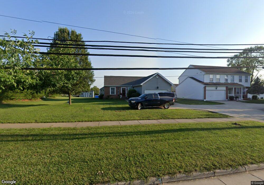
351 MacReady Ave Monroe, OH 45050
Estimated Value: $333,000 - $386,000
3
Beds
3
Baths
1,516
Sq Ft
$241/Sq Ft
Est. Value
About This Home
This home is located at 351 MacReady Ave, Monroe, OH 45050 and is currently estimated at $364,852, approximately $240 per square foot. 351 MacReady Ave is a home located in Butler County with nearby schools including Monroe Primary School, Monroe Elementary School, and Monroe Junior High School.
Ownership History
Date
Name
Owned For
Owner Type
Purchase Details
Closed on
May 26, 2006
Sold by
Maronda Homes Of Ohio Inc
Bought by
Burnside Scott C and Burnside Jennifer M
Current Estimated Value
Home Financials for this Owner
Home Financials are based on the most recent Mortgage that was taken out on this home.
Original Mortgage
$193,125
Outstanding Balance
$111,408
Interest Rate
6.62%
Mortgage Type
FHA
Estimated Equity
$253,444
Create a Home Valuation Report for This Property
The Home Valuation Report is an in-depth analysis detailing your home's value as well as a comparison with similar homes in the area
Home Values in the Area
Average Home Value in this Area
Purchase History
We collect this data history from publicly available records. To have your information removed, we recommend requesting removal directly through your county’s website.
| Date | Buyer | Sale Price | Title Company |
|---|---|---|---|
| Burnside Scott C | $195,000 | Advanced Land Title Agency |
Source: Public Records
Mortgage History
We collect this data history from publicly available records. To have your information removed, we recommend requesting removal directly through your county’s website.
| Date | Status | Borrower | Loan Amount |
|---|---|---|---|
| Open | Burnside Scott C | $193,125 |
Source: Public Records
Tax History
| Year | Tax Paid | Tax Assessment Tax Assessment Total Assessment is a certain percentage of the fair market value that is determined by local assessors to be the total taxable value of land and additions on the property. | Land | Improvement |
|---|---|---|---|---|
| 2025 | $5,334 | $2,370 | $2,370 | -- |
| 2024 | $5,334 | $2,370 | $2,370 | -- |
| 2023 | $5,299 | $2,370 | $2,370 | -- |
| 2022 | $4,089 | $2,370 | $2,370 | $0 |
| 2021 | $3,940 | $2,370 | $2,370 | $0 |
| 2020 | $4,081 | $134,530 | $21,750 | $112,780 |
| 2019 | $3,494 | $50,960 | $2,370 | $48,590 |
| 2018 | $3,921 | $2,370 | $2,370 | $0 |
| 2017 | $4,003 | $2,370 | $2,370 | $0 |
| 2016 | $3,797 | $2,370 | $2,370 | $0 |
| 2015 | $137 | $2,370 | $2,370 | $0 |
| 2014 | $3,343 | $2,370 | $2,370 | $0 |
| 2013 | $3,343 | $2,370 | $2,370 | $0 |
Source: Public Records
Map
Nearby Homes
- 340 MacReady Ave
- 230 Meadowlark Ln
- 32 W Elm St
- 1612 Lakeshore Dr Unit 10302
- 1545 Weatherstone Cir Unit 12302
- 309 Slate Branch Ct
- 3 Lebanon St
- 360 Britton Ln
- 110 Kaitlin Way
- 7180 Carson Rd
- 265 Woodyard Dr
- 325 Easton Manor Dr
- 44 Ridge Wood Dr
- 15 Old Orchard Ln
- 6893 Gaspar Trail
- 110 Stonemill Ct
- 858 S Main St
- 155 Keswick Dr
- 513 Austin Smith Dr
- 145 Stablewatch Ct
- 345 MacReady Ave
- 363 MacReady Ave
- 834 Willowbrook Dr
- 832 Willowbrook Dr
- 335 MacReady Ave
- 381 MacReady Ave
- 360 MacReady Ave
- 330 Sunset Ct
- 350 MacReady Ave
- 830 Willowbrook Dr
- 836 Willowbrook Dr
- 836 Willowbrook Dr Unit 4617
- 370 MacReady Ave
- 325 MacReady Ave
- 828 Willowbrook Dr
- 121 Sunset Ct
- 380 MacReady Ave
- 380 MacReady Ave
- 838 Willowbrook Dr
- 330 MacReady Ave
Your Personal Tour Guide
Ask me questions while you tour the home.