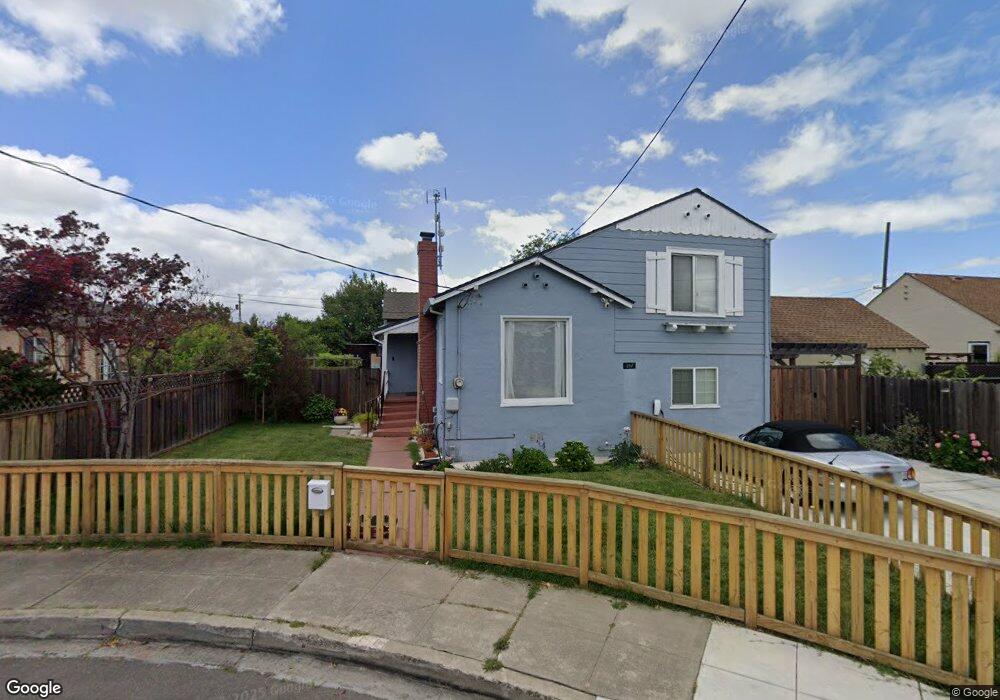
351 Rosewood Ct San Leandro, CA 94577
Farrelly Pond District NeighborhoodEstimated Value: $720,000 - $861,000
4
Beds
2
Baths
1,151
Sq Ft
$696/Sq Ft
Est. Value
About This Home
This home is located at 351 Rosewood Ct, San Leandro, CA 94577 and is currently estimated at $800,910, approximately $695 per square foot. 351 Rosewood Ct is a home located in Alameda County with nearby schools including Washington Elementary School, Bancroft Middle School, and San Leandro High School.
Ownership History
Date
Name
Owned For
Owner Type
Purchase Details
Closed on
Jan 10, 2018
Sold by
Lunge Loran F and Lunge George F
Bought by
Yeung Zi and Chau Dana
Current Estimated Value
Home Financials for this Owner
Home Financials are based on the most recent Mortgage that was taken out on this home.
Original Mortgage
$484,000
Outstanding Balance
$408,020
Interest Rate
3.9%
Mortgage Type
New Conventional
Estimated Equity
$392,890
Purchase Details
Closed on
Mar 24, 2006
Sold by
Lunge Emilyn R F and Lunge George F
Bought by
Lunge Emilyn R and Lunge Loran
Purchase Details
Closed on
Sep 18, 1996
Sold by
Lunge George F and Lunge Emilyn
Bought by
Lunge George F and Lunge Emilyn R
Create a Home Valuation Report for This Property
The Home Valuation Report is an in-depth analysis detailing your home's value as well as a comparison with similar homes in the area
Home Values in the Area
Average Home Value in this Area
Purchase History
| Date | Buyer | Sale Price | Title Company |
|---|---|---|---|
| Yeung Zi | $605,000 | Old Republic Title Company | |
| Lunge Emilyn R | -- | None Available | |
| Lunge George F | -- | -- |
Source: Public Records
Mortgage History
| Date | Status | Borrower | Loan Amount |
|---|---|---|---|
| Open | Yeung Zi | $484,000 |
Source: Public Records
Tax History Compared to Growth
Tax History
| Year | Tax Paid | Tax Assessment Tax Assessment Total Assessment is a certain percentage of the fair market value that is determined by local assessors to be the total taxable value of land and additions on the property. | Land | Improvement |
|---|---|---|---|---|
| 2025 | $9,175 | $688,374 | $206,512 | $481,862 |
| 2024 | $9,175 | $674,877 | $202,463 | $472,414 |
| 2023 | $9,113 | $661,645 | $198,493 | $463,152 |
| 2022 | $8,860 | $648,674 | $194,602 | $454,072 |
| 2021 | $8,585 | $635,957 | $190,787 | $445,170 |
| 2020 | $8,362 | $629,441 | $188,832 | $440,609 |
| 2019 | $8,117 | $617,100 | $185,130 | $431,970 |
| 2018 | $1,526 | $80,589 | $46,328 | $34,261 |
| 2017 | $1,528 | $79,010 | $45,420 | $33,590 |
| 2016 | $1,458 | $77,460 | $44,529 | $32,931 |
| 2015 | $1,432 | $76,297 | $43,861 | $32,436 |
| 2014 | $1,413 | $74,802 | $43,001 | $31,801 |
Source: Public Records
Map
Nearby Homes
- 185 Belleview Dr
- 350 Lafayette Ave
- 182 Garcia Ave
- 337 Farrelly Dr
- 279 Best Ave
- 11070 San Leandro St
- 165 Sunnyside Dr
- 98 Dutton Ave
- 131 Accolade Dr
- 950 Blenheim St
- 1582 Chandler St Unit 131
- 365 Lille Ave
- 1594 Tucker St Unit 56
- 10786 Eagle Ct
- 1060 105th Ave
- 1050 105th Ave
- 1009 106th Ave
- 958 106th Ave
- 1145 Camellia Ct
- 11132 Acalanes Dr
- 361 Rosewood Ct
- 267 Belleview Dr
- 275 Belleview Dr
- 261 Belleview Dr
- 281 Belleview Dr
- 289 Belleview Dr
- 348 Pershing Dr
- 360 Pershing Dr
- 245 Belleview Dr
- 292 Stoakes Ave
- 306 Stoakes Ave
- 368 Pershing Dr
- 293 Belleview Dr
- 290 Stoakes Ave
- 318 Stoakes Ave
- 288 Stoakes Ave
- 352 Rosewood Ct
- 237 Belleview Dr
- 360 Rosewood Ct
- 376 Pershing Dr