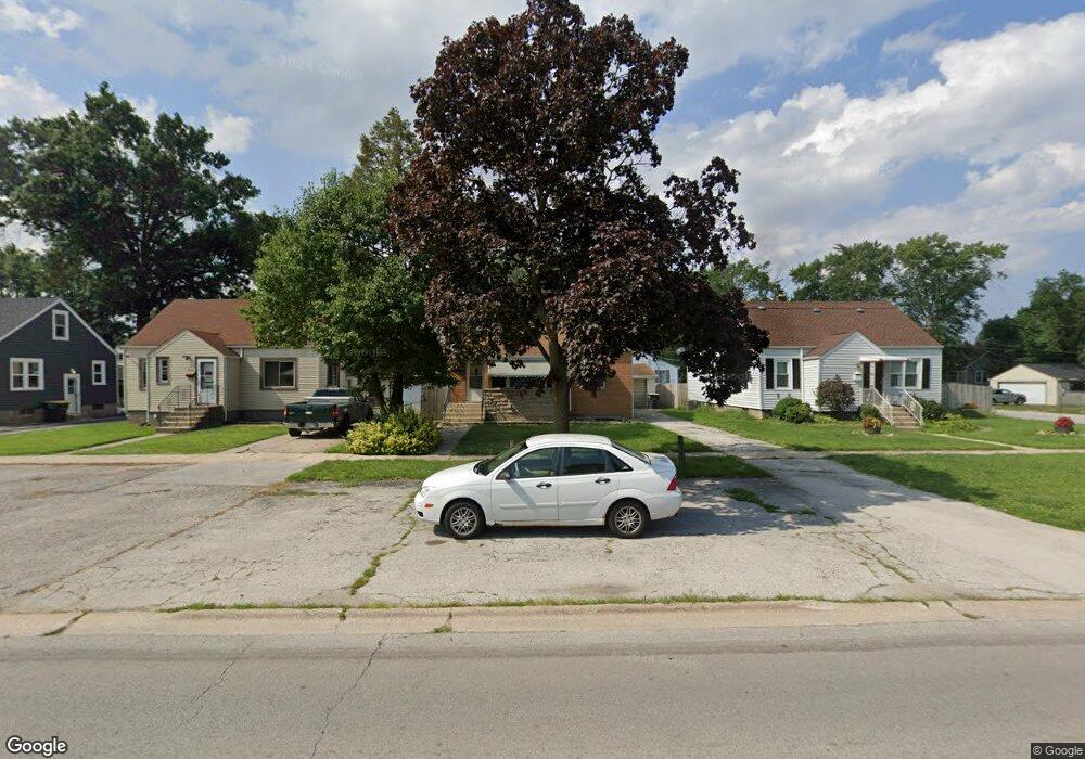
3510 186th St Lansing, IL 60438
Estimated Value: $212,000 - $264,000
4
Beds
3
Baths
1,491
Sq Ft
$152/Sq Ft
Est. Value
About This Home
This home is located at 3510 186th St, Lansing, IL 60438 and is currently estimated at $226,793, approximately $152 per square foot. 3510 186th St is a home located in Cook County with nearby schools including Coolidge Elementary School, Memorial Jr High School, and Thornton Fractnl So High School.
Ownership History
Date
Name
Owned For
Owner Type
Purchase Details
Closed on
Feb 16, 2011
Sold by
Wells Fargo Bank Na
Bought by
Campos Maria G
Current Estimated Value
Purchase Details
Closed on
Feb 5, 2009
Sold by
Erwin Carrie
Bought by
Wells Fargo Bank Na
Purchase Details
Closed on
May 24, 2005
Sold by
Erwin Michael
Bought by
Erwin Carrie
Home Financials for this Owner
Home Financials are based on the most recent Mortgage that was taken out on this home.
Original Mortgage
$150,000
Interest Rate
5.87%
Mortgage Type
Fannie Mae Freddie Mac
Purchase Details
Closed on
Oct 5, 2004
Sold by
Erwin Michael E
Bought by
Donley Erwin Carrie J
Purchase Details
Closed on
Apr 20, 2000
Sold by
Ganz Barbara J
Bought by
Erwin Michael E and Donley Carrie J
Home Financials for this Owner
Home Financials are based on the most recent Mortgage that was taken out on this home.
Original Mortgage
$114,520
Interest Rate
8.19%
Mortgage Type
FHA
Create a Home Valuation Report for This Property
The Home Valuation Report is an in-depth analysis detailing your home's value as well as a comparison with similar homes in the area
Home Values in the Area
Average Home Value in this Area
Purchase History
| Date | Buyer | Sale Price | Title Company |
|---|---|---|---|
| Campos Maria G | $44,000 | Fidelity National Title | |
| Wells Fargo Bank Na | -- | None Available | |
| Erwin Carrie | -- | Stewart Title Of Illinois | |
| Donley Erwin Carrie J | -- | Stewart Title Of Illinois | |
| Erwin Michael E | $120,000 | Professional National Title |
Source: Public Records
Mortgage History
| Date | Status | Borrower | Loan Amount |
|---|---|---|---|
| Previous Owner | Erwin Carrie | $150,000 | |
| Previous Owner | Erwin Michael E | $114,520 |
Source: Public Records
Tax History
| Year | Tax Paid | Tax Assessment Tax Assessment Total Assessment is a certain percentage of the fair market value that is determined by local assessors to be the total taxable value of land and additions on the property. | Land | Improvement |
|---|---|---|---|---|
| 2025 | $7,741 | $16,001 | $3,438 | $12,563 |
| 2024 | $7,741 | $16,001 | $3,438 | $12,563 |
| 2023 | $6,944 | $16,001 | $3,438 | $12,563 |
| 2022 | $6,944 | $10,686 | $2,969 | $7,717 |
| 2021 | $6,754 | $10,684 | $2,968 | $7,716 |
| 2020 | $6,268 | $10,684 | $2,968 | $7,716 |
| 2019 | $6,636 | $11,656 | $2,500 | $9,156 |
| 2018 | $6,513 | $11,656 | $2,500 | $9,156 |
| 2017 | $6,576 | $11,656 | $2,500 | $9,156 |
| 2016 | $6,085 | $11,129 | $2,343 | $8,786 |
| 2015 | $5,654 | $11,129 | $2,343 | $8,786 |
| 2014 | $5,576 | $11,129 | $2,343 | $8,786 |
| 2013 | $5,953 | $13,221 | $2,343 | $10,878 |
Source: Public Records
Map
Nearby Homes
- 18504 Wentworth Ave
- 3620 186th St Unit 405
- 18634 Bernadine St
- 18405 Wentworth Ave Unit 1D
- 18644 William St
- 18443 Maple St
- 3359 Ann St
- 18747 Sherman St
- 18309 Grant St
- 3310 186th St
- 18358 Willow Ln
- 3316 Ann St
- 18215 Wentworth Ave Unit 3B
- 3250 186th St
- 18275 Ada St
- 18 Timrick Dr
- 8546 Hohman Ave
- 3225 Otto St
- 18158 Lange St
- 3527 Lake St
Your Personal Tour Guide
Ask me questions while you tour the home.