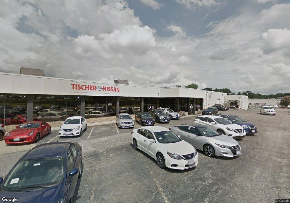
3510 Laurel Fort Meade Rd Laurel, MD 20724
Maryland City NeighborhoodEstimated Value: $7,261,545
--
Bed
--
Bath
18,324
Sq Ft
$396/Sq Ft
Est. Value
About This Home
This home is located at 3510 Laurel Fort Meade Rd, Laurel, MD 20724 and is currently estimated at $7,261,545, approximately $396 per square foot. 3510 Laurel Fort Meade Rd is a home located in Anne Arundel County with nearby schools including Maryland City Elementary School, Meade Middle School, and Meade High School.
Ownership History
Date
Name
Owned For
Owner Type
Purchase Details
Closed on
Aug 13, 2020
Sold by
Car Tis Md Nis Llc
Bought by
198 Property Llc
Current Estimated Value
Home Financials for this Owner
Home Financials are based on the most recent Mortgage that was taken out on this home.
Original Mortgage
$4,520,000
Interest Rate
2.9%
Mortgage Type
Commercial
Purchase Details
Closed on
Dec 15, 2015
Sold by
Pensare Land Development Llc
Bought by
Car Tis Md Nis Llc
Purchase Details
Closed on
Dec 19, 2002
Sold by
Tischer & August Llc
Bought by
Pensare Land Development Llc
Purchase Details
Closed on
Feb 21, 1997
Sold by
Laureldale Business Center
Bought by
Tischer & August Llc
Create a Home Valuation Report for This Property
The Home Valuation Report is an in-depth analysis detailing your home's value as well as a comparison with similar homes in the area
Home Values in the Area
Average Home Value in this Area
Purchase History
| Date | Buyer | Sale Price | Title Company |
|---|---|---|---|
| 198 Property Llc | $5,650,000 | First American Title Ins Co | |
| Car Tis Md Nis Llc | $7,500,000 | First American Title Ins Co | |
| Pensare Land Development Llc | $4,000,000 | -- | |
| Tischer & August Llc | $2,350,000 | -- |
Source: Public Records
Mortgage History
| Date | Status | Borrower | Loan Amount |
|---|---|---|---|
| Previous Owner | 198 Property Llc | $4,520,000 |
Source: Public Records
Tax History Compared to Growth
Tax History
| Year | Tax Paid | Tax Assessment Tax Assessment Total Assessment is a certain percentage of the fair market value that is determined by local assessors to be the total taxable value of land and additions on the property. | Land | Improvement |
|---|---|---|---|---|
| 2025 | $47,431 | $3,995,300 | $1,811,100 | $2,184,200 |
| 2024 | $47,431 | $3,905,000 | $0 | $0 |
| 2023 | $46,117 | $3,814,700 | $0 | $0 |
| 2022 | $43,168 | $3,724,400 | $1,811,100 | $1,913,300 |
| 2021 | $83,336 | $3,580,833 | $0 | $0 |
| 2020 | $80,404 | $3,437,267 | $0 | $0 |
| 2019 | $32,418 | $3,293,700 | $1,646,500 | $1,647,200 |
| 2018 | $32,418 | $3,197,067 | $0 | $0 |
| 2017 | $34,897 | $3,100,433 | $0 | $0 |
| 2016 | -- | $3,003,800 | $0 | $0 |
| 2015 | -- | $2,887,267 | $0 | $0 |
| 2014 | -- | $2,770,733 | $0 | $0 |
Source: Public Records
Map
Nearby Homes
- 231 Brock Bridge Rd
- 229 Old Line Ave
- 235 Brock Bridge Rd
- 237 Brock Bridge Rd
- 266 Brock Bridge Rd
- 242 Elkton S
- 3615 Chase Hills Dr
- 253 Ironshire S
- 3381 Style Ave
- 3381 Horsehead S
- 3500 Old Annapolis Rd
- 3551 Forest Haven Dr
- 9958B Count Fleet Crescent
- 9956B Count Fleet Crescent
- 9954B Count Fleet Crescent
- 9962B Count Fleet Crescent
- 9952B Count Fleet Crescent
- 9958A Count Fleet Crescent
- 9956A Count Fleet Crescent
- 9964B Count Fleet Crescent
- 3506 Laurel Fort Meade Rd
- 8576 Laureldale Dr
- 8574 Laureldale Dr
- 200 Old Line Ave
- 3518 Laurel Fort Meade Rd
- 3397 Laurel Fort Meade Rd
- 202 Old Line Ave
- 203 Old Line Ave
- 8564 Laureldale Dr
- 204 Old Line Ave
- 8560 Laureldale Dr Unit A-B
- 8560 Laureldale Dr Unit 11A 11B
- 8556 Laureldale Dr Unit 13A, 12A, 13B, 12B
- 8556 Laureldale Dr
- 8580 Laureldale Dr
- 205 Old Line Ave
- 206 Old Line Ave
- 3520 Laurel Fort Meade Rd
- 207 Old Line Ave
- 208 Old Line Ave