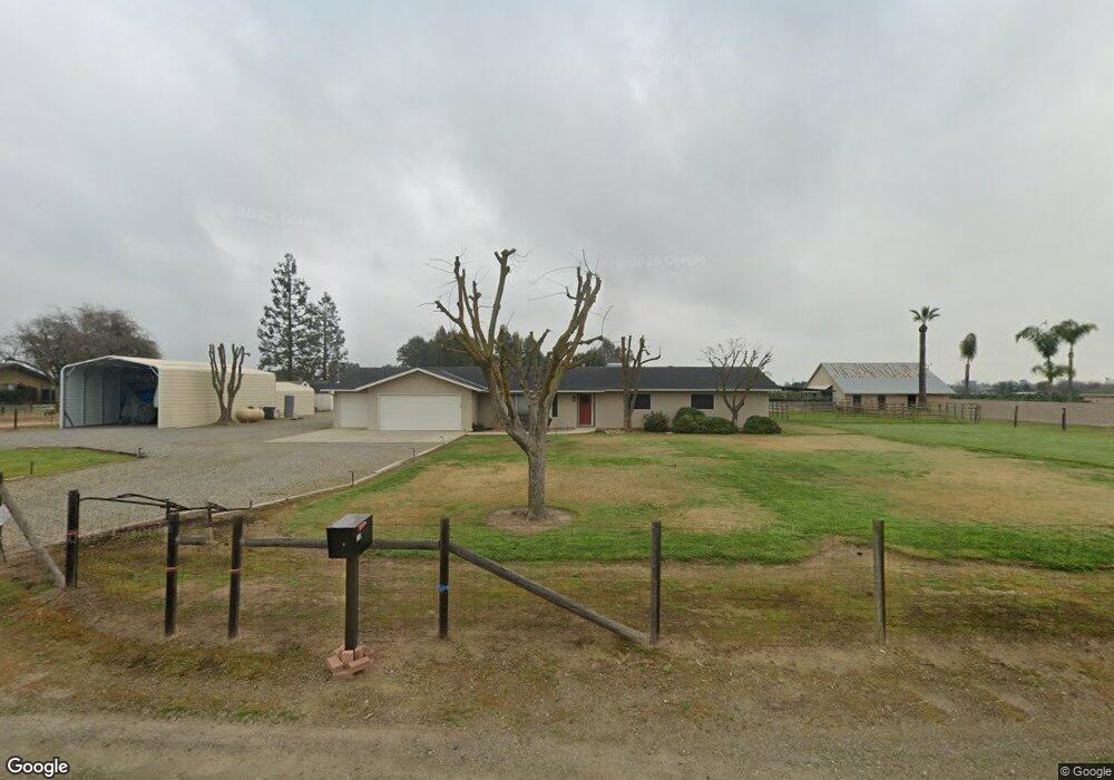
3510 N Del Rey Ave Sanger, CA 93657
Estimated Value: $489,000 - $698,000
3
Beds
2
Baths
1,766
Sq Ft
$347/Sq Ft
Est. Value
About This Home
This home is located at 3510 N Del Rey Ave, Sanger, CA 93657 and is currently estimated at $613,647, approximately $347 per square foot. 3510 N Del Rey Ave is a home located in Fresno County with nearby schools including Fairmont Elementary School, Washington Academic Middle School, and Sanger High School.
Ownership History
Date
Name
Owned For
Owner Type
Purchase Details
Closed on
Feb 15, 1995
Sold by
Barnes Richard A and Barnes Carolyn M
Bought by
Salomonson Robert G and Salomonson Kristine A
Current Estimated Value
Home Financials for this Owner
Home Financials are based on the most recent Mortgage that was taken out on this home.
Original Mortgage
$134,496
Interest Rate
8.6%
Purchase Details
Closed on
Oct 17, 1994
Sold by
Barthuli Wallace D and Barthuli Terry L
Bought by
Barnes Richard A and Barnes Carolyn M
Home Financials for this Owner
Home Financials are based on the most recent Mortgage that was taken out on this home.
Original Mortgage
$64,500
Interest Rate
9.25%
Mortgage Type
Seller Take Back
Create a Home Valuation Report for This Property
The Home Valuation Report is an in-depth analysis detailing your home's value as well as a comparison with similar homes in the area
Home Values in the Area
Average Home Value in this Area
Purchase History
| Date | Buyer | Sale Price | Title Company |
|---|---|---|---|
| Salomonson Robert G | $149,500 | Central Title Company | |
| Barnes Richard A | $64,500 | Central Title Company |
Source: Public Records
Mortgage History
| Date | Status | Borrower | Loan Amount |
|---|---|---|---|
| Previous Owner | Salomonson Robert G | $134,496 | |
| Previous Owner | Barnes Richard A | $64,500 |
Source: Public Records
Tax History Compared to Growth
Tax History
| Year | Tax Paid | Tax Assessment Tax Assessment Total Assessment is a certain percentage of the fair market value that is determined by local assessors to be the total taxable value of land and additions on the property. | Land | Improvement |
|---|---|---|---|---|
| 2025 | $3,330 | $273,519 | $101,439 | $172,080 |
| 2023 | $3,274 | $262,899 | $97,500 | $165,399 |
| 2022 | $3,174 | $257,745 | $95,589 | $162,156 |
| 2021 | $3,145 | $252,692 | $93,715 | $158,977 |
| 2020 | $3,051 | $250,102 | $92,755 | $157,347 |
| 2019 | $2,987 | $245,199 | $90,937 | $154,262 |
| 2018 | $2,861 | $240,392 | $89,154 | $151,238 |
| 2017 | $2,810 | $235,679 | $87,406 | $148,273 |
| 2016 | $2,633 | $231,059 | $85,693 | $145,366 |
| 2015 | $2,654 | $227,589 | $84,406 | $143,183 |
| 2014 | $2,616 | $223,132 | $82,753 | $140,379 |
Source: Public Records
Map
Nearby Homes
- 11335 E Ashlan Ave
- 10911 E Swift Ave
- 4183 N Bodega Bay Rd
- 2630 N Del Rey Ave
- 11722 E Ashlan Ave
- 10615 E Landmark Way
- 3520 N Bethel Ave
- 10952 E Promontory Way
- 2524 N Mccall Ave
- 4626 N Arrow Ridge Way
- 4648 N Windward Way
- 4588 N Mccall Ave
- 4756 N Emerald Peak Dr
- 3245 Lourdes Ave
- 3225 Lourdes Ave
- 4769 N Emerald Peak Dr
- Plan 2321 Modeled at Cielo Ranch - Cielo Ranch 6000s
- Plan 1769 Modeled at Cielo Ranch - Cielo Ranch 5000s
- Plan 1779 at Cielo Ranch - Cielo Ranch 6000s
- 3235 Lourdes Ave Unit 36515531
- 3548 N Del Rey Ave
- 3535 N Del Rey Ave
- 3586 N Del Rey Ave
- 3507 N Markay Ave
- 3601 N Del Rey Ave
- 3545 N Markay Ave
- 3618 N Del Rey Ave
- 3589 N Markay Ave
- 3654 N Del Rey Ave
- 3544 N Markay Ave
- 3506 N Markay Ave
- 3631 N Markay Ave
- 3348 N Del Rey Ave
- 3588 N Markay Ave
- 3681 N Del Rey Ave
- 3690 N Del Rey Ave
- 3673 N Markay Ave
- 3317 Flyer Ln
- 3703 N Del Rey Ave
- 3630 N Markay Ave