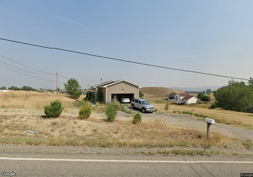
3511 Bitterroot Dr Billings, MT 59105
Billings Heights NeighborhoodEstimated Value: $327,000 - $396,000
3
Beds
1
Bath
1,040
Sq Ft
$344/Sq Ft
Est. Value
About This Home
This home is located at 3511 Bitterroot Dr, Billings, MT 59105 and is currently estimated at $358,113, approximately $344 per square foot. 3511 Bitterroot Dr is a home located in Yellowstone County with nearby schools including Independent Elementary School, Castle Rock Junior High School, and Skyview High School.
Ownership History
Date
Name
Owned For
Owner Type
Purchase Details
Closed on
Dec 23, 2009
Sold by
K M Properties Llc
Bought by
Klein Jeanette K and Kirkbride Isaac J
Current Estimated Value
Home Financials for this Owner
Home Financials are based on the most recent Mortgage that was taken out on this home.
Original Mortgage
$170,000
Outstanding Balance
$120,589
Interest Rate
4.88%
Mortgage Type
Unknown
Estimated Equity
$237,524
Create a Home Valuation Report for This Property
The Home Valuation Report is an in-depth analysis detailing your home's value as well as a comparison with similar homes in the area
Home Values in the Area
Average Home Value in this Area
Purchase History
| Date | Buyer | Sale Price | Title Company |
|---|---|---|---|
| Klein Jeanette K | -- | St |
Source: Public Records
Mortgage History
| Date | Status | Borrower | Loan Amount |
|---|---|---|---|
| Open | Klein Jeanette K | $170,000 |
Source: Public Records
Tax History
| Year | Tax Paid | Tax Assessment Tax Assessment Total Assessment is a certain percentage of the fair market value that is determined by local assessors to be the total taxable value of land and additions on the property. | Land | Improvement |
|---|---|---|---|---|
| 2025 | $2,489 | $344,200 | $97,462 | $246,738 |
| 2024 | $2,489 | $309,000 | $84,990 | $224,010 |
| 2023 | $2,586 | $309,000 | $84,990 | $224,010 |
| 2022 | $2,227 | $239,400 | $0 | $0 |
| 2021 | $2,231 | $239,400 | $0 | $0 |
| 2020 | $1,956 | $214,500 | $0 | $0 |
| 2019 | $1,990 | $214,500 | $0 | $0 |
| 2018 | $1,990 | $197,300 | $0 | $0 |
| 2017 | $1,977 | $197,300 | $0 | $0 |
| 2016 | $1,805 | $189,700 | $0 | $0 |
| 2015 | $1,715 | $189,700 | $0 | $0 |
| 2014 | $1,592 | $88,616 | $0 | $0 |
Source: Public Records
Map
Nearby Homes
- 3415 Cherylon St
- 3520 Cherylon St
- 2719 Strapper Ln
- 2737 Strapper Ln
- 2738 Strapper Ln
- 2743 Strapper Ln
- 2731 Strapper Ln
- B3 L6 Bar 11 Dr
- B3 L5 Bar 11 Dr
- TBD Longhorn Way
- B3 L4A-1 Bar 11 Dr
- B3 L7 Bar 11 Dr
- 1363 Kelsey Ln
- 1368 Kelsey Ln
- 1408 Eugene Ave
- 1375 Kelsey Ln
- 1369 Kelsey Ln
- 1362 Kelsey Ln
- B3 L8 Bar 11 Dr
- 1395 W Eugene Ave
- 3515 Bitterroot Dr
- 3535 Bitterroot Dr
- 3539 Bitterroot Dr
- 1750 Oxbow Cir
- 1738 Oxbow Cir
- 1730 Oxbow Cir
- 1753 Oxbow Cir
- 1751 Oxbow Cir
- 1739 Oxbow Cir
- 1727 Oxbow Cir
- 1632 Wagon Wheel Rd
- 3532 Broken Yoke Dr
- 1715 Oxbow Cir
- 1603 Rawhide Strip
- 3526 Broken Yoke Dr
- 3542 Broken Yoke Dr
- 1609 Rawhide Strip
- 1609 Wagon Wheel Rd
- 1637 Wagon Wheel Rd
- 1535 Rawhide Strip
Your Personal Tour Guide
Ask me questions while you tour the home.