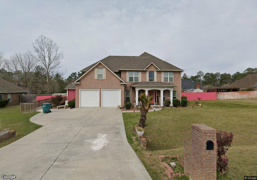
3511 Spence Dr Valdosta, GA 31605
Estimated Value: $371,000 - $453,000
4
Beds
4
Baths
2,862
Sq Ft
$148/Sq Ft
Est. Value
About This Home
This home is located at 3511 Spence Dr, Valdosta, GA 31605 and is currently estimated at $423,315, approximately $147 per square foot. 3511 Spence Dr is a home located in Lowndes County with nearby schools including Dewar Elementary School, Pine Grove Middle School, and Lowndes High School.
Ownership History
Date
Name
Owned For
Owner Type
Purchase Details
Closed on
Aug 22, 2005
Sold by
Stone John L
Bought by
Clark Lendwood A and Clark Cynthia P
Current Estimated Value
Home Financials for this Owner
Home Financials are based on the most recent Mortgage that was taken out on this home.
Original Mortgage
$222,482
Outstanding Balance
$116,722
Interest Rate
5.64%
Mortgage Type
VA
Estimated Equity
$306,593
Purchase Details
Closed on
Sep 17, 2004
Sold by
Rigby Ralph L
Bought by
Stone John L and Stone Deborah L
Purchase Details
Closed on
Oct 5, 1979
Bought by
Rigby Ralph L
Create a Home Valuation Report for This Property
The Home Valuation Report is an in-depth analysis detailing your home's value as well as a comparison with similar homes in the area
Home Values in the Area
Average Home Value in this Area
Purchase History
| Date | Buyer | Sale Price | Title Company |
|---|---|---|---|
| Clark Lendwood A | $222,482 | -- | |
| Stone John L | $25,000 | -- | |
| Rigby Ralph L | -- | -- |
Source: Public Records
Mortgage History
| Date | Status | Borrower | Loan Amount |
|---|---|---|---|
| Open | Clark Lendwood A | $222,482 |
Source: Public Records
Tax History Compared to Growth
Tax History
| Year | Tax Paid | Tax Assessment Tax Assessment Total Assessment is a certain percentage of the fair market value that is determined by local assessors to be the total taxable value of land and additions on the property. | Land | Improvement |
|---|---|---|---|---|
| 2024 | $1,405 | $173,311 | $11,200 | $162,111 |
| 2023 | $1,405 | $158,858 | $11,200 | $147,658 |
| 2022 | $131 | $104,232 | $11,200 | $93,032 |
| 2021 | $159 | $104,232 | $11,200 | $93,032 |
| 2020 | $372 | $101,832 | $8,800 | $93,032 |
| 2019 | $346 | $96,040 | $8,800 | $87,240 |
| 2018 | $474 | $96,040 | $8,800 | $87,240 |
| 2017 | $579 | $96,040 | $8,800 | $87,240 |
| 2016 | $680 | $96,040 | $8,800 | $87,240 |
| 2015 | $743 | $96,040 | $8,800 | $87,240 |
| 2014 | $590 | $87,040 | $8,800 | $78,240 |
Source: Public Records
Map
Nearby Homes
- 3515 Spence Dr
- 3378 Dinky Run
- 4366 Hampton Dr
- 4300 Bemiss Rd
- 4175 Hamilton Cir
- The Palm A Plan at Bemiss Springs
- The Palm B Plan at Bemiss Springs
- 4084 Mulligan Rd
- 6412 Abney Ct
- 6420 Abney Ct
- 3816 Heather Way
- 3848 Zaun Cir
- 3747 Robin Ln
- 3893 Zaun Cir
- 3885 Zaun Cir
- 3735 Studstill Rd
- 4581 4595 Bemiss Rd
- 3999 Brightwell Dr
- 3805 Orchard Way
- 4234 Whithorn Way
- 3362 Dinky Run
- 3509 Spence Dr
- 3366 Dinky Run
- 3358 Dinky Run
- 3512 Spence Dr
- 3508 Spence Dr
- 3516 Spence Dr
- 3340 Dinky Run
- 3370 Dinky Run
- 3519 Spence Dr
- 3502 Spence Dr
- 3520 Spence Dr
- 3357 Dinky Run
- 0 Dinky Run
- 3423 Burkardt Dr
- 3419 Burkardt Dr
- 3334 Dinky Run
- 3524 Spence Dr
- 3427 Burkardt Dr
- 3374 Dinky Run