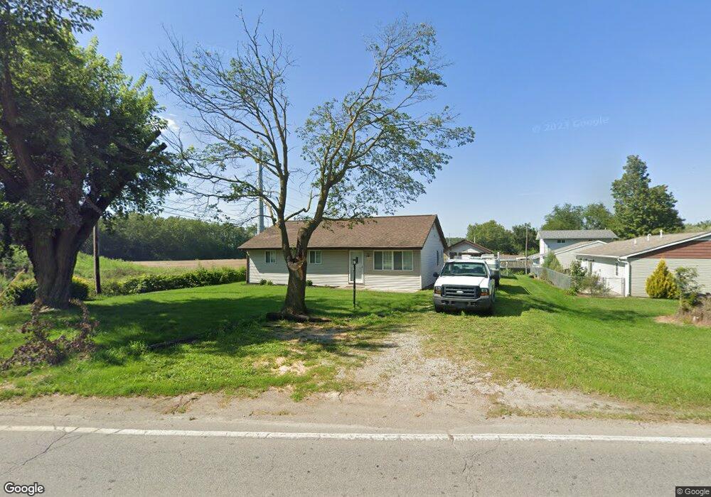
3512 Lower Huntington Rd Fort Wayne, IN 46809
Southwest Fort Wayne NeighborhoodEstimated Value: $143,000 - $168,000
3
Beds
2
Baths
1,120
Sq Ft
$142/Sq Ft
Est. Value
About This Home
This home is located at 3512 Lower Huntington Rd, Fort Wayne, IN 46809 and is currently estimated at $159,047, approximately $142 per square foot. 3512 Lower Huntington Rd is a home located in Allen County with nearby schools including Waynedale Elementary School, Portage Middle School, and Wayne High School.
Ownership History
Date
Name
Owned For
Owner Type
Purchase Details
Closed on
Jan 5, 2009
Sold by
Wells Fargo Bank National Association
Bought by
Olaughlin Michael P
Current Estimated Value
Purchase Details
Closed on
May 21, 2008
Sold by
Garcia Cathy
Bought by
Wells Fargo Bank National Association
Purchase Details
Closed on
May 4, 2004
Sold by
Andress Carol L and Goings Carol L
Bought by
Garcia Cathy
Home Financials for this Owner
Home Financials are based on the most recent Mortgage that was taken out on this home.
Original Mortgage
$75,000
Interest Rate
7.99%
Mortgage Type
Purchase Money Mortgage
Create a Home Valuation Report for This Property
The Home Valuation Report is an in-depth analysis detailing your home's value as well as a comparison with similar homes in the area
Home Values in the Area
Average Home Value in this Area
Purchase History
| Date | Buyer | Sale Price | Title Company |
|---|---|---|---|
| Olaughlin Michael P | -- | Statewide Title Company Inc | |
| Wells Fargo Bank National Association | $62,900 | None Available | |
| Garcia Cathy | -- | Commonwealth-Dreibelbiss Tit |
Source: Public Records
Mortgage History
| Date | Status | Borrower | Loan Amount |
|---|---|---|---|
| Previous Owner | Garcia Cathy | $75,000 |
Source: Public Records
Tax History Compared to Growth
Tax History
| Year | Tax Paid | Tax Assessment Tax Assessment Total Assessment is a certain percentage of the fair market value that is determined by local assessors to be the total taxable value of land and additions on the property. | Land | Improvement |
|---|---|---|---|---|
| 2024 | $1,811 | $75,600 | $21,900 | $53,700 |
| 2022 | $1,438 | $64,000 | $16,900 | $47,100 |
| 2021 | $1,131 | $50,500 | $11,200 | $39,300 |
| 2020 | $1,217 | $55,400 | $11,200 | $44,200 |
| 2019 | $1,211 | $55,400 | $11,200 | $44,200 |
| 2018 | $1,090 | $49,500 | $11,200 | $38,300 |
| 2017 | $1,025 | $46,100 | $11,200 | $34,900 |
| 2016 | $916 | $41,800 | $11,200 | $30,600 |
| 2014 | $410 | $50,800 | $11,200 | $39,600 |
| 2013 | $396 | $50,100 | $11,200 | $38,900 |
Source: Public Records
Map
Nearby Homes
- 7101 Baer Rd
- 6706 Fernwood Ave
- 2600 Blk Timbers Dr
- 3015 Mcarthur Dr
- 3412 Mcarthur Dr
- 3013 Prairie Grove Dr
- 2702 Westward Dr
- 6510 Old Trail Rd
- 2707 Prairie Grove Dr
- 2904 Pinewood Dr
- 6305 Bluffton Rd
- 3001 Sandpoint Rd
- 7324 Springhill Dr
- 5137 Tyrone Rd
- 5205 Kyle Rd
- 1711 Saint Louis Ave
- 97?? Bluffton Rd
- 1805 Lakewood Dr
- 6725 Lakewood Ct
- 1627 Saint Louis Ave
- 6830 Fernwood Ave
- 6826 Fernwood Ave
- 6820 Fernwood Ave
- 3515 Lower Huntington Rd
- 7108 Kumfer Ave
- 3515 Lower Huntington Rd
- 3511 Lower Huntington Rd
- 6812 Fernwood Ave
- 6804 Fernwood Ave
- 6811 Fernwood Ave
- 7116 Kumfer Ave
- 7117 Kumfer Ave
- 6728 Fernwood Ave
- 6803 Fernwood Ave
- 7121 Kumfer Ave
- 7110 Baer Rd
- 7204 Kumfer Ave
- 6727 Fernwood Ave
- 6718 Fernwood Ave
- 7112 Baer Rd