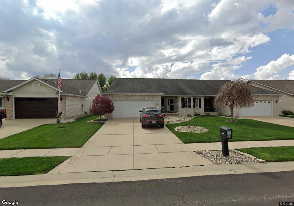
3515 Lytham Dr Springfield, IL 62712
Estimated Value: $227,884 - $269,000
3
Beds
2
Baths
1,538
Sq Ft
$165/Sq Ft
Est. Value
About This Home
This home is located at 3515 Lytham Dr, Springfield, IL 62712 and is currently estimated at $253,221, approximately $164 per square foot. 3515 Lytham Dr is a home located in Sangamon County with nearby schools including Rochester Elementary Ec-1 School, Rochester Elementary School, and Rochester Intermediate School.
Ownership History
Date
Name
Owned For
Owner Type
Purchase Details
Closed on
Feb 24, 2020
Sold by
Storey Debra S
Bought by
Storey Debra S and Fifer Amber Sue
Current Estimated Value
Purchase Details
Closed on
Jan 30, 2020
Sold by
Storey Debra S
Bought by
Storey Debra S
Purchase Details
Closed on
Jun 4, 2018
Sold by
Finnell Kimberly R
Bought by
Storey Debra S and Fifer Amber Sue
Purchase Details
Closed on
May 15, 2009
Purchase Details
Closed on
Jul 22, 2005
Purchase Details
Closed on
Oct 15, 2003
Create a Home Valuation Report for This Property
The Home Valuation Report is an in-depth analysis detailing your home's value as well as a comparison with similar homes in the area
Purchase History
We collect this data history from publicly available records. To have your information removed, we recommend requesting removal directly through your county’s website.
| Date | Buyer | Sale Price | Title Company |
|---|---|---|---|
| Storey Debra S | -- | Reid Law Office Llc | |
| Storey Debra S | -- | Reid Law Office Llc | |
| Storey Debra S | $164,000 | Prairie Land Title | |
| -- | $140,000 | -- | |
| -- | $137,000 | -- | |
| -- | -- | -- |
Source: Public Records
Tax History
| Year | Tax Paid | Tax Assessment Tax Assessment Total Assessment is a certain percentage of the fair market value that is determined by local assessors to be the total taxable value of land and additions on the property. | Land | Improvement |
|---|---|---|---|---|
| 2024 | -- | $65,480 | $8,682 | $56,798 |
| 2023 | -- | $59,810 | $7,930 | $51,880 |
| 2022 | $0 | $56,367 | $7,521 | $48,846 |
| 2021 | $1,568 | $54,256 | $7,239 | $47,017 |
| 2020 | $1,568 | $54,338 | $7,250 | $47,088 |
| 2019 | $1,568 | $54,149 | $7,225 | $46,924 |
| 2018 | $3,135 | $50,502 | $7,191 | $43,311 |
| 2017 | $3,296 | $49,849 | $7,098 | $42,751 |
| 2016 | $3,248 | $49,122 | $6,994 | $42,128 |
| 2015 | $3,213 | $48,534 | $6,910 | $41,624 |
| 2014 | $3,100 | $48,220 | $6,865 | $41,355 |
| 2013 | $3,081 | $47,014 | $6,866 | $40,148 |
Source: Public Records
Map
Nearby Homes
- 3700 Bergamot Dr
- 3725 Indian Grass Ln
- 3806 Bristlecone Dr Unit 2
- 66 White Birch Rd
- 97 White Pine Dr
- 3712 Viking Blvd
- 3805 Viking Blvd
- 180 E Hazel Dell Unit 1
- 2784 Hilltop Rd
- 31 Penacook Dr
- 2632 Hilltop Rd
- 1013 E Lake Shore Dr
- 53 Mishawaka Dr Unit 1
- 8 Riverwood Dr
- 407 Burberry Ln
- 4 Riverwood Dr
- 329-331 Harbor Point Place
- 312 Harbor Point Place
- 314 Harbor Point Place
- 820 W Lake Shore Dr
- 3513 Lytham Dr
- 3517 Lytham Dr
- 3509 Lytham Dr
- 3519 Lytham Dr
- 3508 Hoylake Dr
- 3512 Hoylake Dr
- 3507 Lytham Dr
- 3601 Lytham Dr
- 3512 Lytham Dr
- 3514 Lytham Dr
- 3516 Hoylake Dr
- 3505 Lytham Dr
- 3516 S Lytham
- 3516 Lytham Dr
- 3510 Lytham Dr
- 3508 Lytham Dr
- 3603 Lytham Dr
- 3518 S Lytham
- 3518 Lytham Dr
- 3506 Lytham Dr
Your Personal Tour Guide
Ask me questions while you tour the home.