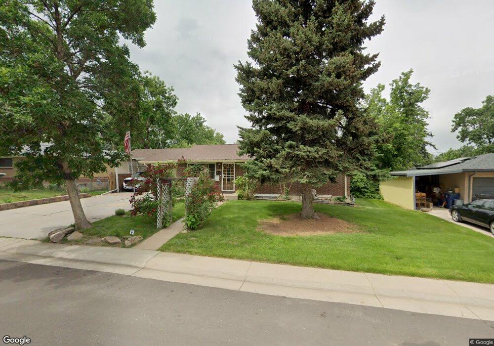
3515 W Union Ave Englewood, CO 80110
Fort Logan NeighborhoodEstimated Value: $439,000 - $583,000
3
Beds
2
Baths
1,394
Sq Ft
$379/Sq Ft
Est. Value
About This Home
This home is located at 3515 W Union Ave, Englewood, CO 80110 and is currently estimated at $528,405, approximately $379 per square foot. 3515 W Union Ave is a home located in Denver County with nearby schools including Kaiser Elementary School, Bear Valley International School, and John F Kennedy High School.
Ownership History
Date
Name
Owned For
Owner Type
Purchase Details
Closed on
Mar 11, 2021
Sold by
Palmer Larry A and Palmer Ellen M
Bought by
The Larry And Ellen Palmer Trust
Current Estimated Value
Purchase Details
Closed on
Oct 9, 2020
Sold by
The Larry And Ellen Palmer Trust
Bought by
Palmer Larry A and Palmer Ellen M
Purchase Details
Closed on
Mar 25, 2013
Sold by
Palmer Ellen Mae
Bought by
Palmer Ellen Mae and Palmer Larry A
Home Financials for this Owner
Home Financials are based on the most recent Mortgage that was taken out on this home.
Original Mortgage
$117,000
Interest Rate
3.62%
Mortgage Type
New Conventional
Purchase Details
Closed on
Aug 6, 1996
Sold by
Hicks Kenneth Ray and Hicks Martha E
Bought by
Palmer Ellen Mae
Create a Home Valuation Report for This Property
The Home Valuation Report is an in-depth analysis detailing your home's value as well as a comparison with similar homes in the area
Home Values in the Area
Average Home Value in this Area
Purchase History
| Date | Buyer | Sale Price | Title Company |
|---|---|---|---|
| The Larry And Ellen Palmer Trust | -- | None Available | |
| Palmer Larry A | -- | None Available | |
| Palmer Ellen Mae | -- | Ct | |
| Palmer Ellen Mae | -- | -- |
Source: Public Records
Mortgage History
| Date | Status | Borrower | Loan Amount |
|---|---|---|---|
| Previous Owner | Palmer Ellen Mae | $117,000 |
Source: Public Records
Tax History Compared to Growth
Tax History
| Year | Tax Paid | Tax Assessment Tax Assessment Total Assessment is a certain percentage of the fair market value that is determined by local assessors to be the total taxable value of land and additions on the property. | Land | Improvement |
|---|---|---|---|---|
| 2024 | $2,409 | $36,240 | $4,440 | $31,800 |
| 2023 | $2,358 | $36,240 | $4,440 | $31,800 |
| 2022 | $1,748 | $28,160 | $8,420 | $19,740 |
| 2021 | $1,687 | $28,980 | $8,670 | $20,310 |
| 2020 | $1,566 | $27,460 | $8,000 | $19,460 |
| 2019 | $1,513 | $27,460 | $8,000 | $19,460 |
| 2018 | $1,215 | $22,490 | $6,040 | $16,450 |
| 2017 | $1,781 | $22,490 | $6,040 | $16,450 |
| 2016 | $1,748 | $20,860 | $6,678 | $14,182 |
| 2015 | $1,674 | $20,860 | $6,678 | $14,182 |
| 2014 | $1,303 | $15,230 | $3,980 | $11,250 |
Source: Public Records
Map
Nearby Homes
- 3395 W Union Ave
- 4749 S Irving St
- 3379 W Wagon Trail Dr
- 3590 W Pimlico Ave
- 3288 W Tufts Ave
- 4621 S Lowell Blvd Unit J6
- 3659 W Union Ave Unit F4
- 4639 S Lowell Blvd Unit B
- 4641 S Lowell Blvd Unit D
- 4643 S Lowell Blvd Unit B
- 3713 W Union Ave
- 4445 S Lowell Blvd
- 4569 S Lowell Blvd Unit B
- 3200 W Chenango Ave
- 3279 W Grand Ave
- 3831 W Rutgers Place
- 3329 W Monmouth Ave
- 4090 W Wagon Trail Dr
- 4671 S Decatur St Unit 232
- 3192 W Monmouth Ave
- 3525 W Union Ave
- 3505 W Union Ave
- 3510 W Union Ave
- 3500 W Union Ave
- 3535 W Union Ave
- 3520 W Union Ave
- 3510 W Pimlico Ave
- 3500 W Pimlico Ave
- 3530 W Union Ave
- 3520 W Pimlico Ave
- 3390 W Union Ave
- 3380 W Pimlico Ave
- 3545 W Union Ave
- 3355 W Union Ave
- 3370 W Union Ave
- 3530 W Pimlico Ave
- 3540 W Union Ave
- 3350 W Pimlico Ave
- 3337 W Wagontrail Dr
- 3343 W Wagontrail Dr