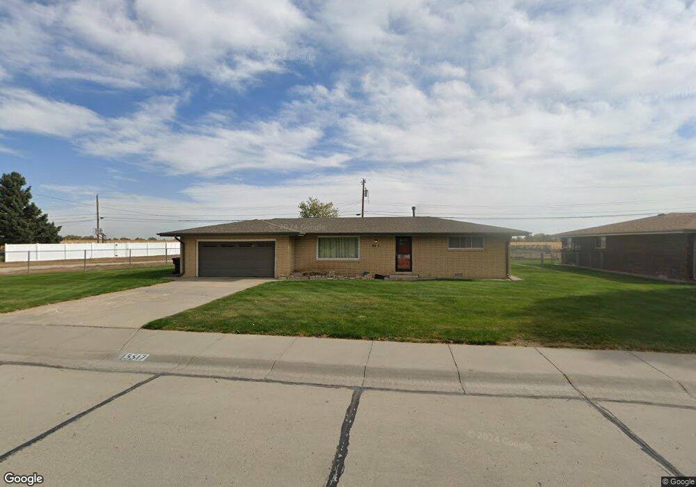
3517 12th Ave Scottsbluff, NE 69361
Estimated Value: $205,659 - $295,000
2
Beds
2
Baths
1,261
Sq Ft
$199/Sq Ft
Est. Value
About This Home
This home is located at 3517 12th Ave, Scottsbluff, NE 69361 and is currently estimated at $250,415, approximately $198 per square foot. 3517 12th Ave is a home located in Scotts Bluff County with nearby schools including Longfellow Elementary School, Bluffs Middle School, and Scottsbluff Senior High School.
Ownership History
Date
Name
Owned For
Owner Type
Purchase Details
Closed on
Mar 2, 2011
Sold by
Thurman Gerald L and Thurman Sharon
Bought by
Green Susan Elaine
Current Estimated Value
Home Financials for this Owner
Home Financials are based on the most recent Mortgage that was taken out on this home.
Original Mortgage
$92,500
Outstanding Balance
$62,679
Interest Rate
4.73%
Mortgage Type
New Conventional
Estimated Equity
$187,736
Create a Home Valuation Report for This Property
The Home Valuation Report is an in-depth analysis detailing your home's value as well as a comparison with similar homes in the area
Home Values in the Area
Average Home Value in this Area
Purchase History
| Date | Buyer | Sale Price | Title Company |
|---|---|---|---|
| Green Susan Elaine | $130,000 | -- |
Source: Public Records
Mortgage History
| Date | Status | Borrower | Loan Amount |
|---|---|---|---|
| Open | Green Susan Elaine | $92,500 |
Source: Public Records
Tax History
| Year | Tax Paid | Tax Assessment Tax Assessment Total Assessment is a certain percentage of the fair market value that is determined by local assessors to be the total taxable value of land and additions on the property. | Land | Improvement |
|---|---|---|---|---|
| 2025 | $1,766 | $146,525 | $30,100 | $116,425 |
| 2024 | $1,716 | $139,265 | $28,385 | $110,880 |
| 2023 | $2,527 | $124,802 | $28,383 | $96,419 |
| 2022 | $2,527 | $124,802 | $28,383 | $96,419 |
| 2021 | $2,385 | $116,037 | $28,383 | $87,654 |
| 2020 | $2,330 | $112,666 | $28,383 | $84,283 |
| 2019 | $2,276 | $110,211 | $28,383 | $81,828 |
| 2018 | $2,179 | $104,858 | $28,383 | $76,475 |
| 2017 | $2,125 | $101,917 | $28,383 | $73,534 |
| 2016 | $2,127 | $101,917 | $28,383 | $73,534 |
| 2015 | $2,112 | $101,917 | $28,383 | $73,534 |
| 2014 | $1,975 | $101,917 | $28,383 | $73,534 |
| 2012 | -- | $101,917 | $28,383 | $73,534 |
Source: Public Records
Map
Nearby Homes
- 1101 Primrose Dr
- 1523 Idlewylde Dr
- 3216 Bluebell Ct
- 3209 8th Ave
- 3918 Hilltop Estate Place
- 908 E 42nd St
- TBD Hillcrest Dr
- 1902 Cheyenne Dr
- 2902 19th Ave
- TBD E 27th St
- 1917 E 29th St
- 522 E 26th St
- TBD U S Highway 26
- 2618 4th Ave
- 3415 Ross Ave
- 2418 6th Ave
- 2426 5th Ave
- Lot 1 31st St
- Lot 2 31st St
- 415 W 36th St
- 3509 12th Ave
- 3501 12th Ave
- 3510 12th Ave
- 3607 12th Ave
- 3518 12th Ave
- 3509 Evergreen Dr
- 3617 12th Ave
- 3612 12th Ave
- 3517 Evergreen Dr
- 3501 Evergreen Dr
- 1202 E 35th St
- 3525 Evergreen Dr
- 1118 E 35th St
- 3701 12th Ave
- 3708 Juniper Dr
- 1110 E 35th St
- 3707 12th Ave
- 3533 Evergreen Dr
- 3401 12th Ave
- 3510 Evergreen Dr