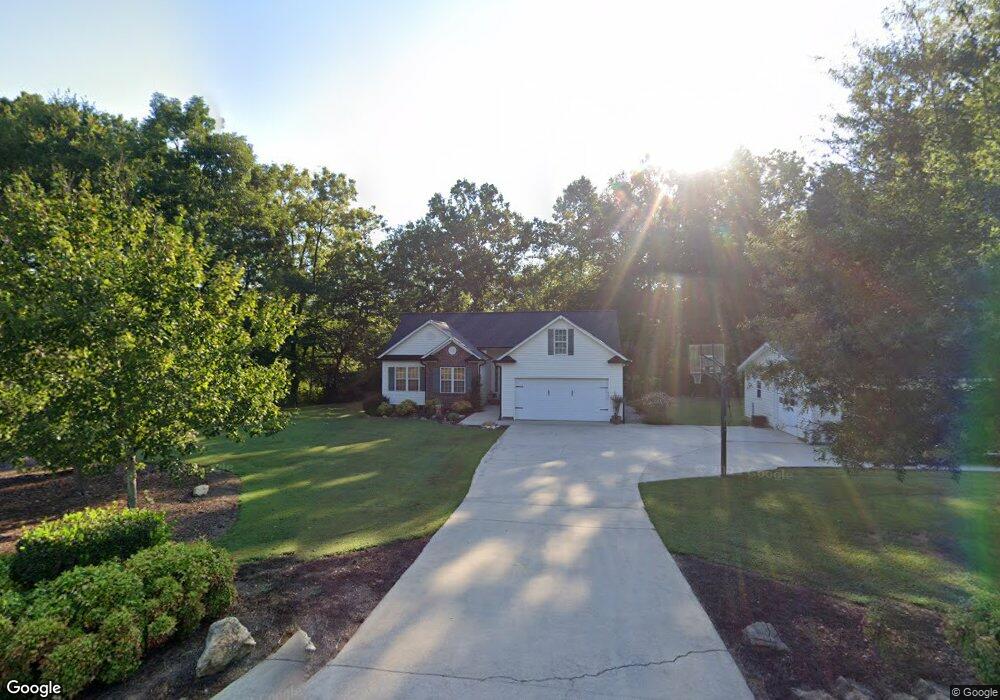
3517 Laboratory Rd Lincolnton, NC 28092
Estimated Value: $300,000 - $379,000
3
Beds
2
Baths
1,180
Sq Ft
$291/Sq Ft
Est. Value
About This Home
This home is located at 3517 Laboratory Rd, Lincolnton, NC 28092 and is currently estimated at $343,615, approximately $291 per square foot. 3517 Laboratory Rd is a home located in Lincoln County with nearby schools including Love Memorial Elementary School, West Lincoln Middle, and West Lincoln High School.
Ownership History
Date
Name
Owned For
Owner Type
Purchase Details
Closed on
Aug 6, 2007
Sold by
Ward Randall S and Ward Susan C
Bought by
Hollis Jason and Hollis Abby C
Current Estimated Value
Home Financials for this Owner
Home Financials are based on the most recent Mortgage that was taken out on this home.
Original Mortgage
$145,000
Outstanding Balance
$91,666
Interest Rate
6.63%
Mortgage Type
New Conventional
Estimated Equity
$251,949
Purchase Details
Closed on
Feb 9, 2001
Bought by
Ward Randall S and Bugg Susan C
Purchase Details
Closed on
Aug 18, 2000
Bought by
Johnson & Associates Real Estate Inc
Create a Home Valuation Report for This Property
The Home Valuation Report is an in-depth analysis detailing your home's value as well as a comparison with similar homes in the area
Home Values in the Area
Average Home Value in this Area
Purchase History
| Date | Buyer | Sale Price | Title Company |
|---|---|---|---|
| Hollis Jason | $170,000 | Chicago Title Insurance Comp | |
| Ward Randall S | $125,900 | -- | |
| Johnson & Associates Real Estate Inc | $23,000 | -- |
Source: Public Records
Mortgage History
| Date | Status | Borrower | Loan Amount |
|---|---|---|---|
| Open | Hollis Jason | $145,000 |
Source: Public Records
Tax History Compared to Growth
Tax History
| Year | Tax Paid | Tax Assessment Tax Assessment Total Assessment is a certain percentage of the fair market value that is determined by local assessors to be the total taxable value of land and additions on the property. | Land | Improvement |
|---|---|---|---|---|
| 2025 | $1,544 | $225,063 | $37,566 | $187,497 |
| 2024 | $1,524 | $225,063 | $37,566 | $187,497 |
| 2023 | $1,519 | $225,063 | $37,566 | $187,497 |
| 2022 | $1,378 | $169,770 | $30,704 | $139,066 |
| 2021 | $1,378 | $169,770 | $30,704 | $139,066 |
| 2020 | $1,229 | $169,770 | $30,704 | $139,066 |
| 2019 | $1,229 | $169,770 | $30,704 | $139,066 |
| 2018 | $1,225 | $0 | $0 | $123,404 |
| 2017 | $1,124 | $152,674 | $29,270 | $123,404 |
| 2016 | $1,124 | $152,674 | $29,270 | $123,404 |
| 2015 | $1,187 | $152,674 | $29,270 | $123,404 |
| 2014 | $1,211 | $163,701 | $32,565 | $131,136 |
Source: Public Records
Map
Nearby Homes
- 000 Riverview Rd
- 3156 Long Shoals Rd
- 2641 Southside Rd
- 1672 Riverview Rd
- 0 Gaston-Webbs Chapel Rd
- 2988 Wesleyan Church Rd
- TBD Southfork Rd
- 2913 & 2901 Wesleyan Church Rd
- 1431 Boy Scout Rd
- 155 Golden Aster Dr
- 1547 Roseland Dr
- 584 Southside Church Rd
- 1690 Roseland Dr
- 2503 Tin Mine Rd
- 1218 W Highview Ln
- 1156 Lyn Well Rd
- 000 Southside Rd
- 170 Whitesides Dr
- 2130 Drive Inn Rd
- 2404 W Highway 150
- #0 Pioneer Trail
- 3579 Laboratory Rd
- 3589 Laboratory Rd
- 1823 Pioneer Trail
- 3441 Laboratory Rd
- 00 Laboratory Rd Unit Lot 2
- 00 Laboratory Rd Unit 1
- 00 Laboratory Rd
- 3425 Laboratory Rd
- 3629 Laboratory Rd
- 3601 Laboratory Rd
- 3430 Laboratory Rd
- 3412 Laboratory Rd
- 3661 Laboratory Rd
- 3402 Laboratory Rd
- 3369 Laboratory Rd
- 2398 Westfork Trail
- 2451 Westfork Trail
- 2505 Westfork Trail
- lot #7 Brookstone Dr Unit 7