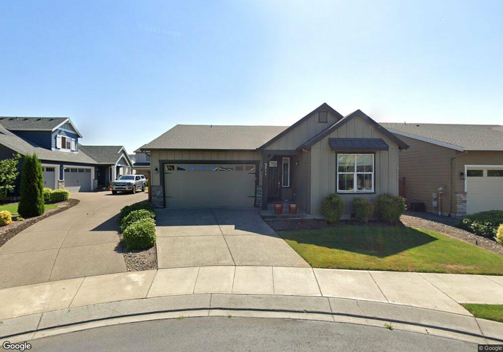
3519 Ardith Ct Forest Grove, OR 97116
Estimated Value: $606,000 - $745,000
4
Beds
3
Baths
2,484
Sq Ft
$267/Sq Ft
Est. Value
About This Home
This home is located at 3519 Ardith Ct, Forest Grove, OR 97116 and is currently estimated at $663,299, approximately $267 per square foot. 3519 Ardith Ct is a home with nearby schools including Harvey Clarke Elementary School, Tom McCall Upper Elementary School, and Neil Armstrong Middle School.
Ownership History
Date
Name
Owned For
Owner Type
Purchase Details
Closed on
Aug 3, 2020
Sold by
Potter Thomas and Potter Linda Gail
Bought by
Potter Thomas and Potter Linda Gail
Current Estimated Value
Home Financials for this Owner
Home Financials are based on the most recent Mortgage that was taken out on this home.
Original Mortgage
$388,500
Outstanding Balance
$343,727
Interest Rate
3.1%
Mortgage Type
New Conventional
Estimated Equity
$319,572
Purchase Details
Closed on
Apr 23, 2019
Sold by
Potter Thomas I and Potter Linda S
Bought by
Potter Thomas I and Potter Linda Gail
Purchase Details
Closed on
Oct 15, 2018
Sold by
Stone Bridge Homes Nw Llc
Bought by
Potter Thomas I and Potter Linda G
Home Financials for this Owner
Home Financials are based on the most recent Mortgage that was taken out on this home.
Original Mortgage
$361,148
Interest Rate
4.5%
Mortgage Type
New Conventional
Create a Home Valuation Report for This Property
The Home Valuation Report is an in-depth analysis detailing your home's value as well as a comparison with similar homes in the area
Home Values in the Area
Average Home Value in this Area
Purchase History
| Date | Buyer | Sale Price | Title Company |
|---|---|---|---|
| Potter Thomas | -- | Ticor Title | |
| Potter Thomas I | -- | None Available | |
| Potter Thomas I | $515,925 | First American Title |
Source: Public Records
Mortgage History
| Date | Status | Borrower | Loan Amount |
|---|---|---|---|
| Open | Potter Thomas | $388,500 | |
| Closed | Potter Thomas I | $361,148 |
Source: Public Records
Tax History Compared to Growth
Tax History
| Year | Tax Paid | Tax Assessment Tax Assessment Total Assessment is a certain percentage of the fair market value that is determined by local assessors to be the total taxable value of land and additions on the property. | Land | Improvement |
|---|---|---|---|---|
| 2026 | $7,050 | $395,900 | -- | -- |
| 2025 | $7,050 | $384,370 | -- | -- |
| 2024 | $6,801 | $373,180 | -- | -- |
| 2023 | $6,801 | $362,320 | $0 | $0 |
| 2022 | $5,947 | $362,320 | $0 | $0 |
| 2021 | $5,870 | $341,530 | $0 | $0 |
| 2020 | $5,838 | $331,590 | $0 | $0 |
| 2019 | $5,708 | $321,940 | $0 | $0 |
| 2018 | $748 | $42,230 | $0 | $0 |
| 2017 | $724 | $41,000 | $0 | $0 |
Source: Public Records
Map
Nearby Homes
- 2035 35th Ave
- 3605 Main St
- Pacific Plan at Davis Estates
- Newport Plan at Davis Estates
- Dahlia Plan at Davis Estates
- Azalea Plan at Davis Estates
- 3609 Main St
- 3594 Ash St Unit Lot 25
- 2043 35th Ave
- 3610 Ash St Unit Lot 17
- 2002 Aspen Ln
- 3522 Arleen Ct
- 2091 35th Ave
- 2081 Silverstone Dr
- 2123 Colby Ln Unit Lot 74
- 2149 36th Unit Lot 59
- 2129 Colby Ln Unit Lot 75
- 3559 Chestnut St Unit Lot 43
- 3613 Chestnut St Unit Lot 48
- 3300 N Main St Unit 110
- 3523 Ardith Ct
- 3530 Main St
- 3520 Main St
- 3527 Ardith Ct
- 3510 Main St
- 2523 Ardith Ct
- 3507 Ardith Ct
- 3511 Ardith Ct
- 3460 Main St
- 3526 Ardith Ct
- 3518 Ardith Ct
- 1941 Silverstone Dr
- 3512 Ardith Ct
- 1935 Silverstone Dr
- 1949 Silverstone Dr
- 2003 35th Ave
- 1961 Silverstone Dr
- 1921 Silverstone Dr
- 2011 35th Ave
- 3463 Main St