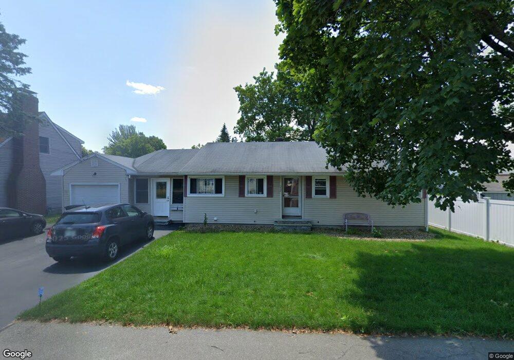
352 Lake St Nashua, NH 03060
South End Nashua NeighborhoodEstimated Value: $516,064 - $528,000
4
Beds
2
Baths
1,532
Sq Ft
$340/Sq Ft
Est. Value
About This Home
This home is located at 352 Lake St, Nashua, NH 03060 and is currently estimated at $521,516, approximately $340 per square foot. 352 Lake St is a home located in Hillsborough County with nearby schools including Fairgrounds Elementary School, Fairgrounds Middle School, and Nashua High School South.
Ownership History
Date
Name
Owned For
Owner Type
Purchase Details
Closed on
Jan 11, 2013
Sold by
Pindeda Linda I
Bought by
Pindeda Linda I
Current Estimated Value
Home Financials for this Owner
Home Financials are based on the most recent Mortgage that was taken out on this home.
Original Mortgage
$226,521
Outstanding Balance
$156,308
Interest Rate
3.36%
Mortgage Type
New Conventional
Estimated Equity
$365,208
Create a Home Valuation Report for This Property
The Home Valuation Report is an in-depth analysis detailing your home's value as well as a comparison with similar homes in the area
Home Values in the Area
Average Home Value in this Area
Purchase History
| Date | Buyer | Sale Price | Title Company |
|---|---|---|---|
| Pindeda Linda I | -- | -- | |
| Pindeda Linda I | -- | -- |
Source: Public Records
Mortgage History
| Date | Status | Borrower | Loan Amount |
|---|---|---|---|
| Open | Pindeda Linda I | $226,521 | |
| Closed | Pindeda Linda I | $226,521 | |
| Previous Owner | Pindeda Linda I | $229,434 |
Source: Public Records
Tax History Compared to Growth
Tax History
| Year | Tax Paid | Tax Assessment Tax Assessment Total Assessment is a certain percentage of the fair market value that is determined by local assessors to be the total taxable value of land and additions on the property. | Land | Improvement |
|---|---|---|---|---|
| 2024 | $7,327 | $460,800 | $139,200 | $321,600 |
| 2023 | $7,126 | $390,900 | $111,400 | $279,500 |
| 2022 | $7,064 | $390,900 | $111,400 | $279,500 |
| 2021 | $5,861 | $252,400 | $74,200 | $178,200 |
| 2020 | $5,707 | $252,400 | $74,200 | $178,200 |
| 2019 | $5,492 | $252,400 | $74,200 | $178,200 |
| 2018 | $5,353 | $252,400 | $74,200 | $178,200 |
| 2017 | $5,385 | $208,800 | $71,300 | $137,500 |
| 2016 | $4,984 | $198,800 | $71,300 | $127,500 |
| 2015 | $4,877 | $198,800 | $71,300 | $127,500 |
| 2014 | $4,752 | $197,600 | $71,300 | $126,300 |
Source: Public Records
Map
Nearby Homes
- 11 Bordeaux St
- 41 New Dunstable Rd Unit 371
- 22 Kern Dr
- 22 New Dunstable Rd Unit 132133
- 247 Main Dunstable Rd
- 6 Lake Ave
- 169A W Hollis St Unit 193
- 4 Henry David Dr Unit 203
- 8 Althea Ln Unit U26
- 97 Linwood St
- 30 Gendron St
- 32-34 Grand Ave
- 63 Dexter St
- 29 Greenwood Dr
- 4 Badger St
- 23 Glen Dr
- 29 Wilder St
- 47 Dogwood Dr Unit U202
- 22 Wilder St
- 599 W Hollis St
- 350 Lake St
- 18 Lund Rd
- 354 Lake St
- 21 Chapman St
- 348 Lake St Unit 10
- 353 Lake St
- 356 Lake St
- 17 Chapman St
- 118-120 Main Dunstable Rd
- 346 Lake St Unit 8
- 118 Main Dunstable Rd Unit 120
- 345 Lake St
- 345 Lake St Unit 347
- 114-116 Main Dunstable Rd
- 114 Main Dunstable Rd Unit 116
- 116 Main Dunstable Rd Unit Second Floor
- 116 Main Dunstable Rd
- 341 Lake St Unit 343
- 341-343 Lake St
- 24 Lund Rd