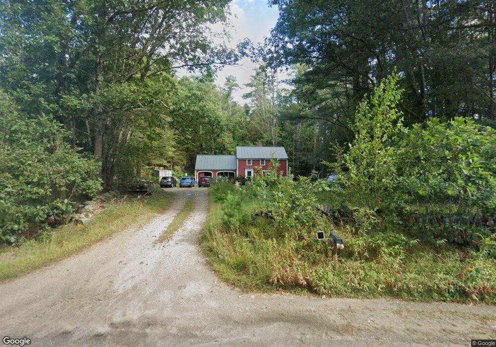
352 Main St Andover, NH 03216
Estimated Value: $374,000 - $429,044
3
Beds
2
Baths
1,946
Sq Ft
$208/Sq Ft
Est. Value
About This Home
This home is located at 352 Main St, Andover, NH 03216 and is currently estimated at $404,511, approximately $207 per square foot. 352 Main St is a home located in Merrimack County with nearby schools including Andover Elementary Middle School, Merrimack Valley High School, and Proctor Academy.
Ownership History
Date
Name
Owned For
Owner Type
Purchase Details
Closed on
Oct 27, 2003
Sold by
Stiles Jason S and Stiles Heather M
Bought by
Kaste James M
Current Estimated Value
Home Financials for this Owner
Home Financials are based on the most recent Mortgage that was taken out on this home.
Original Mortgage
$183,600
Outstanding Balance
$86,004
Interest Rate
6.15%
Estimated Equity
$318,507
Create a Home Valuation Report for This Property
The Home Valuation Report is an in-depth analysis detailing your home's value as well as a comparison with similar homes in the area
Home Values in the Area
Average Home Value in this Area
Purchase History
| Date | Buyer | Sale Price | Title Company |
|---|---|---|---|
| Kaste James M | $204,000 | -- |
Source: Public Records
Mortgage History
| Date | Status | Borrower | Loan Amount |
|---|---|---|---|
| Open | Kaste James M | $183,600 |
Source: Public Records
Tax History Compared to Growth
Tax History
| Year | Tax Paid | Tax Assessment Tax Assessment Total Assessment is a certain percentage of the fair market value that is determined by local assessors to be the total taxable value of land and additions on the property. | Land | Improvement |
|---|---|---|---|---|
| 2024 | $5,518 | $376,900 | $102,900 | $274,000 |
| 2023 | $5,063 | $220,600 | $67,700 | $152,900 |
| 2022 | $4,675 | $220,600 | $67,700 | $152,900 |
| 2021 | $4,613 | $220,600 | $67,700 | $152,900 |
| 2020 | $4,708 | $220,600 | $67,700 | $152,900 |
| 2019 | $4,774 | $220,600 | $67,700 | $152,900 |
| 2018 | $4,388 | $191,300 | $63,800 | $127,500 |
| 2017 | $4,364 | $190,900 | $63,800 | $127,100 |
| 2016 | $4,059 | $190,900 | $63,800 | $127,100 |
| 2015 | $3,795 | $190,900 | $63,800 | $127,100 |
| 2014 | $3,891 | $190,900 | $63,800 | $127,100 |
| 2013 | $3,662 | $195,300 | $72,000 | $123,300 |
Source: Public Records
Map
Nearby Homes
- 19 Ives
- 58 Main St
- 106 Lead Mine Rd
- 151 Beech Hill Rd
- 192 Beech Hill Rd
- 97 Salisbury Hwy
- 2 Monticello Dr
- 32 Monticello Dr
- 221 Campground Rd
- Lot 8 Stone Bridge Rd
- 00 New Canada Rd Unit 7
- 516 W Salisbury Rd
- 760 Racoon Hill Rd
- 62 Patterson Rd
- 375 New Canada Rd
- 133 Nh Route 4a
- 0 Howe Rd Unit 4996459
- 0 Quiet Cove Way Unit 5
- Lot 3 Kimpton Brook Rd
- 0 Putney Rd Unit 433
- 362 Main St
- 4 Bridge Rd
- 332 Main St
- 695 Main St
- 328 Main St
- 328 Main St Unit HOUSE
- 328 Main St Unit Cottg.
- 328 Main St Unit CABIN
- 328 Main St Unit B (Carriage House)
- 1 Bridge Rd
- 13 Bridge Rd
- 391 Main St
- 394 Main St
- 315 Main St
- 308 Main St
- 573 New Hampshire 11
- 403 Main St
- 298 Main St
- 406 Main St
- 61 Bridge Rd