Estimated Value: $221,000 - $282,000
3
Beds
1
Bath
1,652
Sq Ft
$149/Sq Ft
Est. Value
About This Home
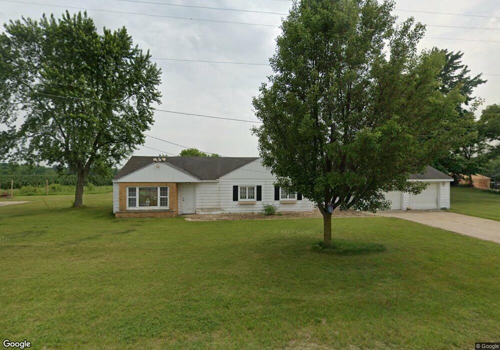
This home is located at 352 W 136th St, Grant, MI 49327 and is currently estimated at $246,625, approximately $149 per square foot. 352 W 136th St is a home located in Newaygo County with nearby schools including Grant Elementary School, Grant Primary Center, and Grant Middle School.
Ownership History
Date
Name
Owned For
Owner Type
Purchase Details
Closed on
Oct 4, 2022
Sold by
Vandepanne Jenne Marie
Bought by
Rodriguez Dominic
Current Estimated Value
Purchase Details
Closed on
Mar 2, 2015
Sold by
Bush Jenne Marie
Bought by
Bush Ian William
Purchase Details
Closed on
May 21, 2010
Sold by
Churchill Estates
Bought by
Bush Ian W
Purchase Details
Closed on
Jun 2, 2005
Sold by
Federal Home Loan
Bought by
Churchill Estates
Purchase Details
Closed on
May 4, 2004
Sold by
Ransier Gary A and Ransier Denise
Bought by
Federal Home Loan Mortgage Corporation
Purchase Details
Closed on
Jun 7, 1999
Sold by
Cook Betty Estate
Bought by
Ransier Gary A
Create a Home Valuation Report for This Property
The Home Valuation Report is an in-depth analysis detailing your home's value as well as a comparison with similar homes in the area
Home Values in the Area
Average Home Value in this Area
Purchase History
| Date | Buyer | Sale Price | Title Company |
|---|---|---|---|
| Rodriguez Dominic | $115,000 | -- | |
| Bush Ian William | -- | -- | |
| Bush Ian W | -- | -- | |
| Churchill Estates | $68,300 | -- | |
| Federal Home Loan Mortgage Corporation | $90,962 | -- | |
| Ransier Gary A | $95,000 | -- |
Source: Public Records
Tax History Compared to Growth
Tax History
| Year | Tax Paid | Tax Assessment Tax Assessment Total Assessment is a certain percentage of the fair market value that is determined by local assessors to be the total taxable value of land and additions on the property. | Land | Improvement |
|---|---|---|---|---|
| 2025 | $1,981 | $100,600 | $0 | $0 |
| 2024 | $8 | $84,600 | $0 | $0 |
| 2023 | $765 | $67,500 | $0 | $0 |
| 2022 | $1,307 | $61,400 | $0 | $0 |
| 2021 | $1,301 | $60,700 | $0 | $0 |
| 2020 | $1,273 | $57,900 | $0 | $0 |
| 2019 | $1,218 | $54,000 | $0 | $0 |
| 2018 | $1,245 | $46,700 | $0 | $0 |
| 2017 | $1,262 | $44,600 | $0 | $0 |
| 2016 | $1,236 | $44,300 | $0 | $0 |
| 2015 | -- | $43,800 | $0 | $0 |
| 2014 | -- | $41,200 | $0 | $0 |
Source: Public Records
Map
Nearby Homes
- 14074 S Elder Ave
- 17474 Connor Cir
- 12536 S Mason Dr
- 10201 Mason Dr
- 953 E 136th St
- 151 & 153 Clark St
- 185 E Commerce St
- Lot 19 S Elder Ave
- 14186 S Mocking Bird Ln
- 122 Lincoln St
- 86 W State Rd
- 17090 Kenowa Ave
- 17197 E Moore Rd
- 3500 Northkent Pine Dr
- 12017 Mcclelland Ave
- 17760 White Rd
- Charlotte Plan at East Peach
- Hampton Plan at East Peach
- Oxford Plan at East Peach
- Reno Plan at East Peach
- 13606 S Mason Dr
- 351 W 136th St Unit 6 & 5
- 351 W 136th St Unit 6
- 351 W 136th St Unit 5 &
- 351 W 136th St Unit 1B
- 351 W 136th St Unit 3
- 351 W 136th St Unit 5 & 6
- 13636 S Mason Dr
- 13656 Mason Dr
- 415 W 136th St
- 275 W 136th St
- 13653 Mason Dr
- 443 W 136th St
- 13526 S Mason Dr
- 13675 S Mason Dr
- 13712 S Mason Dr
- 211 W 136th St
- 445 W 136th St
- 13685 S Mason Dr
- 467 W 136th St