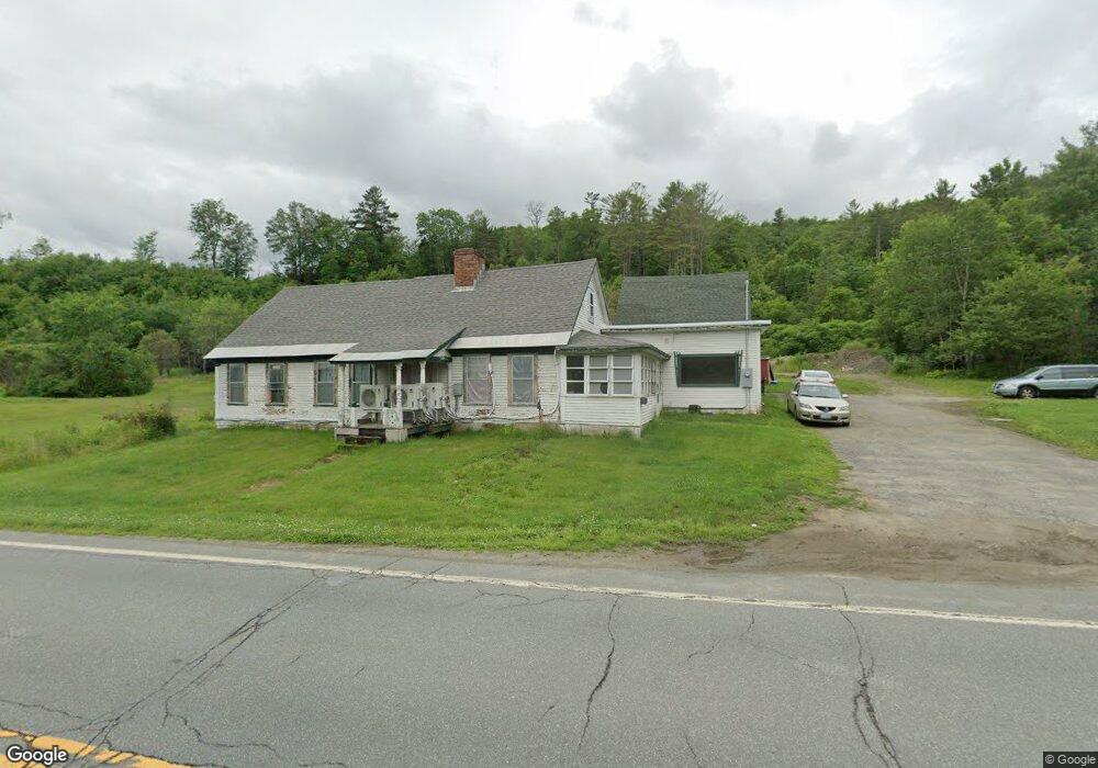
3521 Route 302 Lisbon, NH 03585
Estimated Value: $274,000 - $556,000
3
Beds
1
Bath
2,500
Sq Ft
$162/Sq Ft
Est. Value
About This Home
This home is located at 3521 Route 302, Lisbon, NH 03585 and is currently estimated at $405,673, approximately $162 per square foot. 3521 Route 302 is a home located in Grafton County with nearby schools including Lisbon Regional Middle School, North Country Charter Academy (M), and North Country Charter Academy.
Ownership History
Date
Name
Owned For
Owner Type
Purchase Details
Closed on
Nov 5, 2020
Sold by
Parker Stanley B and Parke Catherine T
Bought by
Sbp Investment Prop Llc
Current Estimated Value
Home Financials for this Owner
Home Financials are based on the most recent Mortgage that was taken out on this home.
Original Mortgage
$59,200
Outstanding Balance
$52,536
Interest Rate
2.9%
Mortgage Type
New Conventional
Estimated Equity
$353,137
Purchase Details
Closed on
Feb 15, 2007
Sold by
Little Richard A and Little Irene G
Bought by
Parker Stanley B and Parker Catherine T
Home Financials for this Owner
Home Financials are based on the most recent Mortgage that was taken out on this home.
Original Mortgage
$100,000
Interest Rate
6.24%
Mortgage Type
Purchase Money Mortgage
Create a Home Valuation Report for This Property
The Home Valuation Report is an in-depth analysis detailing your home's value as well as a comparison with similar homes in the area
Home Values in the Area
Average Home Value in this Area
Purchase History
| Date | Buyer | Sale Price | Title Company |
|---|---|---|---|
| Sbp Investment Prop Llc | $74,000 | None Available | |
| Parker Stanley B | $125,000 | -- |
Source: Public Records
Mortgage History
| Date | Status | Borrower | Loan Amount |
|---|---|---|---|
| Open | Sbp Investment Prop Llc | $59,200 | |
| Previous Owner | Parker Stanley B | $100,000 |
Source: Public Records
Tax History Compared to Growth
Tax History
| Year | Tax Paid | Tax Assessment Tax Assessment Total Assessment is a certain percentage of the fair market value that is determined by local assessors to be the total taxable value of land and additions on the property. | Land | Improvement |
|---|---|---|---|---|
| 2024 | $5,338 | $267,150 | $57,350 | $209,800 |
| 2023 | $4,515 | $131,798 | $31,298 | $100,500 |
| 2022 | $4,518 | $131,798 | $31,298 | $100,500 |
| 2021 | $4,278 | $131,918 | $31,418 | $100,500 |
| 2020 | $4,475 | $131,918 | $31,418 | $100,500 |
| 2019 | $4,046 | $131,921 | $31,421 | $100,500 |
| 2018 | $3,951 | $125,747 | $35,047 | $90,700 |
| 2016 | $3,559 | $124,084 | $34,884 | $89,200 |
| 2015 | $3,557 | $124,017 | $34,817 | $89,200 |
| 2014 | $3,665 | $124,048 | $34,848 | $89,200 |
| 2012 | $4,477 | $138,145 | $40,945 | $97,200 |
Source: Public Records
Map
Nearby Homes
- 113 Buck Ridge Rd
- 00 Buck Ridge Rd Unit A03 & A04
- 00 Buck Ridge and Catterall Rd Unit A03 & A04
- Lot 4 Catterall Rd
- 00 Catterall Rd Unit A03 & A04
- 74-44 Slate Ledge Rd
- 324 Crane Hill Rd
- 99 Girard Rd
- 92-29 Birchcroft Dr
- 000 Dells Rd Unit 1
- 877 St Johnsbury Rd
- 10 Harvest Ct
- 166 Riverside Dr
- 60-70 Meadow St
- 165 Bethlehem Rd
- 134 Cottage St
- 194 Main St
- 251 Bethlehem Rd
- 36 MacIver Rd
- 33 Pleasant St
- 3541 Route 302
- 3541 U S 302
- 469 Mount Eustis Rd
- 3625 Route 302
- 3415 Route 302
- 400 Mount Eustis Rd
- 370 Mount Eustis Rd
- 373 Mount Eustis Rd
- 1713 Meadow St
- 1710 Meadow St
- 1678 Meadow St
- 330 Mount Eustis Rd
- 1599 Mount Eustis Rd
- 3331 Route 302
- 3321 Route 302
- 3299 Route 302
- 289 Mount Eustis Rd
- 1516 Mount Eustis Rd
- 300 Mount Eustis Rd
- Lots 9,12,13 Mount Eustis Rd Unit Map 33 Lots 9,12,13