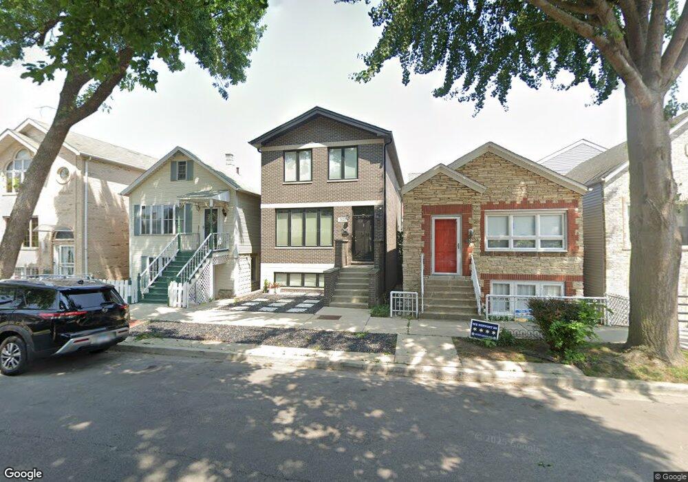
3521 S Lowe Ave Chicago, IL 60609
Bridgeport NeighborhoodEstimated Value: $582,000 - $889,000
4
Beds
3
Baths
2,040
Sq Ft
$369/Sq Ft
Est. Value
About This Home
This home is located at 3521 S Lowe Ave, Chicago, IL 60609 and is currently estimated at $751,753, approximately $368 per square foot. 3521 S Lowe Ave is a home located in Cook County with nearby schools including McClellan Elementary School, Bridgeport Catholic Academy - South Campus, and De La Salle Institute - Lourdes Hall Campus.
Ownership History
Date
Name
Owned For
Owner Type
Purchase Details
Closed on
Oct 22, 2013
Sold by
The Mccloat Tarver Patnership
Bought by
Sheehan David and Sheehan Erin
Current Estimated Value
Home Financials for this Owner
Home Financials are based on the most recent Mortgage that was taken out on this home.
Original Mortgage
$405,015
Outstanding Balance
$295,245
Interest Rate
3.75%
Mortgage Type
FHA
Estimated Equity
$456,508
Purchase Details
Closed on
Feb 22, 2013
Sold by
Kelly Molloy John and Kelly Molly
Bought by
The Mccloat Tarver Partnership
Purchase Details
Closed on
May 23, 2008
Sold by
Thelen Betty Ann
Bought by
Molloy John and Molloy Kelly
Create a Home Valuation Report for This Property
The Home Valuation Report is an in-depth analysis detailing your home's value as well as a comparison with similar homes in the area
Home Values in the Area
Average Home Value in this Area
Purchase History
| Date | Buyer | Sale Price | Title Company |
|---|---|---|---|
| Sheehan David | $419,000 | Cti | |
| The Mccloat Tarver Partnership | $119,000 | None Available | |
| Molloy John | $260,000 | Ticor Title Insurance Co |
Source: Public Records
Mortgage History
| Date | Status | Borrower | Loan Amount |
|---|---|---|---|
| Open | Sheehan David | $405,015 |
Source: Public Records
Tax History Compared to Growth
Tax History
| Year | Tax Paid | Tax Assessment Tax Assessment Total Assessment is a certain percentage of the fair market value that is determined by local assessors to be the total taxable value of land and additions on the property. | Land | Improvement |
|---|---|---|---|---|
| 2024 | $10,694 | $70,000 | $16,219 | $53,781 |
| 2023 | $10,403 | $54,000 | $13,094 | $40,906 |
| 2022 | $10,403 | $54,000 | $13,094 | $40,906 |
| 2021 | $10,189 | $53,999 | $13,094 | $40,905 |
| 2020 | $9,027 | $43,626 | $13,094 | $30,532 |
| 2019 | $9,159 | $49,018 | $13,094 | $35,924 |
| 2018 | $9,004 | $49,018 | $13,094 | $35,924 |
| 2017 | $9,231 | $46,255 | $10,416 | $35,839 |
| 2016 | $8,764 | $46,255 | $10,416 | $35,839 |
| 2015 | $7,995 | $46,255 | $10,416 | $35,839 |
| 2014 | $7,774 | $41,900 | $8,928 | $32,972 |
| 2013 | $2,669 | $14,677 | $8,928 | $5,749 |
Source: Public Records
Map
Nearby Homes
- 3549 S Lowe Ave
- 3600 S Union Ave
- 3505 S Parnell Ave Unit D
- 3416 S Union Ave
- 3405 S Union Ave
- 3640 S Lowe Ave
- 3357 S Emerald Ave
- 3450 S Halsted St Unit 406
- 3450 S Halsted St Unit 416
- 3600 S Halsted St
- 3315 S Lowe Ave
- 3700 S Normal Ave
- 3727 S Lowe Ave
- 3322 S Parnell Ave
- 835 W 35th St
- 3247 S Emerald Ave
- 3812 S Wallace St
- 3246 S Normal Ave
- 917 W 34th Place
- 455 W 38th St
- 3521 S Lowe Ave
- 3523 S Lowe Ave
- 3517 S Lowe Ave
- 3525 S Lowe Ave
- 3515 S Lowe Ave
- 3527 S Lowe Ave
- 3513 S Lowe Ave
- 3511 S Lowe Ave
- 3529 S Lowe Ave
- 3531 S Lowe Ave
- 3531 S Lowe Ave Unit 2
- 3535 S Lowe Ave Unit 1
- 3518 S Wallace St
- 3516 S Wallace St
- 3514 S Wallace St
- 3514 S Wallace St Unit 2
- 3524 S Wallace St
- 3537 S Lowe Ave
- 3524 S Lowe Ave Unit 3
- 3524 S Lowe Ave Unit 2