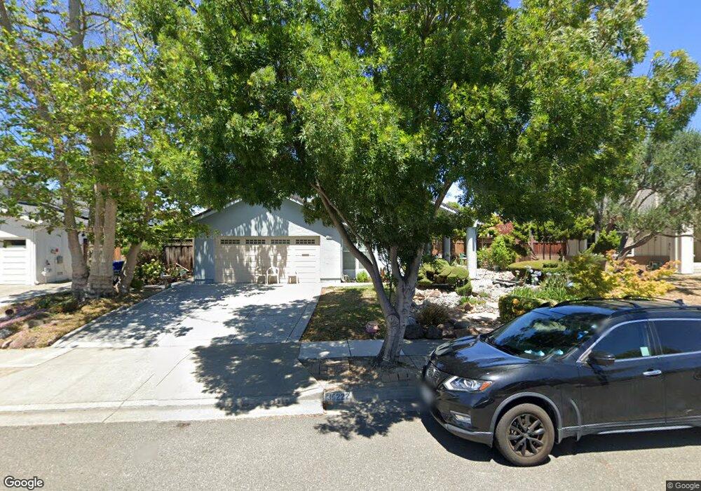
35222 Preston Place Newark, CA 94560
Estimated Value: $1,584,000 - $1,836,000
6
Beds
3
Baths
2,018
Sq Ft
$850/Sq Ft
Est. Value
About This Home
This home is located at 35222 Preston Place, Newark, CA 94560 and is currently estimated at $1,715,160, approximately $849 per square foot. 35222 Preston Place is a home located in Alameda County with nearby schools including John F. Kennedy Elementary School, Newark Junior High School, and Newark Memorial High School.
Ownership History
Date
Name
Owned For
Owner Type
Purchase Details
Closed on
Oct 23, 2007
Sold by
Karantzalis Philip T and Karantzalis Melitza
Bought by
Karantzalis Philip T and Karantzalis Melitza
Current Estimated Value
Purchase Details
Closed on
Apr 24, 2000
Sold by
Blanchard David N and Blanchard Judy
Bought by
Karantzalis Philip T and Karantzalis Melitza
Home Financials for this Owner
Home Financials are based on the most recent Mortgage that was taken out on this home.
Original Mortgage
$190,000
Interest Rate
8.24%
Create a Home Valuation Report for This Property
The Home Valuation Report is an in-depth analysis detailing your home's value as well as a comparison with similar homes in the area
Home Values in the Area
Average Home Value in this Area
Purchase History
| Date | Buyer | Sale Price | Title Company |
|---|---|---|---|
| Karantzalis Philip T | -- | None Available | |
| Karantzalis Philip T | $490,000 | North American Title Co |
Source: Public Records
Mortgage History
| Date | Status | Borrower | Loan Amount |
|---|---|---|---|
| Closed | Karantzalis Philip T | $190,000 |
Source: Public Records
Tax History Compared to Growth
Tax History
| Year | Tax Paid | Tax Assessment Tax Assessment Total Assessment is a certain percentage of the fair market value that is determined by local assessors to be the total taxable value of land and additions on the property. | Land | Improvement |
|---|---|---|---|---|
| 2025 | $9,218 | $746,075 | $225,922 | $527,153 |
| 2024 | $9,218 | $731,311 | $221,493 | $516,818 |
| 2023 | $8,970 | $723,837 | $217,151 | $506,686 |
| 2022 | $8,855 | $702,647 | $212,894 | $496,753 |
| 2021 | $8,633 | $688,735 | $208,720 | $487,015 |
| 2020 | $8,526 | $688,606 | $206,582 | $482,024 |
| 2019 | $8,403 | $675,107 | $202,532 | $472,575 |
| 2018 | $8,278 | $661,871 | $198,561 | $463,310 |
| 2017 | $8,068 | $648,897 | $194,669 | $454,228 |
| 2016 | $7,987 | $636,176 | $190,853 | $445,323 |
| 2015 | $7,960 | $626,621 | $187,986 | $438,635 |
| 2014 | $7,745 | $614,347 | $184,304 | $430,043 |
Source: Public Records
Map
Nearby Homes
- 35220 Cornwall Place
- 5303 Stirling Ct
- 35605 Scarborough Dr
- 5093 Dorking Ct
- 35345 Cabral Dr
- 34771 Tuxedo Common Unit 52
- 4987 Winchester Place
- 35794 Cabral Dr
- 34627 Pueblo Terrace
- 34607 Pueblo Terrace
- 5176 Tacoma Common
- 34565 Pueblo Terrace
- 34768 Swain Common
- 35377 Cabrillo Dr
- 35856 Adobe Dr
- 35936 Magellan Dr
- 4955 Swindon Place
- 5308 Tacoma Common
- 5220 Fairbanks Common
- 4626 Alhambra Dr
- 35234 Preston Place
- 35208 Preston Place
- 35221 Ramsgate Dr
- 35213 Ramsgate Dr
- 35229 Ramsgate Dr
- 35248 Preston Place
- 35219 Preston Place
- 35227 Preston Place
- 35211 Preston Place
- 35249 Ramsgate Dr
- 35260 Preston Place
- 35243 Preston Place
- 35194 Millwood Ct
- 35195 Dorchester Ct
- 35267 Ramsgate Dr
- 35259 Preston Place
- 35212 Ramsgate Dr
- 35206 Cornwall Place
- 35232 Cornwall Place
- 35193 Millwood Ct