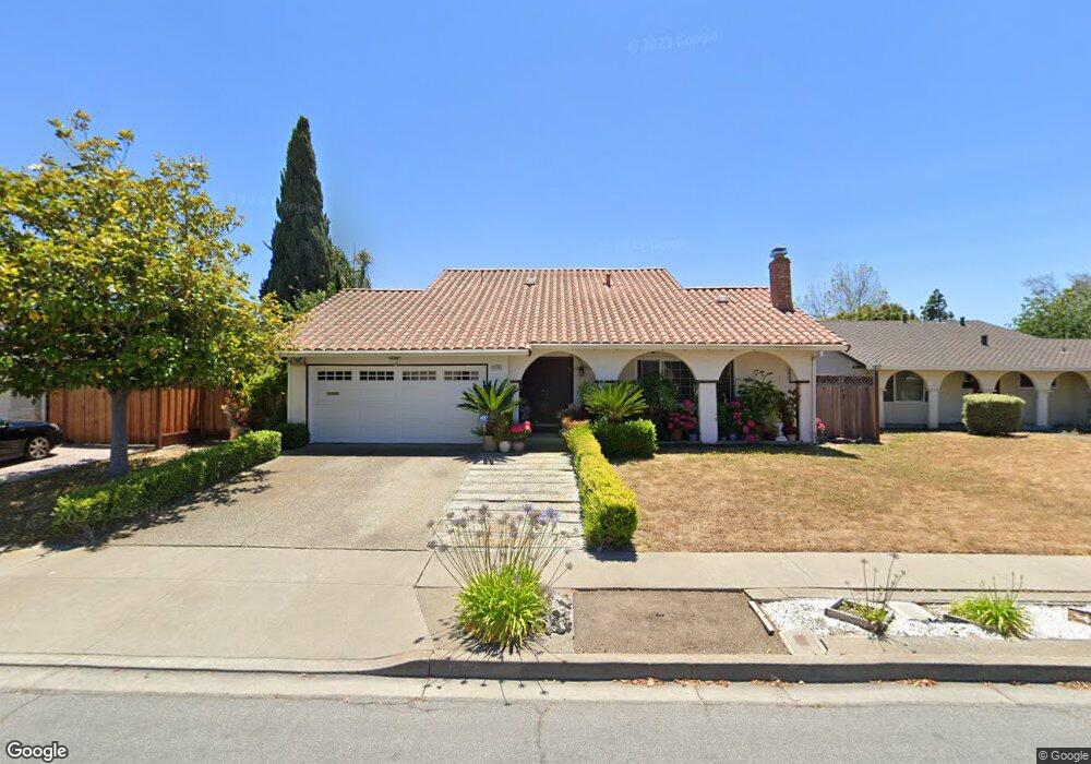
35229 Ramsgate Dr Newark, CA 94560
Estimated Value: $1,539,696 - $1,706,000
2
Beds
2
Baths
1,824
Sq Ft
$889/Sq Ft
Est. Value
About This Home
This home is located at 35229 Ramsgate Dr, Newark, CA 94560 and is currently estimated at $1,622,424, approximately $889 per square foot. 35229 Ramsgate Dr is a home located in Alameda County with nearby schools including John F. Kennedy Elementary School, Newark Junior High School, and Newark Memorial High School.
Ownership History
Date
Name
Owned For
Owner Type
Purchase Details
Closed on
Aug 30, 2010
Sold by
Phan Nhon M
Bought by
Le Thanh Thuy
Current Estimated Value
Home Financials for this Owner
Home Financials are based on the most recent Mortgage that was taken out on this home.
Original Mortgage
$345,000
Interest Rate
4.48%
Mortgage Type
New Conventional
Create a Home Valuation Report for This Property
The Home Valuation Report is an in-depth analysis detailing your home's value as well as a comparison with similar homes in the area
Home Values in the Area
Average Home Value in this Area
Purchase History
| Date | Buyer | Sale Price | Title Company |
|---|---|---|---|
| Le Thanh Thuy | -- | Mid Valley Title & Escrow Co |
Source: Public Records
Mortgage History
| Date | Status | Borrower | Loan Amount |
|---|---|---|---|
| Closed | Le Thanh Thuy | $345,000 |
Source: Public Records
Tax History Compared to Growth
Tax History
| Year | Tax Paid | Tax Assessment Tax Assessment Total Assessment is a certain percentage of the fair market value that is determined by local assessors to be the total taxable value of land and additions on the property. | Land | Improvement |
|---|---|---|---|---|
| 2025 | $5,324 | $401,823 | $125,899 | $282,924 |
| 2024 | $5,324 | $393,808 | $123,431 | $277,377 |
| 2023 | $5,169 | $392,950 | $121,011 | $271,939 |
| 2022 | $5,086 | $378,246 | $118,638 | $266,608 |
| 2021 | $4,962 | $370,692 | $116,312 | $261,380 |
| 2020 | $4,856 | $373,820 | $115,120 | $258,700 |
| 2019 | $4,788 | $366,491 | $112,863 | $253,628 |
| 2018 | $4,713 | $359,306 | $110,650 | $248,656 |
| 2017 | $4,593 | $352,260 | $108,480 | $243,780 |
| 2016 | $4,537 | $345,355 | $106,354 | $239,001 |
| 2015 | $4,521 | $340,169 | $104,757 | $235,412 |
| 2014 | $4,395 | $333,506 | $102,705 | $230,801 |
Source: Public Records
Map
Nearby Homes
- 4987 Winchester Place
- 34791 Dorado Common
- 34607 Pueblo Terrace
- 34565 Pueblo Terrace
- 5139 Dryden Ct
- 5220 Fairbanks Common
- 36202 Worthing Dr
- 34648 Musk Terrace
- 36164 Cabrillo Dr
- 35050 Lido Blvd Unit B
- 6179 Tourraine Dr
- 4347 San Juan Ave
- 5311 Port Sailwood Dr
- 4091 Lorenzo Terrace
- 35875 Argonne St
- 6449 Cedar Blvd
- 34198 Tony Terrace
- 4212 Gordon St
- 34512 Nantucket Common
- 34319 Chester Ct
- 35221 Ramsgate Dr
- 35249 Ramsgate Dr
- 35234 Preston Place
- 35248 Preston Place
- 35222 Preston Place
- 35267 Ramsgate Dr
- 35213 Ramsgate Dr
- 35260 Preston Place
- 35224 Ramsgate Dr
- 35212 Ramsgate Dr
- 35240 Ramsgate Dr
- 35208 Preston Place
- 35273 Ramsgate Dr
- 35282 Preston Place
- 35268 Ramsgate Dr
- 35227 Preston Place
- 35243 Preston Place
- 35317 Ramsgate Dr
- 35219 Preston Place
- 5086 Abbotford Ct
