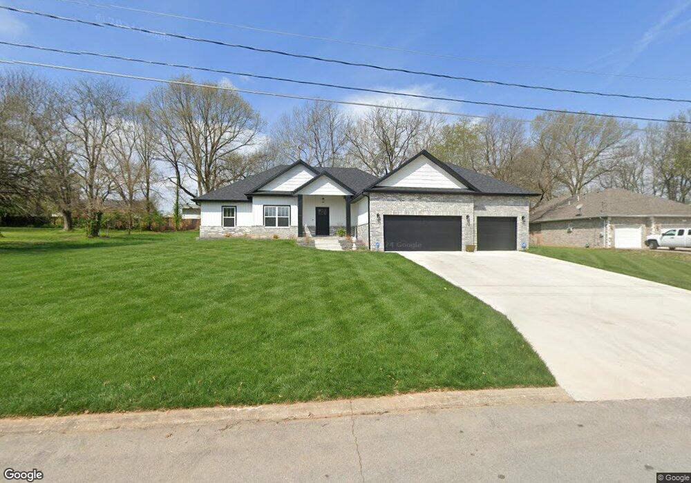
3523 S Woodstock Ave Springfield, MO 65809
Southeast Springfield NeighborhoodEstimated Value: $397,000 - $512,000
4
Beds
3
Baths
2,101
Sq Ft
$213/Sq Ft
Est. Value
About This Home
This home is located at 3523 S Woodstock Ave, Springfield, MO 65809 and is currently estimated at $447,690, approximately $213 per square foot. 3523 S Woodstock Ave is a home with nearby schools including Sequiota Elementary School, Glendale High School, and Springfield Catholic High School.
Ownership History
Date
Name
Owned For
Owner Type
Purchase Details
Closed on
Nov 8, 2021
Sold by
Herren Gregory B and Herren Debra J
Bought by
Marsh Jeffrey and Marsh Lori
Current Estimated Value
Purchase Details
Closed on
Apr 22, 2021
Sold by
Herren Gregory B and Herren Debra J
Bought by
Herren Gregory B and Herren Debra J
Purchase Details
Closed on
Apr 9, 2018
Sold by
Belote Robert F and Belote Jean C
Bought by
Herren Gregory B and Herren Debra J
Create a Home Valuation Report for This Property
The Home Valuation Report is an in-depth analysis detailing your home's value as well as a comparison with similar homes in the area
Home Values in the Area
Average Home Value in this Area
Purchase History
| Date | Buyer | Sale Price | Title Company |
|---|---|---|---|
| Marsh Jeffrey | -- | None Available | |
| Marsh Jeffrey | -- | None Listed On Document | |
| Herren Gregory B | -- | None Available | |
| Herren Gregory B | -- | None Available |
Source: Public Records
Tax History Compared to Growth
Tax History
| Year | Tax Paid | Tax Assessment Tax Assessment Total Assessment is a certain percentage of the fair market value that is determined by local assessors to be the total taxable value of land and additions on the property. | Land | Improvement |
|---|---|---|---|---|
| 2025 | $3,354 | $67,930 | $11,400 | $56,530 |
| 2024 | $3,354 | $60,250 | $11,400 | $48,850 |
| 2023 | $3,186 | $60,250 | $11,400 | $48,850 |
| 2022 | $1,171 | $52,040 | $11,400 | $40,640 |
| 2021 | $464 | $8,550 | $8,550 | $0 |
| 2020 | $487 | $8,550 | $8,550 | $0 |
| 2019 | $473 | $8,550 | $8,550 | $0 |
| 2018 | $473 | $8,550 | $8,550 | $0 |
| 2017 | $468 | $8,550 | $8,550 | $0 |
| 2016 | $468 | $8,550 | $8,550 | $0 |
| 2015 | $465 | $8,550 | $8,550 | $0 |
| 2014 | $446 | $8,550 | $8,550 | $0 |
Source: Public Records
Map
Nearby Homes
- 3449 S Woodstock Dr
- 3439 S Brunswick Ave
- 3444 S Forestdale St
- 3882 E Woodbridge St
- 3642 S Sulgrove Ave
- 3442 E Fox Grape St
- 3963 E El Dorado St
- 3244 E Gasconade St
- 3243 Shady Glen St
- 3760 E Pond Apple Dr
- 3070 E Beaumont St
- 3064 E Gasconade St
- 3321 S Parkview Ave
- 3141 E Mimosa St Unit K
- 3740 S Elmview Ave
- 2956 S Ranch Dr
- 3141 E Raynell St Unit B
- 3055 S Oak Ave
- 3000 E Lolo Trail
- 2948 E Erie St
- 3539 S Woodstock Ave
- 3522 S Carriage Ave
- 3530 S Carriage Ave
- 3507 S Woodstock Ave
- 3514 S Carriage Ave
- 3540 S Carriage Ave
- 3520 S Woodstock Ave
- 3506 S Carriage Ave
- 3621 E Woodbridge St
- 3540 S Woodstock Ave
- 3458 S Carriage Ave
- 3633 E Woodbridge St
- 3555 S Woodstock Ave
- 3521 S Carriage Ave
- 3531 S Carriage Ave
- 3515 S Carriage Ave
- 3541 S Carriage Ave
- 3562 S Carriage Ave
- 3523 S Cara Ln
- 3501 S Carriage Ave