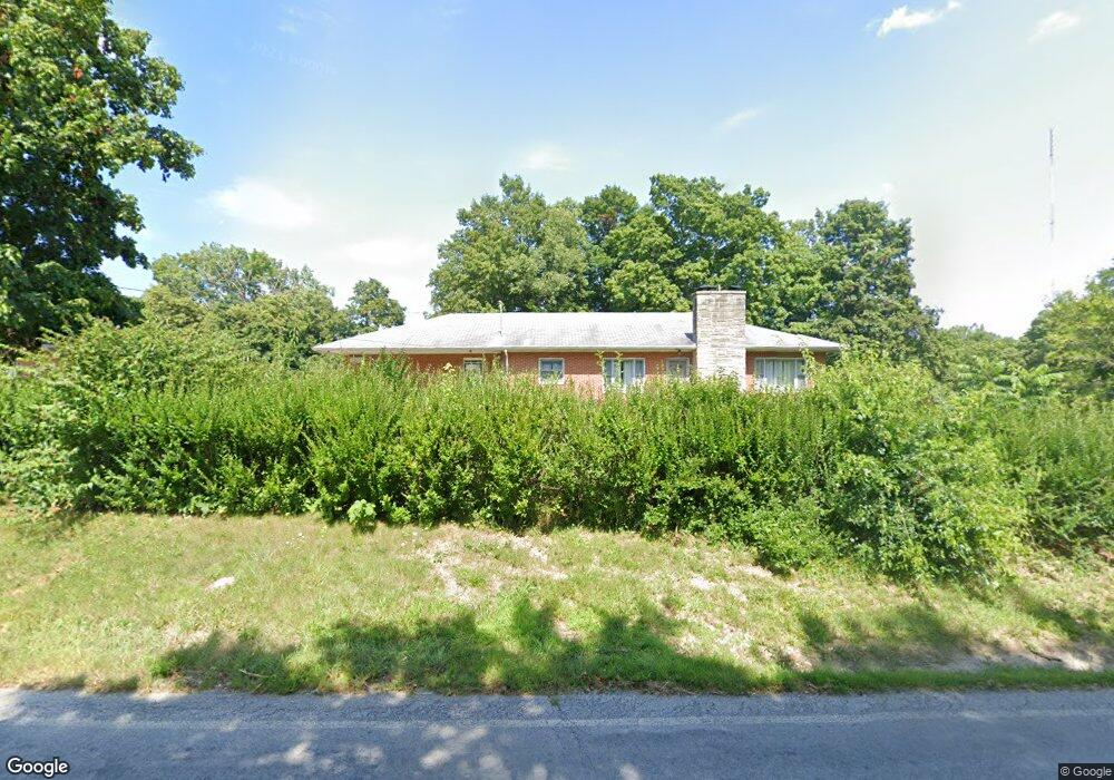
3524 Miller Rd Springfield, OH 45502
Cedar Hills/Broadview NeighborhoodEstimated Value: $120,000 - $283,000
About This Home
This home is located at 3524 Miller Rd, Springfield, OH 45502 and is currently estimated at $221,125, approximately $102 per square foot. 3524 Miller Rd is a home located in Clark County with nearby schools including Northwestern Elementary School, Northwestern Junior/Senior High School, and Buckeye Community School - Springfield.
Ownership History
We collect this data history from publicly available records. To have your information removed, we recommend requesting removal directly through your county’s website.
Purchase Details
Home Financials for this Owner
Home Financials are based on the most recent Mortgage that was taken out on this home.Purchase Details
Purchase Details
Home Values in the Area
Average Home Value in this Area
Purchase History
We collect this data history from publicly available records. To have your information removed, we recommend requesting removal directly through your county’s website.
| Date | Buyer | Sale Price | Title Company |
|---|---|---|---|
| $123,000 | City Title | ||
| -- | None Available | ||
| $65,000 | -- |
Mortgage History
We collect this data history from publicly available records. To have your information removed, we recommend requesting removal directly through your county’s website.
| Date | Status | Borrower | Loan Amount |
|---|---|---|---|
| Open | $126,600 | ||
| Previous Owner | $25,000 |
Tax History
We collect this data history from publicly available records. To have your information removed, we recommend requesting removal directly through your county’s website.
| Year | Tax Paid | Tax Assessment Tax Assessment Total Assessment is a certain percentage of the fair market value that is determined by local assessors to be the total taxable value of land and additions on the property. | Land | Improvement |
|---|---|---|---|---|
| 2025 | $4,776 | $81,050 | $11,600 | $69,450 |
| 2024 | $3,026 | $66,240 | $9,110 | $57,130 |
| 2023 | $3,026 | $66,240 | $9,110 | $57,130 |
| 2022 | $3,108 | $66,240 | $9,110 | $57,130 |
| 2021 | $2,669 | $50,560 | $6,950 | $43,610 |
| 2020 | $2,696 | $50,560 | $6,950 | $43,610 |
| 2019 | $2,671 | $50,560 | $6,950 | $43,610 |
| 2018 | $2,209 | $41,090 | $6,320 | $34,770 |
| 2017 | $2,210 | $41,090 | $6,321 | $34,769 |
| 2016 | $2,166 | $41,090 | $6,321 | $34,769 |
| 2015 | $2,129 | $40,436 | $6,321 | $34,115 |
| 2014 | $2,128 | $40,436 | $6,321 | $34,115 |
| 2013 | $2,113 | $40,436 | $6,321 | $34,115 |
Map
- 3540 Miller Rd
- 3787 Miller Rd
- 1610 Troy Rd
- 2244 Manhattan Blvd
- 2900 Dogwood Dr
- 4004 Sintz Rd
- 2619 Fox Hollow Rd
- 815 W Eva Cir
- 925 Upper Valley Pike
- 800 White Oak Dr
- 2373 Shrine Rd
- 2341 Shrine Rd
- 00 Upper Valley Pike
- 2756 Cottonwood Dr
- 2375 Upper Valley Pike
- 2850 Locust Dr
- 422 Shrine Rd
- 330 Saint Paul Ave
- 2630 Shrine Rd
- 254 Oakridge Dr
Ask me questions while you tour the home.