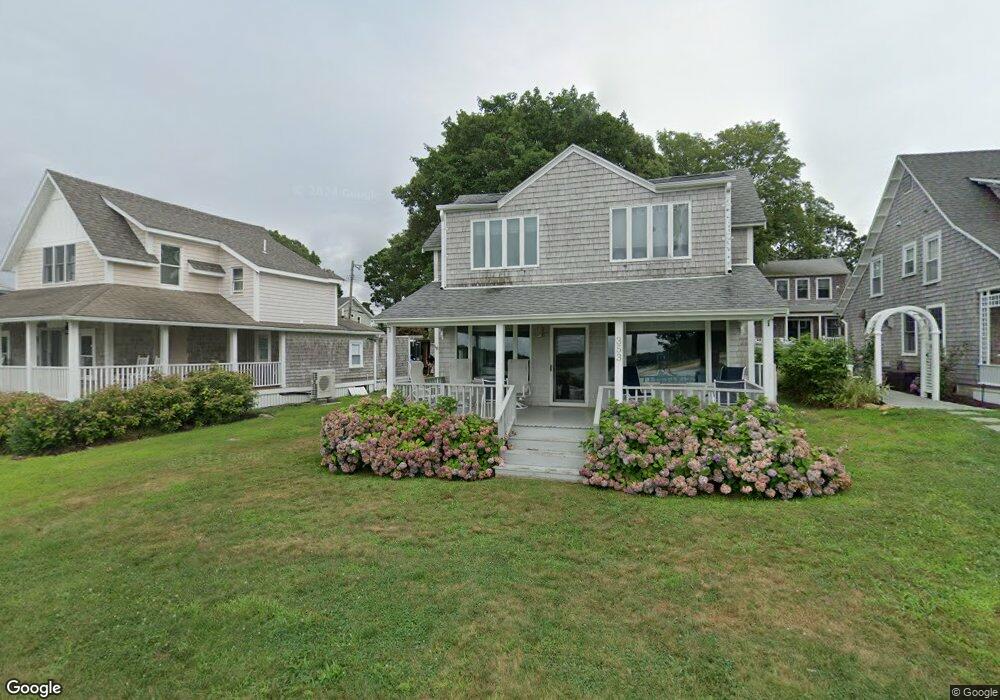
353 Circuit Ave Pocasset, MA 02559
Pocasset NeighborhoodEstimated Value: $896,000 - $1,164,000
4
Beds
1
Bath
1,544
Sq Ft
$650/Sq Ft
Est. Value
About This Home
This home is located at 353 Circuit Ave, Pocasset, MA 02559 and is currently estimated at $1,003,970, approximately $650 per square foot. 353 Circuit Ave is a home located in Barnstable County with nearby schools including Bourne High School and Cadence Academy Preschool - Bourne.
Ownership History
Date
Name
Owned For
Owner Type
Purchase Details
Closed on
Aug 29, 1992
Sold by
Harvey Lynn A and Cascio Carol L
Bought by
Foote Timothy P and Foote Karen L
Current Estimated Value
Home Financials for this Owner
Home Financials are based on the most recent Mortgage that was taken out on this home.
Original Mortgage
$90,800
Interest Rate
8.09%
Mortgage Type
Purchase Money Mortgage
Create a Home Valuation Report for This Property
The Home Valuation Report is an in-depth analysis detailing your home's value as well as a comparison with similar homes in the area
Home Values in the Area
Average Home Value in this Area
Purchase History
| Date | Buyer | Sale Price | Title Company |
|---|---|---|---|
| Foote Timothy P | $195,000 | -- | |
| Foote Timothy P | $195,000 | -- |
Source: Public Records
Mortgage History
| Date | Status | Borrower | Loan Amount |
|---|---|---|---|
| Open | Foote Timothy P | $122,200 | |
| Closed | Foote Timothy P | $90,800 |
Source: Public Records
Tax History Compared to Growth
Tax History
| Year | Tax Paid | Tax Assessment Tax Assessment Total Assessment is a certain percentage of the fair market value that is determined by local assessors to be the total taxable value of land and additions on the property. | Land | Improvement |
|---|---|---|---|---|
| 2025 | $7,627 | $976,600 | $687,500 | $289,100 |
| 2024 | $7,459 | $930,000 | $654,700 | $275,300 |
| 2023 | $7,888 | $895,400 | $651,800 | $243,600 |
| 2022 | $8,288 | $821,400 | $628,100 | $193,300 |
| 2021 | $8,051 | $747,500 | $571,600 | $175,900 |
| 2020 | $7,973 | $742,400 | $566,200 | $176,200 |
| 2019 | $7,464 | $710,200 | $566,200 | $144,000 |
| 2018 | $7,130 | $676,500 | $539,300 | $137,200 |
| 2017 | $6,902 | $670,100 | $534,200 | $135,900 |
| 2016 | $6,743 | $663,700 | $534,200 | $129,500 |
| 2015 | $6,683 | $663,700 | $534,200 | $129,500 |
Source: Public Records
Map
Nearby Homes
- 171 Bellavista Dr
- 34 Kenwood Rd
- 45 Kenwood Rd
- 89 Harbor Dr
- 70 Wings Neck Rd
- 24 Richmond Rd
- 22 Nairn Rd
- 14 Navajo Rd
- 48 Red Brook Harbor Rd
- 254 Barlows Landing Rd
- 3 Red Brook Pond Dr
- 75 Winsor Rd
- 1094 County Rd
- 940 County Rd
- 709 County Rd
- 940 County Rd
- 461 Wings Neck Rd
- 174 Barlows Landing Rd
- 10 Squeteague Harbor Rd
- 357 Circuit Ave
- 349 Circuit Ave
- 361 Circuit Ave
- 344 Circuit Ave
- 350 Circuit Ave
- 346 Circuit Ave
- 333 Circuit Ave
- 354 Circuit Ave
- 51 Circuit Ave
- 10 Hope Ave
- 371 Circuit Ave
- 340 Circuit Ave
- 331 Circuit Ave
- 20 Hope Ave
- 332 Circuit Ave
- 354 Circuit Ave Patuisset Isl
- 40 Massasoit Ave
- 326 Circuit Ave
- 379 Circuit Ave
- 38 Massasoit Ave