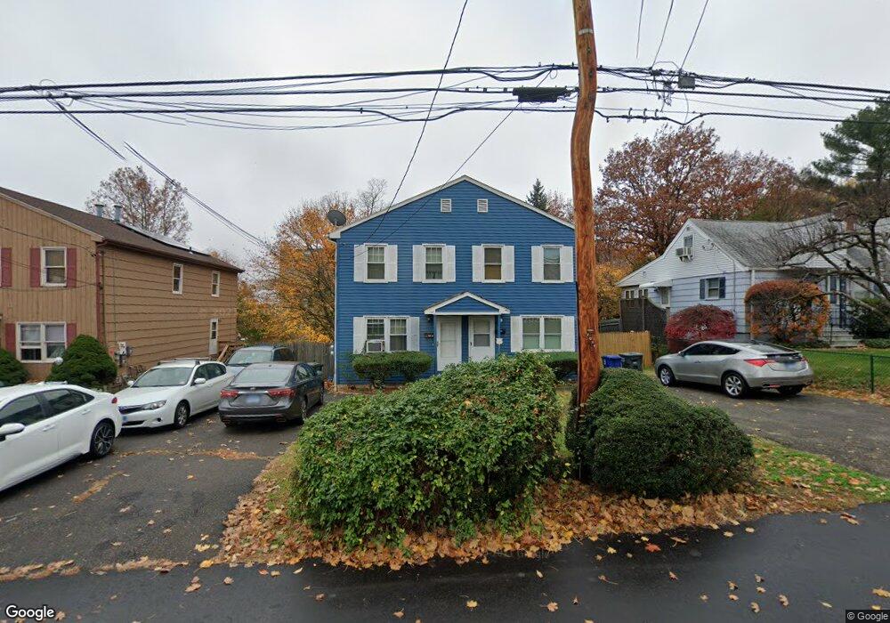
353 High Ridge Dr Bridgeport, CT 06606
Brooklawn-Saint Vincent NeighborhoodEstimated Value: $251,000 - $380,958
3
Beds
2
Baths
1,376
Sq Ft
$238/Sq Ft
Est. Value
About This Home
This home is located at 353 High Ridge Dr, Bridgeport, CT 06606 and is currently estimated at $327,740, approximately $238 per square foot. 353 High Ridge Dr is a home located in Fairfield County with nearby schools including Blackham School, Central High School, and Assumption Catholic School.
Ownership History
Date
Name
Owned For
Owner Type
Purchase Details
Closed on
May 2, 2005
Sold by
Brooks Deborah
Bought by
Turenne Pierre
Current Estimated Value
Home Financials for this Owner
Home Financials are based on the most recent Mortgage that was taken out on this home.
Original Mortgage
$182,000
Interest Rate
8.3%
Purchase Details
Closed on
Apr 16, 1998
Sold by
Stone David G and Stone Elizabeth
Bought by
Carswell Deborah C
Purchase Details
Closed on
Jan 5, 1998
Sold by
Stone David and Stone Elizabeth
Bought by
Taylor Deborah F
Purchase Details
Closed on
Jul 27, 1988
Sold by
Vossler Robert
Bought by
Stone David
Create a Home Valuation Report for This Property
The Home Valuation Report is an in-depth analysis detailing your home's value as well as a comparison with similar homes in the area
Home Values in the Area
Average Home Value in this Area
Purchase History
| Date | Buyer | Sale Price | Title Company |
|---|---|---|---|
| Turenne Pierre | $182,000 | -- | |
| Turenne Pierre | $182,000 | -- | |
| Carswell Deborah C | $74,000 | -- | |
| Carswell Deborah C | $74,000 | -- | |
| Taylor Deborah F | $76,000 | -- | |
| Taylor Deborah F | $76,000 | -- | |
| Stone David | $130,000 | -- |
Source: Public Records
Mortgage History
| Date | Status | Borrower | Loan Amount |
|---|---|---|---|
| Open | Stone David | $184,700 | |
| Closed | Stone David | $182,000 |
Source: Public Records
Tax History Compared to Growth
Tax History
| Year | Tax Paid | Tax Assessment Tax Assessment Total Assessment is a certain percentage of the fair market value that is determined by local assessors to be the total taxable value of land and additions on the property. | Land | Improvement |
|---|---|---|---|---|
| 2025 | $6,062 | $139,521 | $36,701 | $102,820 |
| 2024 | $6,062 | $139,521 | $36,701 | $102,820 |
| 2023 | $6,062 | $139,521 | $36,701 | $102,820 |
| 2022 | $6,062 | $139,521 | $36,701 | $102,820 |
| 2021 | $6,062 | $139,521 | $36,701 | $102,820 |
| 2020 | $4,423 | $81,920 | $19,190 | $62,730 |
| 2019 | $4,423 | $81,920 | $19,190 | $62,730 |
| 2018 | $4,454 | $81,920 | $19,190 | $62,730 |
| 2017 | $4,454 | $81,920 | $19,190 | $62,730 |
| 2016 | $4,454 | $81,920 | $19,190 | $62,730 |
| 2015 | $4,955 | $117,410 | $34,810 | $82,600 |
| 2014 | $4,955 | $117,410 | $34,810 | $82,600 |
Source: Public Records
Map
Nearby Homes
- 150 Alexander Dr
- 125 Alexander Dr
- 11 Myron Ave
- 241 Sampson St
- 201 High Ridge Dr
- 2625 Park Ave Unit 12L
- 2625 Park Ave Unit 5N
- 76 Suburban Ave
- 2675 Park Ave Unit 3
- 2675 Park Ave Unit 22
- 2445 Park Ave Unit 23
- 1275 Capitol Ave
- 2345 Park Ave
- 203 Wayne St
- 1480 Capitol Ave Unit 811
- 105 Tremont Ave Unit E
- 105 Tremont Ave Unit B
- 119 Madison Terrace
- 252 Harlem Ave Unit B6
- 252 Harlem Ave Unit B5
- 333 High Ridge Dr
- 355 High Ridge Dr
- 357 High Ridge Dr
- 364 High Ridge Dr
- 336 High Ridge Dr
- 332 High Ridge Dr Unit 336
- 334 High Ridge Dr
- 369 High Ridge Dr Unit 371
- 329 High Ridge Dr
- 319 High Ridge Dr
- 371 High Ridge Dr
- 323 High Ridge Dr
- 115 Alexander Dr
- 370 High Ridge Dr
- 117 Alexander Dr
- 318 High Ridge Dr Unit 320
- 97 Alexander Dr
- 99 Alexander Dr
- 97-99 Alexander Dr Unit 99
- 97-99 Alexander Dr