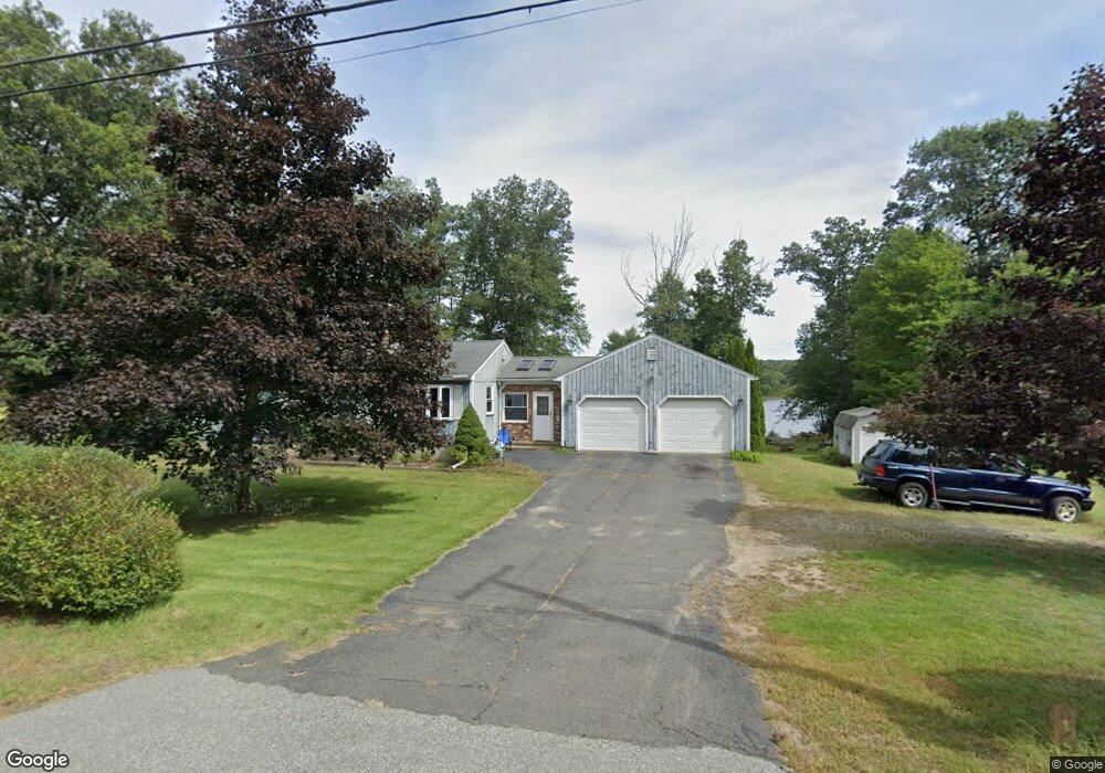
353 Monson Rd Stafford Springs, CT 06076
Stafford NeighborhoodEstimated Value: $342,708 - $380,000
3
Beds
2
Baths
1,100
Sq Ft
$325/Sq Ft
Est. Value
About This Home
This home is located at 353 Monson Rd, Stafford Springs, CT 06076 and is currently estimated at $357,677, approximately $325 per square foot. 353 Monson Rd is a home located in Tolland County with nearby schools including Stafford Elementary School, Stafford Middle School, and Stafford High School.
Ownership History
Date
Name
Owned For
Owner Type
Purchase Details
Closed on
Jun 22, 1992
Sold by
Moreau Marie
Bought by
Ouellette Darren and Ouellette Tracy
Current Estimated Value
Home Financials for this Owner
Home Financials are based on the most recent Mortgage that was taken out on this home.
Original Mortgage
$122,300
Interest Rate
8.67%
Mortgage Type
Unknown
Create a Home Valuation Report for This Property
The Home Valuation Report is an in-depth analysis detailing your home's value as well as a comparison with similar homes in the area
Home Values in the Area
Average Home Value in this Area
Purchase History
| Date | Buyer | Sale Price | Title Company |
|---|---|---|---|
| Ouellette Darren | $128,800 | -- |
Source: Public Records
Mortgage History
| Date | Status | Borrower | Loan Amount |
|---|---|---|---|
| Closed | Ouellette Darren | $119,000 | |
| Closed | Ouellette Darren | $122,300 | |
| Previous Owner | Ouellette Darren | $17,000 |
Source: Public Records
Tax History Compared to Growth
Tax History
| Year | Tax Paid | Tax Assessment Tax Assessment Total Assessment is a certain percentage of the fair market value that is determined by local assessors to be the total taxable value of land and additions on the property. | Land | Improvement |
|---|---|---|---|---|
| 2025 | $7,985 | $139,790 | $37,450 | $102,340 |
| 2024 | $5,394 | $139,790 | $37,450 | $102,340 |
| 2023 | $5,139 | $139,790 | $37,450 | $102,340 |
| 2022 | $5,002 | $139,790 | $37,450 | $102,340 |
| 2021 | $4,883 | $139,790 | $37,450 | $102,340 |
| 2020 | $4,543 | $130,060 | $38,150 | $91,910 |
| 2019 | $4,543 | $130,060 | $38,150 | $91,910 |
| 2018 | $4,456 | $130,060 | $38,150 | $91,910 |
| 2017 | $4,413 | $130,060 | $38,150 | $91,910 |
| 2016 | $4,358 | $130,060 | $38,150 | $91,910 |
| 2015 | $4,331 | $129,780 | $38,150 | $91,630 |
| 2014 | $4,287 | $129,780 | $38,150 | $91,630 |
Source: Public Records
Map
Nearby Homes
- 10 Ash St
- 24 Ash St
- 0 Stony Ln
- 89 Crow Hill Rd
- 150 Stafford Hollow Rd
- 96 Stafford Hollow Rd
- 283 Leonard Rd
- 14 Valley View Dr
- 192 Leonard Rd
- 12 Hillcrest Dr
- 221 Moulton Hill Rd
- 10 Laurel Ln
- 15 Deepwood Dr
- 105 Leonard Rd
- 201 Diamond Ledge Rd
- 19 Potter Rd
- 2 Pinewood Ln
- 4 Pinewood Ln
- 205 Cedar Swamp Rd
- 179 Bumstead Rd