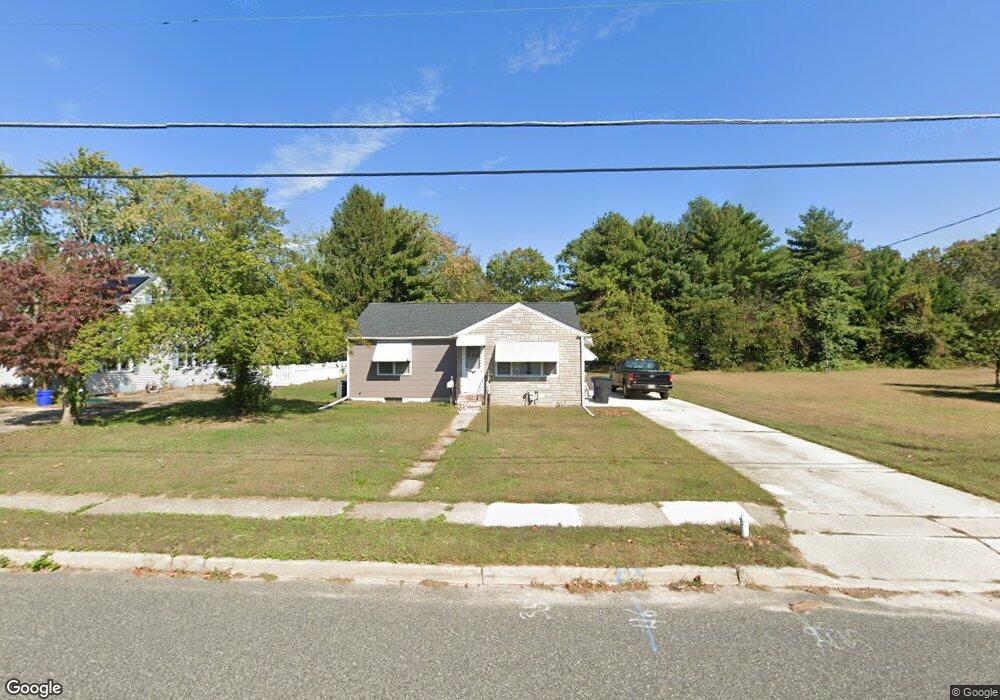
353 S Liberty St Hammonton, NJ 08037
Estimated Value: $258,743 - $298,000
--
Bed
--
Bath
884
Sq Ft
$320/Sq Ft
Est. Value
About This Home
This home is located at 353 S Liberty St, Hammonton, NJ 08037 and is currently estimated at $282,686, approximately $319 per square foot. 353 S Liberty St is a home located in Atlantic County with nearby schools including Hammonton Early Childhood Education Center, Warren E. Sooy Jr. Elementary School, and Hammonton Middle School.
Ownership History
Date
Name
Owned For
Owner Type
Purchase Details
Closed on
Jun 23, 2016
Sold by
Spado Deborah A and Spado John J
Bought by
Spado Deborah A
Current Estimated Value
Home Financials for this Owner
Home Financials are based on the most recent Mortgage that was taken out on this home.
Original Mortgage
$89,889
Outstanding Balance
$72,233
Interest Rate
3.87%
Mortgage Type
FHA
Estimated Equity
$210,453
Purchase Details
Closed on
May 29, 2003
Sold by
Estate Of Joseph Siligato
Bought by
Spado Deborah and Spado John
Home Financials for this Owner
Home Financials are based on the most recent Mortgage that was taken out on this home.
Original Mortgage
$118,000
Interest Rate
5.77%
Mortgage Type
FHA
Create a Home Valuation Report for This Property
The Home Valuation Report is an in-depth analysis detailing your home's value as well as a comparison with similar homes in the area
Home Values in the Area
Average Home Value in this Area
Purchase History
| Date | Buyer | Sale Price | Title Company |
|---|---|---|---|
| Spado Deborah A | -- | Agent For Old Republic Natl | |
| Spado Deborah | $119,000 | -- | |
| Spado Deborah A | $119,000 | Landis Title Corporation |
Source: Public Records
Mortgage History
| Date | Status | Borrower | Loan Amount |
|---|---|---|---|
| Open | Spado Deborah A | $89,889 | |
| Closed | Spado Deborah A | $118,000 |
Source: Public Records
Tax History Compared to Growth
Tax History
| Year | Tax Paid | Tax Assessment Tax Assessment Total Assessment is a certain percentage of the fair market value that is determined by local assessors to be the total taxable value of land and additions on the property. | Land | Improvement |
|---|---|---|---|---|
| 2025 | $3,503 | $127,300 | $56,000 | $71,300 |
| 2024 | $3,503 | $127,300 | $56,000 | $71,300 |
| 2023 | $3,466 | $127,300 | $56,000 | $71,300 |
| 2022 | $3,466 | $127,300 | $56,000 | $71,300 |
| 2021 | $3,479 | $127,300 | $56,000 | $71,300 |
| 2020 | $3,461 | $127,300 | $56,000 | $71,300 |
| 2019 | $3,449 | $127,300 | $56,000 | $71,300 |
| 2018 | $3,432 | $127,300 | $56,000 | $71,300 |
| 2017 | $3,384 | $127,300 | $56,000 | $71,300 |
| 2016 | $3,260 | $127,300 | $56,000 | $71,300 |
| 2015 | $3,135 | $126,100 | $56,000 | $70,100 |
| 2014 | $3,041 | $82,000 | $31,800 | $50,200 |
Source: Public Records
Map
Nearby Homes
- 31 N Liberty St
- 763 Central Ave
- 56 Samuel Dr
- 52 N Packard St
- 862 Central Ave
- 362 S 3rd St
- 124 Batchelor Ln
- 415 S White Horse Pike
- 38 Pressey St
- 425 N Packard St
- 365 S Egg Harbor Rd
- 44 Harborwood Dr Unit CO44
- 413 Pratt St
- 426 Bella Vita Ct
- 918 Central Ave
- 557 S White Horse Pike
- 247 Lincoln St
- 242 Lincoln St
- 103 W End Ave
- 450 N 2nd St
- 349 S Liberty St
- 367 S Liberty St
- 345 S Liberty St
- 348 S Liberty St
- 344 S Liberty St
- 436 Marlyn Ave
- 373 S Liberty St
- 356 S Liberty St
- 338 S Liberty St
- 336 S Liberty St
- 346 S Liberty St
- 377 S Liberty St
- 333 S Liberty St
- 720 Woodlawn Ave
- 408 S Liberty St
- 330 S Liberty St
- 360 S Liberty St
- 379 S Liberty St
- 450 Marlyn Ave
- 419 Marlyn Ave