Estimated Value: $315,096 - $477,000
3
Beds
3
Baths
2,432
Sq Ft
$168/Sq Ft
Est. Value
About This Home
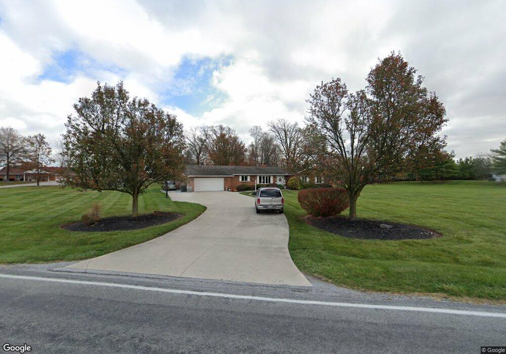
This home is located at 353 S Wapak Rd, Lima, OH 45807 and is currently estimated at $408,274, approximately $167 per square foot. 353 S Wapak Rd is a home located in Allen County with nearby schools including Maplewood Elementary School, Elmwood Elementary School, and Shawnee Middle School.
Ownership History
Date
Name
Owned For
Owner Type
Purchase Details
Closed on
Aug 15, 2007
Sold by
Jackson Barbara J and Sodders Douglas A
Bought by
Sodders Barbara J and Sodders Douglas A
Current Estimated Value
Purchase Details
Closed on
Oct 13, 2001
Sold by
Sodders Barbara J and Sodders Douglas A
Bought by
Hutchins Joseph L
Home Financials for this Owner
Home Financials are based on the most recent Mortgage that was taken out on this home.
Original Mortgage
$211,353
Interest Rate
4.5%
Mortgage Type
FHA
Purchase Details
Closed on
Mar 15, 1990
Bought by
Jackson Barbara J
Create a Home Valuation Report for This Property
The Home Valuation Report is an in-depth analysis detailing your home's value as well as a comparison with similar homes in the area
Purchase History
| Date | Buyer | Sale Price | Title Company |
|---|---|---|---|
| Sodders Barbara J | -- | None Available | |
| Hutchins Joseph L | $214,200 | Attorney | |
| Jackson Barbara J | -- | -- |
Source: Public Records
Mortgage History
| Date | Status | Borrower | Loan Amount |
|---|---|---|---|
| Previous Owner | Hutchins Joseph L | $211,353 |
Source: Public Records
Tax History
| Year | Tax Paid | Tax Assessment Tax Assessment Total Assessment is a certain percentage of the fair market value that is determined by local assessors to be the total taxable value of land and additions on the property. | Land | Improvement |
|---|---|---|---|---|
| 2024 | $4,366 | $98,640 | $16,280 | $82,360 |
| 2023 | $3,557 | $71,480 | $11,800 | $59,680 |
| 2022 | $3,586 | $71,480 | $11,800 | $59,680 |
| 2021 | $3,605 | $71,480 | $11,800 | $59,680 |
| 2020 | $3,182 | $63,950 | $11,410 | $52,540 |
| 2019 | $3,182 | $63,950 | $11,410 | $52,540 |
| 2018 | $3,108 | $63,950 | $11,410 | $52,540 |
| 2017 | $2,869 | $57,090 | $11,410 | $45,680 |
| 2016 | $2,845 | $57,090 | $11,410 | $45,680 |
| 2015 | $2,762 | $57,090 | $11,410 | $45,680 |
| 2014 | $2,762 | $54,570 | $11,870 | $42,700 |
| 2013 | $2,487 | $54,570 | $11,870 | $42,700 |
Source: Public Records
Map
Nearby Homes
- 616 Wildbrook Ln
- 845 Atalan Trail
- 4875 Wenatchi Trail
- 4906 Shoshone Trail
- 000 N Stevick Rd
- 0000 N Stevick Rd
- 1602 Wonderlick Rd
- 3953 Willow Oak Trail
- 123 Eagles Point W
- 1393 N Stevick Rd
- 206 Eagles Point St E
- 3055 Freyer Rd
- 2940 Koop Rd
- 5924 Timberstone Dr
- 145 N Concept Dr
- 3360 Springview Dr
- 00 Allentown Rd
- 1955 Dutch Hollow Rd
- 2340 S Wapak Rd
- 0 Springview Dr
- 353 S Wapakoneta Rd
- 435 S Wapakoneta Rd
- 331 S Wapak Rd
- 331 S Wapakoneta Rd
- N/A S Wapak Rd
- 300 S Wapakoneta Rd
- 303 S Wapakoneta Rd
- 487 S Wapakoneta Rd
- 487 S Wapak Rd
- 270 S Wapakoneta Rd
- 297 S Wapak Rd
- 297 S Wapakoneta Rd
- 256 S Wapakoneta Rd
- 5237 Shores Ln
- 5185 Shores Ln
- 5269 Shores Ln
- 569 S Wapak Rd
- 5153 Shores Ln
Your Personal Tour Guide
Ask me questions while you tour the home.