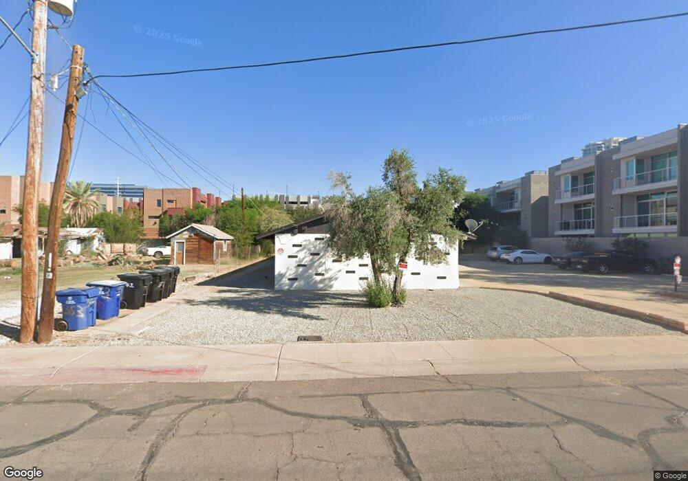
353 S Wilson St Tempe, AZ 85281
Downtown Tempe NeighborhoodEstimated Value: $911,865 - $1,061,000
Studio
--
Bath
3,164
Sq Ft
$313/Sq Ft
Est. Value
About This Home
This home is located at 353 S Wilson St, Tempe, AZ 85281 and is currently estimated at $989,216, approximately $312 per square foot. 353 S Wilson St is a home located in Maricopa County with nearby schools including Scales Technology Academy, Geneva Epps Mosley Middle School, and Tempe High School.
Ownership History
Date
Name
Owned For
Owner Type
Purchase Details
Closed on
Aug 11, 2022
Sold by
Manuela Banuelos
Bought by
Manuela Banuelos Revocable Living Trust
Current Estimated Value
Purchase Details
Closed on
Jan 31, 2001
Sold by
Aossey Anace
Bought by
Banuelos Manuela
Purchase Details
Closed on
Jul 7, 2000
Sold by
Benton Robb Development Associates
Bought by
5Th & Farmer Llc
Purchase Details
Closed on
May 1, 1995
Sold by
Woodard Maria Delosangeles
Bought by
Woodard Henry S
Create a Home Valuation Report for This Property
The Home Valuation Report is an in-depth analysis detailing your home's value as well as a comparison with similar homes in the area
Home Values in the Area
Average Home Value in this Area
Purchase History
| Date | Buyer | Sale Price | Title Company |
|---|---|---|---|
| Manuela Banuelos Revocable Living Trust | -- | None Listed On Document | |
| Banuelos Manuela | $280,000 | Security Title Agency | |
| 5Th & Farmer Llc | -- | Fidelity National Title | |
| Woodard Henry S | -- | -- |
Source: Public Records
Tax History
| Year | Tax Paid | Tax Assessment Tax Assessment Total Assessment is a certain percentage of the fair market value that is determined by local assessors to be the total taxable value of land and additions on the property. | Land | Improvement |
|---|---|---|---|---|
| 2025 | $3,393 | $28,311 | -- | -- |
| 2024 | $3,133 | $26,962 | -- | -- |
| 2023 | $3,133 | $83,050 | $14,910 | $68,140 |
| 2022 | $3,005 | $65,580 | $11,770 | $53,810 |
| 2021 | $3,026 | $55,790 | $10,010 | $45,780 |
| 2020 | $2,934 | $49,270 | $8,840 | $40,430 |
| 2019 | $2,879 | $39,410 | $7,070 | $32,340 |
| 2018 | $2,807 | $32,200 | $5,780 | $26,420 |
| 2017 | $2,724 | $27,650 | $4,960 | $22,690 |
| 2016 | $2,704 | $26,870 | $4,820 | $22,050 |
Source: Public Records
Map
Nearby Homes
- 401 W 5th St
- 323 S Roosevelt St Unit 1001
- 508 S Farmer Ave
- 154 W 5th St Unit 250
- 420 W 1st St Unit 110
- 548 S Wilson St Unit 104
- 577 S Roosevelt St
- 581 S Roosevelt St
- 606 S Wilson St
- 435 W Rio Salado Pkwy Unit 210
- 435 W Rio Salado Pkwy Unit 303
- 525 W Lakeside Dr Unit 141
- 425 W Rio Salado Pkwy Unit 110
- 425 W Rio Salado Pkwy Unit 101
- 626 S Wilson St
- 510 W University Dr Unit 118
- 21 E 6th St Unit 311
- 21 E 6th St Unit 412
- 21 E 6th St Unit 507
- 21 E 6th St Unit 614
- 353 S Wilson St Unit 1
- 382 S Farmer Ave
- 378 S Farmer Ave
- 386 S Farmer Ave
- 366 S Farmer Ave
- 390 S Farmer Ave
- 368 S Farmer Ave
- 368 S Farmer Ave Unit 368
- 364 S Farmer Ave
- 370 S Farmer Ave
- 351 S Wilson St
- 351 S Wilson St
- 394 S Farmer Ave
- 372 S Farmer Ave
- 374 S Farmer Ave
- 398 S Farmer Ave Unit 352
- 398 S Farmer Ave
- 400 S Farmer Ave
- 330 S Farmer Ave Unit 115
- 330 S Farmer Ave Unit 106
Your Personal Tour Guide
Ask me questions while you tour the home.