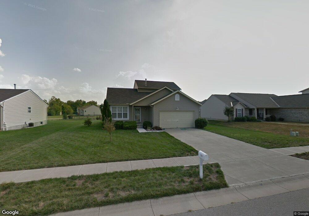
353 Stone Ridge Ln Middletown, OH 45044
Estimated Value: $335,000 - $361,000
3
Beds
2
Baths
1,722
Sq Ft
$202/Sq Ft
Est. Value
About This Home
This home is located at 353 Stone Ridge Ln, Middletown, OH 45044 and is currently estimated at $347,140, approximately $201 per square foot. 353 Stone Ridge Ln is a home located in Butler County with nearby schools including Monroe Primary School, Monroe Elementary School, and Monroe Junior High School.
Ownership History
Date
Name
Owned For
Owner Type
Purchase Details
Closed on
Dec 3, 2004
Sold by
Apex Enterprises Inc
Bought by
Delano Winifred B
Current Estimated Value
Home Financials for this Owner
Home Financials are based on the most recent Mortgage that was taken out on this home.
Original Mortgage
$137,610
Outstanding Balance
$69,419
Interest Rate
5.84%
Mortgage Type
Purchase Money Mortgage
Estimated Equity
$277,721
Create a Home Valuation Report for This Property
The Home Valuation Report is an in-depth analysis detailing your home's value as well as a comparison with similar homes in the area
Home Values in the Area
Average Home Value in this Area
Purchase History
| Date | Buyer | Sale Price | Title Company |
|---|---|---|---|
| Delano Winifred B | $152,900 | -- |
Source: Public Records
Mortgage History
| Date | Status | Borrower | Loan Amount |
|---|---|---|---|
| Open | Delano Winifred B | $137,610 |
Source: Public Records
Tax History Compared to Growth
Tax History
| Year | Tax Paid | Tax Assessment Tax Assessment Total Assessment is a certain percentage of the fair market value that is determined by local assessors to be the total taxable value of land and additions on the property. | Land | Improvement |
|---|---|---|---|---|
| 2024 | $4,088 | $90,750 | $13,060 | $77,690 |
| 2023 | $4,061 | $90,800 | $13,060 | $77,740 |
| 2022 | $3,346 | $65,880 | $13,060 | $52,820 |
| 2021 | $3,224 | $65,880 | $13,060 | $52,820 |
| 2020 | $3,339 | $65,880 | $13,060 | $52,820 |
| 2019 | $3,003 | $54,940 | $13,580 | $41,360 |
| 2018 | $3,006 | $54,940 | $13,580 | $41,360 |
| 2017 | $3,069 | $54,940 | $13,580 | $41,360 |
| 2016 | $2,988 | $51,270 | $13,580 | $37,690 |
| 2015 | $2,954 | $51,270 | $13,580 | $37,690 |
| 2014 | $2,685 | $51,270 | $13,580 | $37,690 |
| 2013 | $2,685 | $46,930 | $10,860 | $36,070 |
Source: Public Records
Map
Nearby Homes
- 1952 Michelle Ln
- 6261 Todhunter Rd
- 401 Granny Smith Ln
- 6383 Todhunter Rd
- 27 Kameron Dr
- 2043 Bridgewater Ln
- 6631 Hamilton Middletown Rd
- 176 Lakeview Dr
- 75 Bayberry Ln
- 5346 Roden Park Dr
- 389 David Lee Ct
- 511 Shawn Dr
- 393 David Lee Ct
- 390 David Lee Ct
- 395 David Lee Ct
- 404 David Lee Ct
- 925 Morgan Dr
- 912 Morgan Dr
- BENNETT Plan at Estates of Monroe Crossings
- STRATTON Plan at Estates of Monroe Crossings
- 355 Stone Ridge Ln
- 351 Stone Ridge Ln
- 8 Forest Pond Dr
- 357 Stone Ridge Ln
- 347 Stone Ridge Ln
- 352 Stone Ridge Ln
- 6 Forest Pond Dr
- 6 Forest Pond Dr
- 13 Forest Pond Dr
- 11 Forest Pond Dr
- 358 Stone Ridge Ln
- 350 Stone Ridge Ln
- 354 Stone Ridge Ln
- 343 Stone Ridge Ln
- 359 Stone Ridge Ln
- 356 Stone Ridge Ln
- 10 Forest Pond Dr
- 360 Stone Ridge Ln
- 15 Forest Pond Dr
- 210 Hollytree Dr