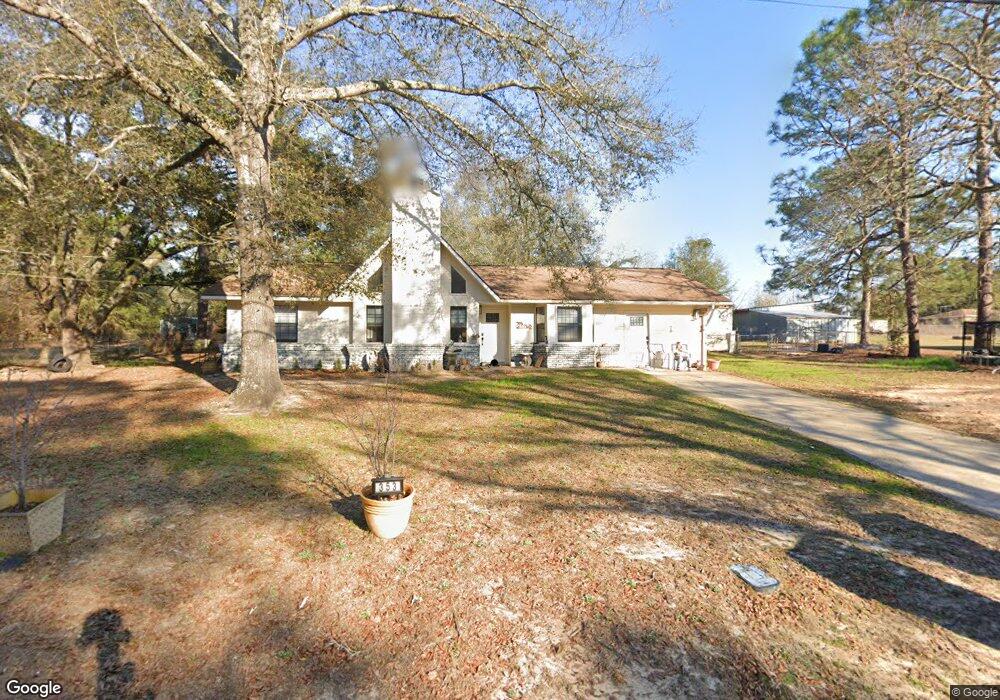
353 Thomas Rd Enterprise, AL 36330
Daleville AreaEstimated Value: $136,000 - $181,000
About This Home
This home is located at 353 Thomas Rd, Enterprise, AL 36330 and is currently estimated at $151,050, approximately $113 per square foot. 353 Thomas Rd is a home located in Dale County with nearby schools including Rucker Boulevard Elementary School, Coppinville School, and Enterprise High School.
Ownership History
We collect this data history from publicly available records. To have your information removed, we recommend requesting removal directly through your county’s website.
Purchase Details
Purchase Details
Home Values in the Area
Average Home Value in this Area
Purchase History
We collect this data history from publicly available records. To have your information removed, we recommend requesting removal directly through your county’s website.
| Date | Buyer | Sale Price | Title Company |
|---|---|---|---|
| $48,281 | None Available | ||
| $85,000 | None Available |
Tax History
We collect this data history from publicly available records. To have your information removed, we recommend requesting removal directly through your county’s website.
| Year | Tax Paid | Tax Assessment Tax Assessment Total Assessment is a certain percentage of the fair market value that is determined by local assessors to be the total taxable value of land and additions on the property. | Land | Improvement |
|---|---|---|---|---|
| 2025 | $767 | $20,760 | $1,360 | $19,400 |
| 2024 | $767 | $19,420 | $1,420 | $18,000 |
| 2023 | $719 | $17,060 | $1,420 | $15,640 |
| 2022 | $240 | $7,440 | $0 | $0 |
| 2021 | $209 | $6,560 | $720 | $5,840 |
| 2020 | $209 | $6,560 | $720 | $5,840 |
| 2019 | $554 | $14,760 | $1,420 | $13,340 |
| 2018 | $589 | $15,760 | $2,480 | $13,280 |
| 2017 | $573 | $15,300 | $2,400 | $12,900 |
| 2016 | $551 | $14,680 | $2,400 | $12,280 |
| 2015 | $551 | $14,680 | $2,400 | $12,280 |
| 2014 | $544 | $14,480 | $2,400 | $12,080 |
| 2013 | $537 | $14,480 | $2,400 | $12,080 |
Map
- 501 Thomas Rd
- 102 Hope St
- 75 Spearhead Dr
- 62 Myrtle St
- 111 Oak Lake Dr
- 523 Averett St
- 267 Maree Dr
- 108 Trent Rd
- 1279 County Road 445
- 14 County Road 737
- 22 County Road 739
- 106 Acres County Road 705
- 0 Private Road 1705 Unit 186609
- 159 Concord Ave
- 123 Winthrope Ln
- 112 Allisha Ct
- 200 Fountain Crest Dr
- 207 Wakefield Way
- 109 Remington Way
- 113 Wakefield Way
Ask me questions while you tour the home.