353 Walker Dr Morganton, GA 30560
Estimated payment $3,108/month
Highlights
- Spa
- Deck
- Wood Flooring
- View of Trees or Woods
- Cathedral Ceiling
- 2 Fireplaces
About This Home
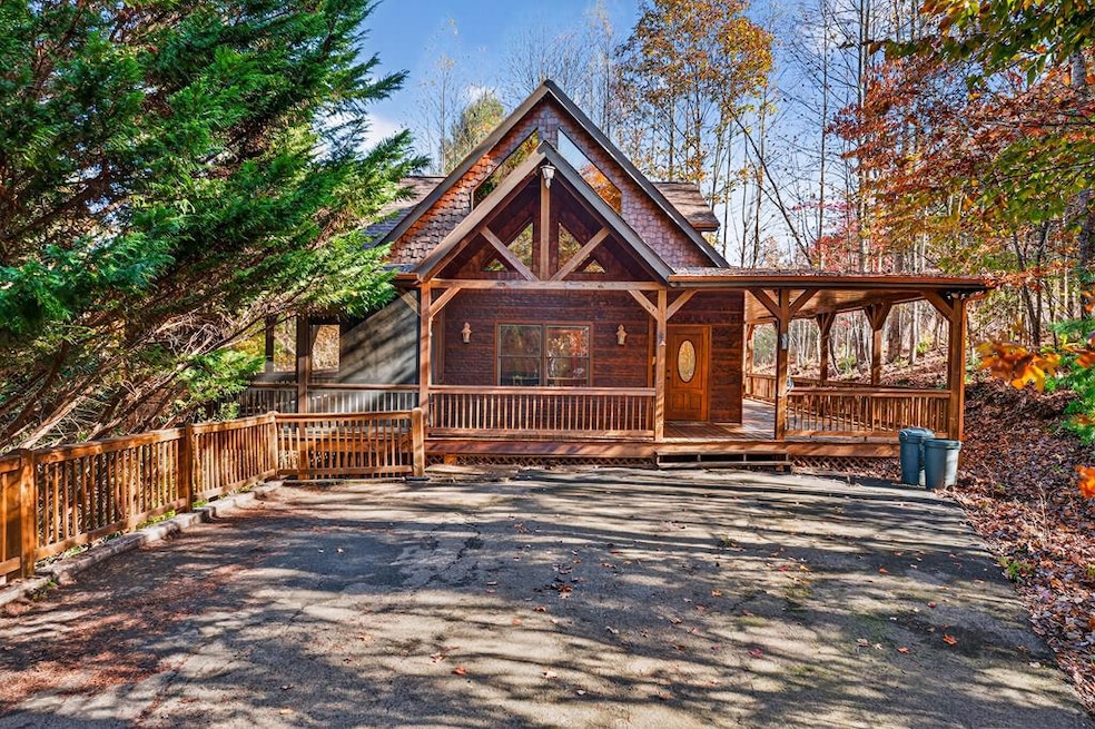
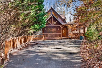
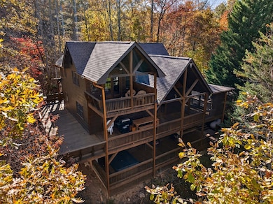
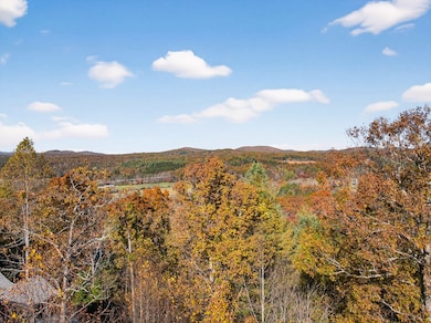
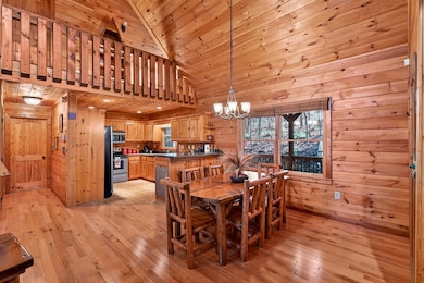
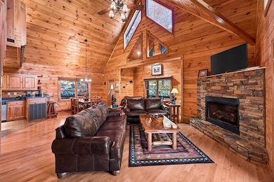
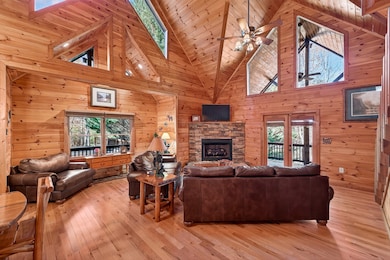
Finally, a reasonably price, furnished cabin in the beautiful mountains of north Georgia. End of road privacy with pavement all the way to the door. This three bedroom, three bath beauty is a one owner home that has never been in a rental program. As you enter, the cathedral ceilings and towering windows allow natural light to bathe the lovingly preserved wood flooring. Spread across three floors, the main level features a spacious bedroom with double doors leading onto a covered deck surrounded by gorgeous foliage. A bath with laundry closet, kitchen, dining area and great room complete this level. The main porch features a screened area with stacked stone fireplace, great for gathering around the fire on chilly evenings or on moonlit spring/summer nights. With three quarters of the porch covered, there's ample outdoor space to accommodate large gatherings of friends and family. The primary bedroom is upstairs and features more cathedral ceilings and a wall of windows. Take in the view from your private deck just off this bedroom. There is an oversized closet, jacuzzi tub and separate shower in the private, well-appointed bathroom. The terrace level features a large, inviting space great for a game room, tv room or both! There also is a third bedroom and bathroom here. Outside is another spacious deck with a large hot tub - perfect for relaxing after a day of walking the trails, horseback riding, zip lining, fishing, rafting, winery hopping or shopping in downtown Blue Ridge. This is just what the doctor ordered! Great place for second home living or as a rental investment. Plenty of parking for multiple vehicles.
Listing Agent
North Georgia Cabins & Land, LLC. Brokerage Phone: 7066327111 License #289066 Listed on: 11/07/2025
Home Details
Home Type
- Single Family
Year Built
- Built in 2006
Lot Details
- 1.45 Acre Lot
Property Views
- Woods
- Mountain
- Seasonal
Home Design
- Cabin
- Frame Construction
- Shingle Roof
- Wood Siding
Interior Spaces
- 2,436 Sq Ft Home
- 3-Story Property
- Furnished
- Cathedral Ceiling
- Ceiling Fan
- 2 Fireplaces
- Insulated Windows
- Wood Frame Window
- Window Screens
- Finished Basement
- Basement Fills Entire Space Under The House
Kitchen
- Range
- Microwave
- Dishwasher
Flooring
- Wood
- Tile
Bedrooms and Bathrooms
- 3 Bedrooms
- Primary Bedroom Upstairs
- 3 Full Bathrooms
- Soaking Tub
- Spa Bath
Laundry
- Laundry on main level
- Dryer
- Washer
Parking
- Driveway
- Open Parking
Outdoor Features
- Spa
- Deck
- Covered Patio or Porch
Utilities
- Central Heating and Cooling System
- Septic Tank
Community Details
- No Home Owners Association
Listing and Financial Details
- Tax Lot 6
- Assessor Parcel Number 0013045B1A
Map
Home Values in the Area
Average Home Value in this Area
Tax History
| Year | Tax Paid | Tax Assessment Tax Assessment Total Assessment is a certain percentage of the fair market value that is determined by local assessors to be the total taxable value of land and additions on the property. | Land | Improvement |
|---|---|---|---|---|
| 2025 | $2,159 | $235,548 | $19,200 | $216,348 |
| 2024 | $2,159 | $235,548 | $19,200 | $216,348 |
| 2023 | $2,068 | $202,822 | $19,200 | $183,622 |
| 2022 | $2,090 | $204,984 | $19,200 | $185,784 |
| 2021 | $1,486 | $105,948 | $19,200 | $86,748 |
| 2020 | $1,510 | $105,948 | $19,200 | $86,748 |
| 2019 | $1,540 | $105,948 | $19,200 | $86,748 |
| 2018 | $1,675 | $108,707 | $19,200 | $89,507 |
| 2017 | $1,873 | $105,839 | $15,360 | $90,479 |
| 2016 | $1,634 | $96,195 | $15,360 | $80,835 |
| 2015 | $1,750 | $98,636 | $15,360 | $83,276 |
| 2014 | $2,011 | $114,100 | $15,360 | $98,740 |
| 2013 | -- | $91,058 | $15,360 | $75,698 |
Property History
| Date | Event | Price | List to Sale | Price per Sq Ft |
|---|---|---|---|---|
| 11/07/2025 11/07/25 | For Sale | $560,000 | -- | $230 / Sq Ft |
Purchase History
| Date | Type | Sale Price | Title Company |
|---|---|---|---|
| Deed | $315,000 | -- | |
| Deed | $48,000 | -- |
Mortgage History
| Date | Status | Loan Amount | Loan Type |
|---|---|---|---|
| Open | $100,000 | New Conventional |
Source: Northeast Georgia Board of REALTORS®
MLS Number: 420145
APN: 0013-045B1A
- 00 Walker Dr
- 0 Walker Dr Unit 10545675
- 0 Walker Dr Unit 420718
- 0 Walker Dr Unit 10545421
- Lot 1 Spring Ridge Dr
- 120 Mountain Meadows Dr
- L-134 Mountain Meadows Dr
- 51 Mountain Meadows Dr
- 34 Mountain Meadows Cir
- 66 Mountain Meadows Trail
- 161 Mountain Meadows Dr
- 121 Mountain Meadows Dr
- 3 Hideaway
- L-183 Mountain Meadows Dr
- 113 Mountain Meadows Dr
- LOT 9 Folklore Ct
- 33 Mountain Meadows Cir
- 154 Hideout Trail St
- 26 Mountain Meadows Cir
- 12293 Old Highway 76
- LT 62 Waterside Blue Ridge
- 66 Evening Shadows Rd Unit ID1269722P
- 124 Lake Shore Dr Unit House
- 1519 Tipton Springs Rd
- 725 Rocky Point Dr
- 120 Hummingbird Way Unit ID1282660P
- 328 Sharp Top Cir
- 48 Glen Torr
- 58 Dillard Place
- 88 Black Gum Ln
- 101 Hothouse Dr
- 544 E Main St
- 22 Green Mountain Ct Unit ID1264827P
- 60 E Highland St
- 3739 Pat Colwell Rd
- 863 Woodland Dr
- 1390 Snake Nation Rd Unit ID1310911P
- 348 the Forest Has Eyes
- 451 Cobb Mountain Rd
