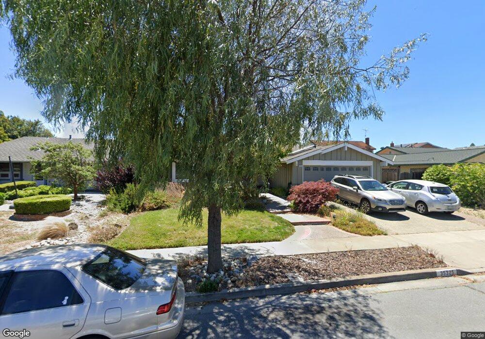
35325 Ramsgate Dr Newark, CA 94560
Estimated Value: $1,439,074 - $1,547,000
3
Beds
2
Baths
1,610
Sq Ft
$929/Sq Ft
Est. Value
About This Home
This home is located at 35325 Ramsgate Dr, Newark, CA 94560 and is currently estimated at $1,495,519, approximately $928 per square foot. 35325 Ramsgate Dr is a home located in Alameda County with nearby schools including John F. Kennedy Elementary School, Newark Junior High School, and Newark Memorial High School.
Ownership History
Date
Name
Owned For
Owner Type
Purchase Details
Closed on
Dec 4, 2009
Sold by
Siacotos Thomas John and Siacotos Carol Elaine
Bought by
Siacotos Thomas John and Siacotos Carol Elaine
Current Estimated Value
Purchase Details
Closed on
May 26, 2000
Sold by
Goodger Norman G and Goodger Cheryl A
Bought by
Siacotos Thomas J and Siacotos Carol E
Home Financials for this Owner
Home Financials are based on the most recent Mortgage that was taken out on this home.
Original Mortgage
$250,000
Outstanding Balance
$87,883
Interest Rate
8.18%
Estimated Equity
$1,407,636
Create a Home Valuation Report for This Property
The Home Valuation Report is an in-depth analysis detailing your home's value as well as a comparison with similar homes in the area
Home Values in the Area
Average Home Value in this Area
Purchase History
| Date | Buyer | Sale Price | Title Company |
|---|---|---|---|
| Siacotos Thomas John | -- | None Available | |
| Siacotos Thomas John | -- | None Available | |
| Siacotos Thomas J | $426,000 | American Title Co |
Source: Public Records
Mortgage History
| Date | Status | Borrower | Loan Amount |
|---|---|---|---|
| Open | Siacotos Thomas J | $250,000 |
Source: Public Records
Tax History
| Year | Tax Paid | Tax Assessment Tax Assessment Total Assessment is a certain percentage of the fair market value that is determined by local assessors to be the total taxable value of land and additions on the property. | Land | Improvement |
|---|---|---|---|---|
| 2025 | $8,105 | $647,714 | $196,414 | $458,300 |
| 2024 | $8,105 | $634,878 | $192,563 | $449,315 |
| 2023 | $7,884 | $629,295 | $188,788 | $440,507 |
| 2022 | $7,778 | $609,958 | $185,087 | $431,871 |
| 2021 | $7,584 | $597,864 | $181,459 | $423,405 |
| 2020 | $7,477 | $598,665 | $179,599 | $419,066 |
| 2019 | $7,370 | $586,930 | $176,079 | $410,851 |
| 2018 | $7,259 | $575,423 | $172,627 | $402,796 |
| 2017 | $7,075 | $564,142 | $169,242 | $394,900 |
| 2016 | $7,001 | $553,084 | $165,925 | $387,159 |
| 2015 | $6,977 | $544,777 | $163,433 | $381,344 |
| 2014 | $6,788 | $534,105 | $160,231 | $373,874 |
Source: Public Records
Map
Nearby Homes
- 5136 Ramsgate Dr
- 35605 Scarborough Dr
- 35345 Cabral Dr
- 4987 Winchester Place
- 5030 Chelsea Dr
- 35415 Blackburn Dr
- 4862 Garnet Common
- 4628 Capitan Dr
- 5298 Sussex Place
- 5228 Falmouth Place
- 34767 Shalimar Terrace
- 34631 Pueblo Terrace Unit 99
- 34607 Pueblo Terrace
- 34565 Pueblo Terrace
- 34590 Falls Terrace
- 36302 Tunbridge Dr
- 35952 Rosewood Dr
- 35172 Lancero St
- 5220 Fairbanks Common
- 36255 Casey Ct
- 35317 Ramsgate Dr
- 35337 Ramsgate Dr
- 35318 Newcastle Ct
- 35332 Newcastle Ct
- 35306 Newcastle Ct
- 35273 Ramsgate Dr
- 35349 Ramsgate Dr
- 35340 Newcastle Ct
- 35316 Ramsgate Dr
- 35310 Ramsgate Dr
- 35282 Preston Place
- 35338 Ramsgate Dr
- 35274 Ramsgate Dr
- 35267 Ramsgate Dr
- 35357 Ramsgate Dr
- 35358 Newcastle Ct
- 35350 Ramsgate Dr
- 35260 Preston Place
- 35268 Ramsgate Dr
- 35323 Newcastle Ct
Your Personal Tour Guide
Ask me questions while you tour the home.