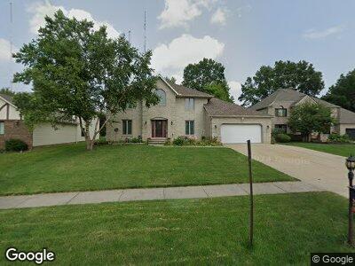
3533 Sparrow Flight Dr Seven Hills, OH 44131
Estimated Value: $374,000 - $464,000
4
Beds
3
Baths
2,672
Sq Ft
$156/Sq Ft
Est. Value
About This Home
This home is located at 3533 Sparrow Flight Dr, Seven Hills, OH 44131 and is currently estimated at $415,724, approximately $155 per square foot. 3533 Sparrow Flight Dr is a home located in Cuyahoga County with nearby schools including Green Valley Elementary School, Normandy High School, and Hillside Middle School.
Ownership History
Date
Name
Owned For
Owner Type
Purchase Details
Closed on
Jun 24, 1994
Sold by
Trusso Sebastiano
Bought by
Bunjevac Antun and Bunjevac Maria M
Current Estimated Value
Home Financials for this Owner
Home Financials are based on the most recent Mortgage that was taken out on this home.
Original Mortgage
$175,000
Interest Rate
8.78%
Mortgage Type
New Conventional
Purchase Details
Closed on
May 26, 1993
Bought by
Trusso Sebastiano
Purchase Details
Closed on
Dec 30, 1992
Bought by
Perrico Property Systems,
Purchase Details
Closed on
Jan 1, 1990
Bought by
Perrico Property
Create a Home Valuation Report for This Property
The Home Valuation Report is an in-depth analysis detailing your home's value as well as a comparison with similar homes in the area
Home Values in the Area
Average Home Value in this Area
Purchase History
| Date | Buyer | Sale Price | Title Company |
|---|---|---|---|
| Bunjevac Antun | $225,000 | -- | |
| Trusso Sebastiano | $35,000 | -- | |
| Perrico Property Systems, | -- | -- | |
| Perrico Property | -- | -- |
Source: Public Records
Mortgage History
| Date | Status | Borrower | Loan Amount |
|---|---|---|---|
| Closed | Bunjevac Antun | $175,000 |
Source: Public Records
Tax History Compared to Growth
Tax History
| Year | Tax Paid | Tax Assessment Tax Assessment Total Assessment is a certain percentage of the fair market value that is determined by local assessors to be the total taxable value of land and additions on the property. | Land | Improvement |
|---|---|---|---|---|
| 2024 | $7,132 | $119,875 | $23,590 | $96,285 |
| 2023 | $7,628 | $109,870 | $23,280 | $86,590 |
| 2022 | $7,585 | $109,870 | $23,280 | $86,590 |
| 2021 | $7,818 | $109,870 | $23,280 | $86,590 |
| 2020 | $7,924 | $98,980 | $20,970 | $78,020 |
| 2019 | $7,597 | $282,800 | $59,900 | $222,900 |
| 2018 | $7,623 | $98,980 | $20,970 | $78,020 |
| 2017 | $7,995 | $96,500 | $24,680 | $71,820 |
| 2016 | $7,935 | $96,500 | $24,680 | $71,820 |
| 2015 | $7,174 | $96,500 | $24,680 | $71,820 |
| 2014 | $7,174 | $91,040 | $23,280 | $67,760 |
Source: Public Records
Map
Nearby Homes
- 0 V L Gene Dr
- 4253 Vincent Dr
- 3187 Jasmine Dr
- 4300 Lake Charles Dr
- 1159 Orchardview Rd
- 7480 Ludwin Dr
- 0 Hillside Rd
- 200 Village Dr Unit 15
- 7214 Hawthorne Trace
- 8086 Mccreary Rd
- VL Orchardview Rd
- 7178 Hawthorn Trace
- 3938 E Wallings Rd
- 7417 Broadview Rd
- 6119 E Sprague Rd
- 4520 E Wallings Rd
- 6315 Brookside Rd
- 6319 E Pleasant Valley Rd
- 8327 Eastwood Dr
- 1632 Jo Ann Dr
- 3533 Sparrow Flight Dr
- 3475 Sparrow Flight Dr
- 3591 Sparrow Flight Dr
- 3417 Sparrow Flight Dr
- 3649 Sparrow Flight Dr
- 3359 Sparrow Flight Dr
- 3540 Sparrow Flight Dr
- 3470 Sparrow Flight Dr
- 3610 Sparrow Flight Dr
- 7600 Sparrow Flight Dr
- 3400 Sparrow Flight Dr
- 3301 Sparrow Flight Dr
- 7620 Sparrow Flight Dr
- 3360 Sparrow Flight Dr
- 7640 Sparrow Flight Dr
- 3243 Sparrow Flight Dr
- 3330 Sparrow Flight Dr
- 3587 Wynde Tree Dr
- 3633 Wynde Tree Dr
- 3493 Wynde Tree Dr