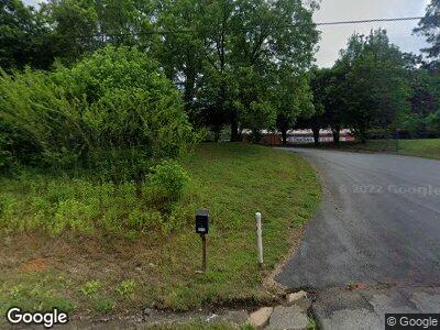
3541 S Chestatee Dahlonega, GA 30533
Estimated Value: $1,565,359
--
Bed
3
Baths
32,840
Sq Ft
$48/Sq Ft
Est. Value
About This Home
This home is located at 3541 S Chestatee, Dahlonega, GA 30533 and is currently estimated at $1,565,359, approximately $47 per square foot. 3541 S Chestatee is a home located in Lumpkin County with nearby schools including Lumpkin County High School.
Ownership History
Date
Name
Owned For
Owner Type
Purchase Details
Closed on
Mar 25, 2022
Sold by
C A Mullins Llc
Bought by
Truesafe Storage Dahlonega Llc
Current Estimated Value
Home Financials for this Owner
Home Financials are based on the most recent Mortgage that was taken out on this home.
Original Mortgage
$2,407,500
Outstanding Balance
$1,019,857
Interest Rate
3.92%
Mortgage Type
Mortgage Modification
Estimated Equity
$545,502
Purchase Details
Closed on
May 11, 2015
Sold by
Fieldale Farms Corp
Bought by
Ca Mullins Llc
Purchase Details
Closed on
Apr 1, 1984
Bought by
Fieldale Farms Inc
Purchase Details
Closed on
Jan 1, 1977
Bought by
Folger Hatchery Inc
Create a Home Valuation Report for This Property
The Home Valuation Report is an in-depth analysis detailing your home's value as well as a comparison with similar homes in the area
Home Values in the Area
Average Home Value in this Area
Purchase History
| Date | Buyer | Sale Price | Title Company |
|---|---|---|---|
| Truesafe Storage Dahlonega Llc | $3,210,000 | -- | |
| Ca Mullins Llc | $850,000 | -- | |
| Fieldale Farms Inc | -- | -- | |
| Folger Hatchery Inc | -- | -- |
Source: Public Records
Mortgage History
| Date | Status | Borrower | Loan Amount |
|---|---|---|---|
| Open | Truesafe Storage Dahlonega Llc | $2,407,500 | |
| Previous Owner | C A Mullins Llc | $1,888,220 | |
| Previous Owner | C A Mullins Llc | $1,292,340 |
Source: Public Records
Tax History Compared to Growth
Tax History
| Year | Tax Paid | Tax Assessment Tax Assessment Total Assessment is a certain percentage of the fair market value that is determined by local assessors to be the total taxable value of land and additions on the property. | Land | Improvement |
|---|---|---|---|---|
| 2024 | $30,814 | $1,068,993 | $123,000 | $945,993 |
| 2023 | $30,814 | $1,068,993 | $123,000 | $945,993 |
| 2022 | $31,210 | $1,021,641 | $209,400 | $812,241 |
| 2021 | $13,194 | $404,414 | $167,520 | $236,894 |
| 2020 | $11,746 | $346,585 | $167,520 | $179,065 |
| 2019 | $11,805 | $346,585 | $167,520 | $179,065 |
| 2018 | $12,492 | $343,222 | $167,520 | $175,702 |
| 2017 | $12,686 | $342,754 | $167,520 | $175,234 |
| 2016 | $12,862 | $340,289 | $167,520 | $172,769 |
| 2015 | $12,296 | $340,289 | $167,520 | $172,769 |
| 2014 | $12,296 | $379,890 | $167,520 | $212,370 |
| 2013 | -- | $398,540 | $167,520 | $231,020 |
Source: Public Records
Map
Nearby Homes
- 157 River Knoll Way
- 67 Rockhound Dr
- 245 River Knoll Way
- 533 Birch River Dr Unit GV17
- 104 Prospector Ridge
- 270 Prospector Ridge
- 0 Stamp Mill Dr
- 133 Stamp Mill Dr
- 176 Stamp Mill Ln
- 29 Chestatee Springs Ln
- 68 Flynt Ridge Dr
- 85 Fairway Ct Unit 5
- 297 Holly Ridge
- 0 Fairway Ct Unit 6 10415271
- 0 Fairway Ct Unit 6 7194005
- 4.6ac Heritage Dr
- 640 Bear Paw Ridge
- 105 Sandhill Dr
- 3541 S Chestatee
- 3619 S Chestatee
- 0 S Chestatee St at River Knoll Way Unit 7547106
- 0 S Chestatee St at River Knoll Way
- 260 Rockhound Dr
- 3620 S Chestatee
- 73 River Knoll Way Unit 1
- 73 River Knoll Way
- 0 River Knoll Way Unit 8160917
- 0 River Knoll Way Unit 7101198
- 0 River Knoll Way Unit 7030710
- 0 River Knoll Way Unit 7030709
- 0 River Knoll Way Unit 3164281
- 0 River Knoll Way Unit 3164278
- 0 River Knoll Way Unit 3164279
- 0 River Knoll Way Unit 8617438
- 0 River Knoll Way Unit 8049886
- 0 River Knoll Way Unit 7465327
- 0 River Knoll Way Unit 26 7432318
- 0 River Knoll Way Unit 7284276
