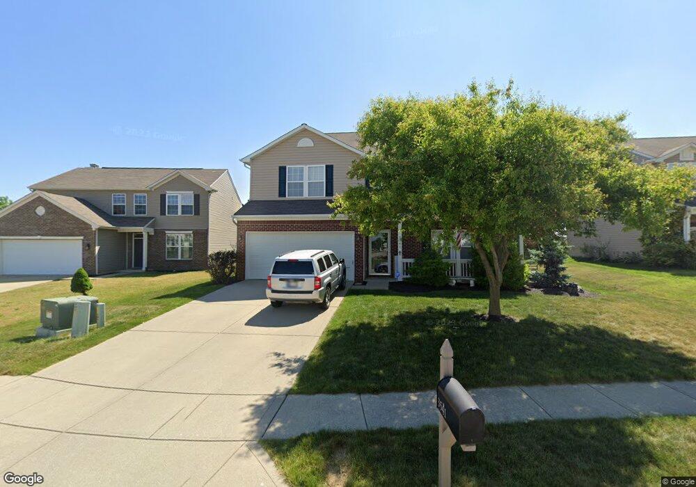
3541 White Cliff Way Whitestown, IN 46075
Estimated Value: $354,000 - $376,000
4
Beds
3
Baths
2,736
Sq Ft
$134/Sq Ft
Est. Value
About This Home
This home is located at 3541 White Cliff Way, Whitestown, IN 46075 and is currently estimated at $366,725, approximately $134 per square foot. 3541 White Cliff Way is a home located in Boone County with nearby schools including Perry Worth Elementary School, Lebanon Middle School, and Lebanon Senior High School.
Ownership History
Date
Name
Owned For
Owner Type
Purchase Details
Closed on
Aug 17, 2005
Sold by
Beazer Homes Indiana Llp
Bought by
Walker Christopher David and Walker Lisa Kay
Current Estimated Value
Home Financials for this Owner
Home Financials are based on the most recent Mortgage that was taken out on this home.
Original Mortgage
$120,164
Outstanding Balance
$62,849
Interest Rate
5.69%
Mortgage Type
New Conventional
Estimated Equity
$303,876
Create a Home Valuation Report for This Property
The Home Valuation Report is an in-depth analysis detailing your home's value as well as a comparison with similar homes in the area
Home Values in the Area
Average Home Value in this Area
Purchase History
| Date | Buyer | Sale Price | Title Company |
|---|---|---|---|
| Walker Christopher David | -- | -- |
Source: Public Records
Mortgage History
| Date | Status | Borrower | Loan Amount |
|---|---|---|---|
| Open | Walker Christopher David | $120,164 |
Source: Public Records
Tax History Compared to Growth
Tax History
| Year | Tax Paid | Tax Assessment Tax Assessment Total Assessment is a certain percentage of the fair market value that is determined by local assessors to be the total taxable value of land and additions on the property. | Land | Improvement |
|---|---|---|---|---|
| 2025 | $3,527 | $319,400 | $29,600 | $289,800 |
| 2024 | $3,527 | $306,800 | $29,600 | $277,200 |
| 2023 | $3,652 | $310,100 | $29,600 | $280,500 |
| 2022 | $3,431 | $276,500 | $29,600 | $246,900 |
| 2021 | $2,738 | $236,700 | $29,600 | $207,100 |
| 2020 | $2,646 | $226,100 | $29,600 | $196,500 |
| 2019 | $2,480 | $209,500 | $29,600 | $179,900 |
| 2018 | $2,246 | $192,300 | $29,600 | $162,700 |
| 2017 | $2,195 | $185,200 | $29,600 | $155,600 |
| 2016 | $2,169 | $184,000 | $29,600 | $154,400 |
| 2014 | $1,879 | $168,100 | $29,600 | $138,500 |
| 2013 | $1,779 | $160,500 | $29,600 | $130,900 |
Source: Public Records
Map
Nearby Homes
- 3696 White Cliff Way
- 6328 Dusty Laurel Dr
- Hendricks Plan at Haven at Whitestown
- Waveland Plan at Haven at Whitestown
- Dawson Plan at Haven at Whitestown
- Sutcliffe Plan at Haven at Whitestown
- Hampton Plan at Haven at Whitestown
- Addison Plan at Haven at Whitestown
- Buckner Plan at Haven at Whitestown
- Sheffield Plan at Haven at Whitestown
- Payton Plan at Haven at Whitestown
- 3822 Limelight Ln
- 3406 Preakness St
- 3347 Churchill Ln
- 3511 Firethorn Dr
- 3391 Roundlake Ln
- 6840 Seabiscuit Rd
- 3743 Indigo Blue Blvd
- 3374 Paisley Pointe
- 207 S Buck St
- 3553 White Cliff Way
- 3529 White Cliff Way
- 3565 White Cliff Way
- 6445 Dusty Laurel Dr
- 3517 White Cliff Way
- 3577 White Cliff Way
- 6444 Green Grass Ln
- 10 S 650 E
- 6460 Dusty Laurel Dr
- 6433 Dusty Laurel Dr
- 3589 White Cliff Way
- 6432 Green Grass Ln
- 6436 Dusty Laurel Dr
- 6421 Dusty Laurel Dr
- 3601 White Cliff Way
- 6447 Green Grass Ln
- 6424 Dusty Laurel Dr
- 6420 Green Grass Ln
- 6409 Dusty Laurel Dr
- 6437 Green Grass Ln