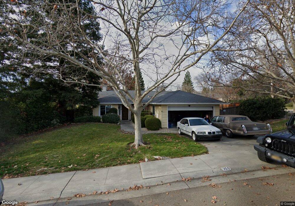
355 Brookside Dr Chico, CA 95928
California Park NeighborhoodEstimated Value: $447,818 - $504,000
3
Beds
2
Baths
1,481
Sq Ft
$316/Sq Ft
Est. Value
About This Home
This home is located at 355 Brookside Dr, Chico, CA 95928 and is currently estimated at $467,705, approximately $315 per square foot. 355 Brookside Dr is a home located in Butte County with nearby schools including Sierra View Elementary School, Harry M. Marsh Junior High School, and Pleasant Valley High School.
Ownership History
Date
Name
Owned For
Owner Type
Purchase Details
Closed on
Jul 26, 1999
Sold by
Strisower John
Bought by
Jessick Eric T and Jessick Shawnmarie
Current Estimated Value
Home Financials for this Owner
Home Financials are based on the most recent Mortgage that was taken out on this home.
Original Mortgage
$117,200
Outstanding Balance
$38,900
Interest Rate
10.75%
Estimated Equity
$428,805
Create a Home Valuation Report for This Property
The Home Valuation Report is an in-depth analysis detailing your home's value as well as a comparison with similar homes in the area
Home Values in the Area
Average Home Value in this Area
Purchase History
| Date | Buyer | Sale Price | Title Company |
|---|---|---|---|
| Jessick Eric T | $146,500 | Fidelity National Title | |
| Strisower John | -- | Fidelity National Title |
Source: Public Records
Mortgage History
| Date | Status | Borrower | Loan Amount |
|---|---|---|---|
| Open | Jessick Eric T | $117,200 |
Source: Public Records
Tax History
| Year | Tax Paid | Tax Assessment Tax Assessment Total Assessment is a certain percentage of the fair market value that is determined by local assessors to be the total taxable value of land and additions on the property. | Land | Improvement |
|---|---|---|---|---|
| 2025 | $2,473 | $227,444 | $89,130 | $138,314 |
| 2024 | $2,473 | $222,985 | $87,383 | $135,602 |
| 2023 | $2,443 | $218,614 | $85,670 | $132,944 |
| 2022 | $2,404 | $214,329 | $83,991 | $130,338 |
| 2021 | $2,358 | $210,128 | $82,345 | $127,783 |
| 2020 | $2,352 | $207,974 | $81,501 | $126,473 |
| 2019 | $2,309 | $203,897 | $79,903 | $123,994 |
| 2018 | $2,267 | $199,900 | $78,337 | $121,563 |
| 2017 | $2,221 | $195,981 | $76,801 | $119,180 |
| 2016 | $2,027 | $192,140 | $75,296 | $116,844 |
| 2015 | $2,027 | $189,254 | $74,165 | $115,089 |
| 2014 | $1,978 | $185,548 | $72,713 | $112,835 |
Source: Public Records
Map
Nearby Homes
- 451 Palisades Dr
- 2673 Lakewest Dr
- 3171 Sandstone Ln
- 2918 Pennyroyal Dr
- 2932 Pennyroyal Dr
- 267 Idyllwild Cir
- 3 Kestrel Ct
- 18 Kestrel Ct
- 93 Benson Terrace
- 97 Benson Terrace
- 14 Sparrow Hawk Ln
- 112 Benson Terrace
- 121 Wawona Place
- 6 Matada Ct
- 43 Edgewater Ct
- 853 Coit Tower Way
- 17 Sierra Lakeside Ln Unit 32
- 26 Sierra Lakeside Ln
- 2855 Pin Oak Ln
- 5 Valley Lake Commons
- 357 Brookside Dr
- 1070 Yosemite Dr Unit 1B
- 1 Palomar Ln
- 359 Brookside Dr Unit 223
- 359 Brookside Dr
- 352 Brookside Dr
- 1060 Yosemite Dr
- 354 Brookside Dr
- 361 Brookside Dr
- 356 Brookside Dr
- 2 Palomar Ln
- 6 Palomar Ln
- 358 Brookside Dr
- 453 Palisades Dr Unit 1B
- 1118 Yosemite Dr
- 1050 Yosemite Dr
- 360 Brookside Dr
- 363 Brookside Dr
- 1113 Yosemite Dr
- 455 Palisades Dr