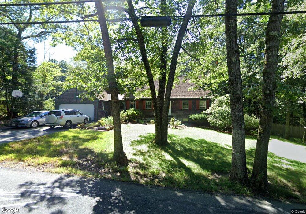
355 Cedar St Ashland, MA 01721
Estimated Value: $792,000 - $903,000
4
Beds
2
Baths
2,168
Sq Ft
$380/Sq Ft
Est. Value
About This Home
This home is located at 355 Cedar St, Ashland, MA 01721 and is currently estimated at $824,559, approximately $380 per square foot. 355 Cedar St is a home located in Middlesex County with nearby schools including William Pittaway Elementary School, Henry E. Warren Elementary School, and David Mindess Elementary School.
Ownership History
Date
Name
Owned For
Owner Type
Purchase Details
Closed on
Jul 22, 2009
Sold by
Muren Clifford A and Muren Linda M
Bought by
Lymburner Andrew D and Brostrup-Jensen Susan
Current Estimated Value
Home Financials for this Owner
Home Financials are based on the most recent Mortgage that was taken out on this home.
Original Mortgage
$330,600
Outstanding Balance
$218,712
Interest Rate
5.58%
Mortgage Type
Purchase Money Mortgage
Estimated Equity
$605,847
Purchase Details
Closed on
Feb 27, 1998
Sold by
Shupe John P and Shupe Danielle D
Bought by
Muren Clifford A and Muren Linda M
Home Financials for this Owner
Home Financials are based on the most recent Mortgage that was taken out on this home.
Original Mortgage
$160,000
Interest Rate
6.85%
Mortgage Type
Purchase Money Mortgage
Purchase Details
Closed on
May 15, 1996
Sold by
Chiumento Joseph A and Chiumento Lana E
Bought by
Shupe John P and Shupe Danielle D
Create a Home Valuation Report for This Property
The Home Valuation Report is an in-depth analysis detailing your home's value as well as a comparison with similar homes in the area
Home Values in the Area
Average Home Value in this Area
Purchase History
| Date | Buyer | Sale Price | Title Company |
|---|---|---|---|
| Lymburner Andrew D | $389,000 | -- | |
| Muren Clifford A | $247,500 | -- | |
| Shupe John P | $201,000 | -- |
Source: Public Records
Mortgage History
| Date | Status | Borrower | Loan Amount |
|---|---|---|---|
| Open | Lymburner Andrew D | $330,600 | |
| Previous Owner | Shupe John P | $186,000 | |
| Previous Owner | Shupe John P | $28,000 | |
| Previous Owner | Shupe John P | $160,000 |
Source: Public Records
Tax History Compared to Growth
Tax History
| Year | Tax Paid | Tax Assessment Tax Assessment Total Assessment is a certain percentage of the fair market value that is determined by local assessors to be the total taxable value of land and additions on the property. | Land | Improvement |
|---|---|---|---|---|
| 2025 | $9,466 | $741,300 | $239,600 | $501,700 |
| 2024 | $9,227 | $696,900 | $239,600 | $457,300 |
| 2023 | $8,391 | $609,400 | $228,200 | $381,200 |
| 2022 | $8,489 | $534,600 | $207,300 | $327,300 |
| 2021 | $8,053 | $505,500 | $207,300 | $298,200 |
| 2020 | $7,878 | $487,500 | $207,300 | $280,200 |
| 2019 | $7,560 | $464,400 | $207,300 | $257,100 |
| 2018 | $7,295 | $439,200 | $205,000 | $234,200 |
| 2017 | $6,779 | $405,900 | $201,100 | $204,800 |
| 2016 | $6,489 | $381,700 | $196,000 | $185,700 |
| 2015 | $6,346 | $366,800 | $183,100 | $183,700 |
| 2014 | $6,363 | $365,900 | $163,600 | $202,300 |
Source: Public Records
Map
Nearby Homes
- 277 Meeting House Path
- 97 Meeting House Path Unit 97
- 74 Meeting House Path
- 72 Meeting House Path
- 8 Raymond Way
- 157 Leland Farm Rd
- 120 Prospect St
- 152 Turner Rd Unit 43
- 152 Turner Rd Unit 14
- 63 Trailside Way Unit 63
- 147 Turner Rd Unit 80
- 67 Spyglass Hill Dr
- 306 Trailside Way
- 84 E Bluff Rd
- 59 Turner Rd
- 102 Captain Eames Cir
- 49 Prospect St
- 76 Algonquin Trail
- 25 Prospect St
- 45 Half Crown Cir
- 349 Cedar St
- 361 Cedar St
- 28 Donna Lee Ln
- 24 Donna Lee Ln
- 1 Shady Hollow Path
- 3 Edward Dr
- 11 Edward Dr
- 2 Shady Hollow Path
- 343 Cedar St
- 20 Donna Lee Ln
- 358 Cedar St
- 342 Cedar St
- 16 Donna Lee Ln
- 23 Donna Lee Ln
- 31 Donna Lee Ln
- 366 Cedar St
- 3 Shady Hollow Path
- 337 Cedar St
- 27 Donna Lee Ln
- 4 Shady Hollow Path