Estimated Value: $571,097 - $770,000
4
Beds
3
Baths
2,514
Sq Ft
$262/Sq Ft
Est. Value
About This Home
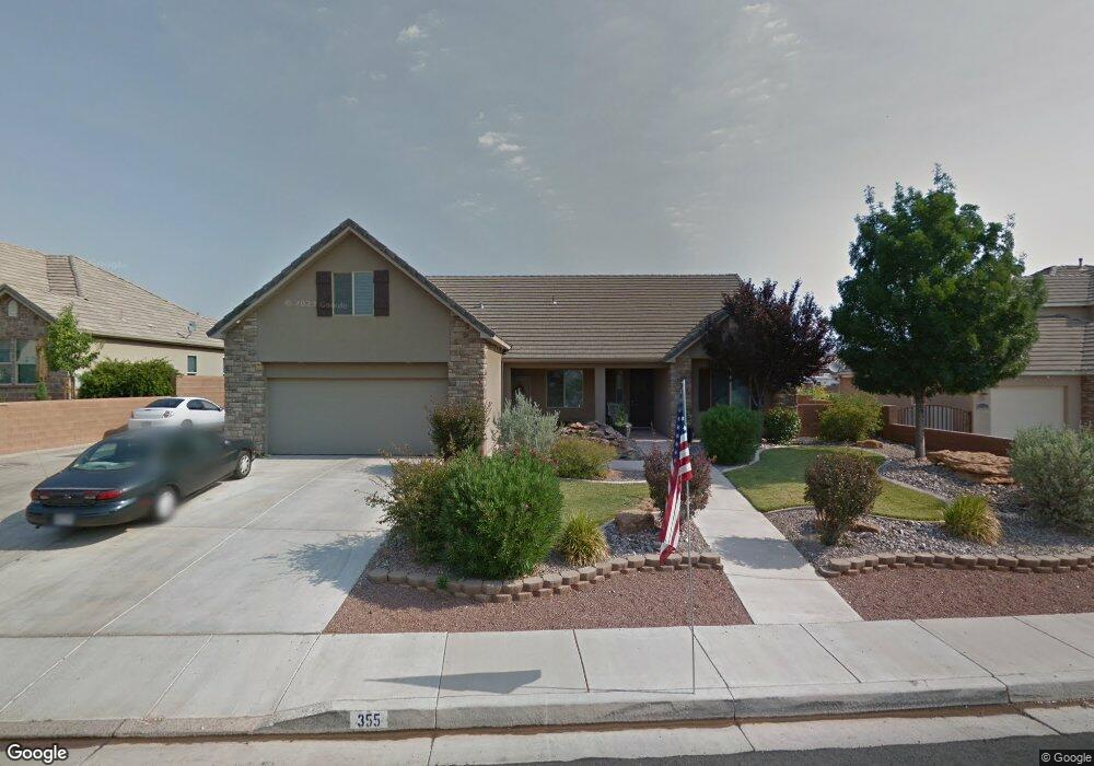
This home is located at 355 E 1175 S, Ivins, UT 84738 and is currently estimated at $658,274, approximately $261 per square foot. 355 E 1175 S is a home located in Washington County with nearby schools including Red Mountain School, Snow Canyon Middle School, and Lava Ridge Intermediate School.
Ownership History
Date
Name
Owned For
Owner Type
Purchase Details
Closed on
Jun 15, 2022
Sold by
Brown James P
Bought by
James And Lori Brown Family Trust
Current Estimated Value
Purchase Details
Closed on
Dec 24, 2019
Sold by
Brown James P and Brown Lori K
Bought by
Brown James P and Brown Lori Kay
Home Financials for this Owner
Home Financials are based on the most recent Mortgage that was taken out on this home.
Original Mortgage
$278,600
Interest Rate
3.7%
Mortgage Type
New Conventional
Create a Home Valuation Report for This Property
The Home Valuation Report is an in-depth analysis detailing your home's value as well as a comparison with similar homes in the area
Purchase History
| Date | Buyer | Sale Price | Title Company |
|---|---|---|---|
| James And Lori Brown Family Trust | -- | Snow Caldwell Beckstrom & Wilb | |
| Brown James P | -- | Accommodation |
Source: Public Records
Mortgage History
| Date | Status | Borrower | Loan Amount |
|---|---|---|---|
| Previous Owner | Brown James P | $278,600 |
Source: Public Records
Tax History
| Year | Tax Paid | Tax Assessment Tax Assessment Total Assessment is a certain percentage of the fair market value that is determined by local assessors to be the total taxable value of land and additions on the property. | Land | Improvement |
|---|---|---|---|---|
| 2025 | $2,144 | $302,555 | $88,000 | $214,555 |
| 2023 | $2,025 | $296,780 | $71,500 | $225,280 |
| 2022 | $2,179 | $300,575 | $71,500 | $229,075 |
| 2021 | $1,962 | $402,100 | $85,000 | $317,100 |
| 2020 | $1,895 | $367,500 | $85,000 | $282,500 |
| 2019 | $1,976 | $374,800 | $85,000 | $289,800 |
| 2018 | $1,849 | $180,455 | $0 | $0 |
| 2017 | $1,749 | $166,100 | $0 | $0 |
| 2016 | $1,731 | $151,855 | $0 | $0 |
| 2015 | $1,635 | $137,995 | $0 | $0 |
| 2014 | $1,573 | $133,430 | $0 | $0 |
Source: Public Records
Map
Nearby Homes
- 337 E 1100 S
- 3902 London Ln
- 2433 Patricia Dr
- 2405 Patricia Dr
- 2401 Patricia Dr
- 2385 Patricia Dr
- 3879 London Ln
- 336 E Desert Rose Way
- 312 E Desert Rose Way
- 3853 Mitchell Dr
- 2480 Manzoni Rd
- 4263 Bella Vista Dr
- 133 Terrace Ln
- 3859 Rachel Dr
- 915 S 170 E
- 3746 Mitchell Dr
- 2319 Bryson Cir
- 2115 Blake
- 3837 W Lazy River Cir Unit 100
- 2600 Ocotillo Way Unit 56
Your Personal Tour Guide
Ask me questions while you tour the home.