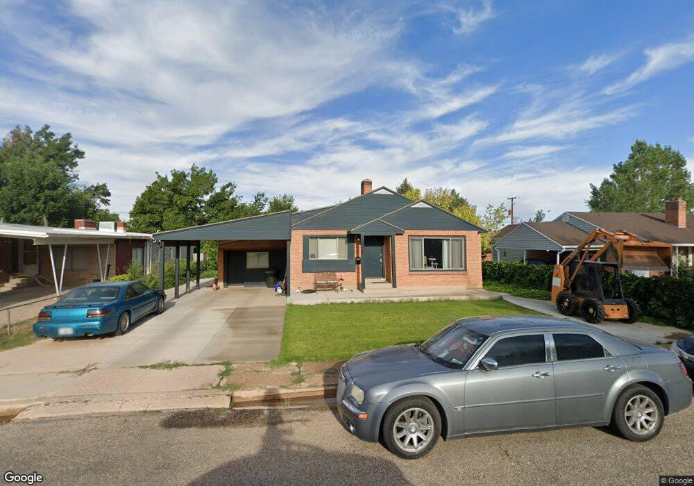
355 N 600 W Cedar City, UT 84721
Estimated Value: $300,000 - $384,000
--
Bed
--
Bath
1,201
Sq Ft
$291/Sq Ft
Est. Value
About This Home
This home is located at 355 N 600 W, Cedar City, UT 84721 and is currently estimated at $349,265, approximately $290 per square foot. 355 N 600 W is a home located in Iron County with nearby schools including Cedar North School, Cedar Middle School, and Cedar City High School.
Ownership History
Date
Name
Owned For
Owner Type
Purchase Details
Closed on
Sep 7, 2012
Sold by
Dalton Leslie Blackburn and Blackburn Brenda
Bought by
Lefevre Carl J and Lefevre Margene Blackburn
Current Estimated Value
Purchase Details
Closed on
Jun 28, 2007
Sold by
Western National Trust Co
Bought by
Blackburn Charles H and Blackburn Marjorie B
Create a Home Valuation Report for This Property
The Home Valuation Report is an in-depth analysis detailing your home's value as well as a comparison with similar homes in the area
Home Values in the Area
Average Home Value in this Area
Purchase History
| Date | Buyer | Sale Price | Title Company |
|---|---|---|---|
| Lefevre Carl J | -- | Cedar Land Title Inc | |
| Dalton Leslie Blackburn | -- | Cedar Land Title Inc | |
| Dalton Leslie Blackburn | -- | Cedar Land Title Inc | |
| Blackburn Charles H | -- | -- |
Source: Public Records
Tax History Compared to Growth
Tax History
| Year | Tax Paid | Tax Assessment Tax Assessment Total Assessment is a certain percentage of the fair market value that is determined by local assessors to be the total taxable value of land and additions on the property. | Land | Improvement |
|---|---|---|---|---|
| 2025 | $1,374 | $176,599 | $41,804 | $134,795 |
| 2023 | $1,523 | $175,405 | $36,350 | $139,055 |
| 2022 | $1,536 | $167,055 | $34,620 | $132,435 |
| 2021 | $1,090 | $118,530 | $16,485 | $102,045 |
| 2020 | $1,181 | $113,925 | $16,485 | $97,440 |
| 2019 | $1,059 | $97,685 | $16,485 | $81,200 |
| 2018 | $1,100 | $98,160 | $16,485 | $81,675 |
| 2017 | $1,048 | $92,075 | $11,940 | $80,135 |
| 2016 | $897 | $73,390 | $9,665 | $63,725 |
| 2015 | $868 | $67,355 | $0 | $0 |
| 2014 | $829 | $60,145 | $0 | $0 |
Source: Public Records
Map
Nearby Homes
- 4.12 Acre Water Rights
- 465 N 800 W Unit 3
- 465 N 800 W Unit 7
- 465 N 800 W Unit 2
- 4961 N 900 W Unit lot 68
- 4973 N 900 W Unit lot 69
- 373 N 400 W
- 457 N 400 W Unit 7
- 376 N 400 W
- 2904 W Oak Springs Rd
- 237 N 400 W
- 261 N 300 W
- 1120 Bulloch Cir
- 1918 S Oak Springs Cir
- 4883 N 10 E
- 4898 N 10 E
- 3.73 ac N 100 W
- 240 N 1400 W
- 0 1 Af Water (Wr # 73-999) Unit 25-265506
- 364 N 1500 W