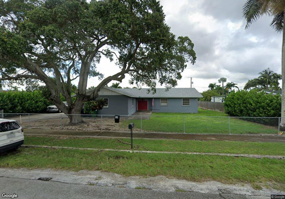
355 NW 22nd St Homestead, FL 33030
Modello NeighborhoodEstimated Value: $499,000 - $576,000
3
Beds
2
Baths
1,681
Sq Ft
$319/Sq Ft
Est. Value
About This Home
This home is located at 355 NW 22nd St, Homestead, FL 33030 and is currently estimated at $535,956, approximately $318 per square foot. 355 NW 22nd St is a home located in Miami-Dade County with nearby schools including Avocado Elementary School, South Dade Middle School, and Arthur And Polly Mays Conservatory Of The Arts.
Ownership History
Date
Name
Owned For
Owner Type
Purchase Details
Closed on
Jun 21, 2021
Sold by
Alonso Brian and Webb William A
Bought by
Oconnor Debbie A
Current Estimated Value
Home Financials for this Owner
Home Financials are based on the most recent Mortgage that was taken out on this home.
Original Mortgage
$125,000
Outstanding Balance
$94,908
Interest Rate
2.9%
Mortgage Type
Seller Take Back
Estimated Equity
$441,048
Purchase Details
Closed on
Oct 21, 1993
Sold by
Graves J Warren and Graves Barbara A
Bought by
Cole Marcia A and Webb Frank R
Home Financials for this Owner
Home Financials are based on the most recent Mortgage that was taken out on this home.
Original Mortgage
$90,000
Interest Rate
7.07%
Create a Home Valuation Report for This Property
The Home Valuation Report is an in-depth analysis detailing your home's value as well as a comparison with similar homes in the area
Home Values in the Area
Average Home Value in this Area
Purchase History
| Date | Buyer | Sale Price | Title Company |
|---|---|---|---|
| Oconnor Debbie A | $225,000 | Title Company Of Homestead | |
| Cole Marcia A | $113,500 | -- |
Source: Public Records
Mortgage History
| Date | Status | Borrower | Loan Amount |
|---|---|---|---|
| Open | Oconnor Debbie A | $125,000 | |
| Previous Owner | Cole Marcia A | $90,000 |
Source: Public Records
Tax History Compared to Growth
Tax History
| Year | Tax Paid | Tax Assessment Tax Assessment Total Assessment is a certain percentage of the fair market value that is determined by local assessors to be the total taxable value of land and additions on the property. | Land | Improvement |
|---|---|---|---|---|
| 2025 | $5,879 | $356,046 | -- | -- |
| 2024 | $5,591 | $346,012 | -- | -- |
| 2023 | $5,591 | $335,934 | $0 | $0 |
| 2022 | $5,380 | $326,150 | $108,800 | $217,350 |
| 2021 | $4,409 | $222,954 | $81,600 | $141,354 |
| 2020 | $4,183 | $209,489 | $81,600 | $127,889 |
| 2019 | $4,103 | $204,419 | $74,800 | $129,619 |
| 2018 | $3,767 | $195,952 | $64,600 | $131,352 |
| 2017 | $3,509 | $171,238 | $0 | $0 |
| 2016 | $3,224 | $155,671 | $0 | $0 |
| 2015 | $3,079 | $144,613 | $0 | $0 |
| 2014 | -- | $102,183 | $0 | $0 |
Source: Public Records
Map
Nearby Homes
- 296 296
- 29425 SW 182nd Ave
- 505 NW 20th St
- 18200 SW 296th St
- 29405 SW 179th Ave
- 35714 SW 178th Ct
- 434 NW 20th St
- 17900 SW 292nd St
- 142 NW 21st St
- 29282 SW 181st Ave
- 85 NW 21st St
- 29201 SW 181st Ave
- 407 NW 18th St
- 17731 SW 295th St
- 16916 SW 291st St
- 53 NW 19th St
- 18270 SW 292nd St
- 690 NW 18th St
- 18320 SW 293rd St
- 16932 SW 291st St
- 375 NW 22nd St
- 245 NW 22nd St
- 17960 SW 296th St Unit A
- 17962 SW 296th St Unit A
- 17962 SW 296th St
- 17962 SW 296th St Unit B
- 17970 SW 296th St Unit A
- 17970 SW 296th St
- 17982 SW 296th St Unit A
- 17982 SW 296th St
- 17982 SW 296th St Unit B
- 17982 Avocado Dr (296 St)
- 2201 NW 4th Ave
- 17920 SW 296th St
- 205 NW 22nd St
- 358 NW 22nd St
- 244 NW 22nd St
- 390 NW 22nd St
- 238 NW 22nd St
- 17900 SW 296th St