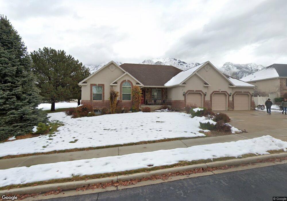
355 Red Pine Dr Alpine, UT 84004
Estimated Value: $953,000 - $1,129,000
4
Beds
3
Baths
4,056
Sq Ft
$251/Sq Ft
Est. Value
About This Home
This home is located at 355 Red Pine Dr, Alpine, UT 84004 and is currently estimated at $1,017,707, approximately $250 per square foot. 355 Red Pine Dr is a home located in Utah County with nearby schools including Westfield School, Timberline Middle School, and Lone Peak High School.
Ownership History
Date
Name
Owned For
Owner Type
Purchase Details
Closed on
May 17, 2019
Sold by
Pedigo Troy K and Pedigo Alexandra
Bought by
Pedigo Troy K and Pedigo Alexandra
Current Estimated Value
Home Financials for this Owner
Home Financials are based on the most recent Mortgage that was taken out on this home.
Original Mortgage
$253,800
Outstanding Balance
$165,203
Interest Rate
4.1%
Mortgage Type
New Conventional
Estimated Equity
$852,504
Purchase Details
Closed on
Mar 29, 1999
Sold by
Taylor Homes Associates Inc
Bought by
Harvey Harry and Harvey Deanna
Home Financials for this Owner
Home Financials are based on the most recent Mortgage that was taken out on this home.
Original Mortgage
$240,000
Interest Rate
6.73%
Create a Home Valuation Report for This Property
The Home Valuation Report is an in-depth analysis detailing your home's value as well as a comparison with similar homes in the area
Home Values in the Area
Average Home Value in this Area
Purchase History
| Date | Buyer | Sale Price | Title Company |
|---|---|---|---|
| Pedigo Troy K | -- | Metro National Title | |
| Harvey Harry | -- | First American Title Co | |
| Taylor Homes Associates Inc | -- | First American Title Co |
Source: Public Records
Mortgage History
| Date | Status | Borrower | Loan Amount |
|---|---|---|---|
| Open | Pedigo Troy K | $253,800 | |
| Closed | Harvey Harry | $240,000 |
Source: Public Records
Tax History
| Year | Tax Paid | Tax Assessment Tax Assessment Total Assessment is a certain percentage of the fair market value that is determined by local assessors to be the total taxable value of land and additions on the property. | Land | Improvement |
|---|---|---|---|---|
| 2025 | $4,031 | $532,895 | -- | -- |
| 2024 | $4,031 | $469,810 | $0 | $0 |
| 2023 | $3,638 | $455,235 | $0 | $0 |
| 2022 | $3,824 | $464,695 | $0 | $0 |
| 2021 | $3,392 | $640,200 | $279,600 | $360,600 |
| 2020 | $3,290 | $607,700 | $254,200 | $353,500 |
| 2019 | $3,095 | $596,800 | $254,200 | $342,600 |
| 2018 | $2,749 | $523,800 | $225,900 | $297,900 |
| 2017 | $2,686 | $272,360 | $0 | $0 |
| 2016 | $2,693 | $254,540 | $0 | $0 |
| 2015 | $2,549 | $227,975 | $0 | $0 |
| 2014 | $2,269 | $200,750 | $0 | $0 |
Source: Public Records
Map
Nearby Homes
- 202 E Alpine Dr
- 250 S Main St Unit 25
- 250 S Main St Unit 20
- 250 S Main St Unit 9
- 250 S Main St Unit 7
- 88 W Cascade Ave
- 48 N 100 E
- 30 S Main St
- 259 Twin River Loop
- 887 E Village Way
- 682 Healey Blvd
- 1063 E Alpine Dr
- 868 S Braddock Ln
- 5046 W Jonathon Rd Unit 10
- 475 Grove Dr
- 151 Glacier Lily Dr
- 1263 E Chapman Ct
- 11107 Manor Dr Unit 1
- 196 Holly Dr
- 76 N Bald Mountain Dr
- 358 Silver Leaf Dr
- 363 Red Pine Dr
- 438 Wood Dr
- 434 Wood Dr
- 370 Silver Leaf Dr
- 339 Red Pine Dr
- 390 Ponderosa Dr
- 370 S Ponderosa Dr
- 365 Silver Leaf Dr
- 375 E Silver Leaf Dr
- 342 Red Pine Dr
- 348 Red Pine Dr
- 395 Ridge Dr
- 340 E Ridge Dr
- 340 Ridge Dr
- 319 Red Pine Dr
- 319 Red Pine Dr Unit 39
- 399 Wood Dr Unit 339
- 395 Silver Leaf Dr
- 385 Ponderosa Dr
Your Personal Tour Guide
Ask me questions while you tour the home.