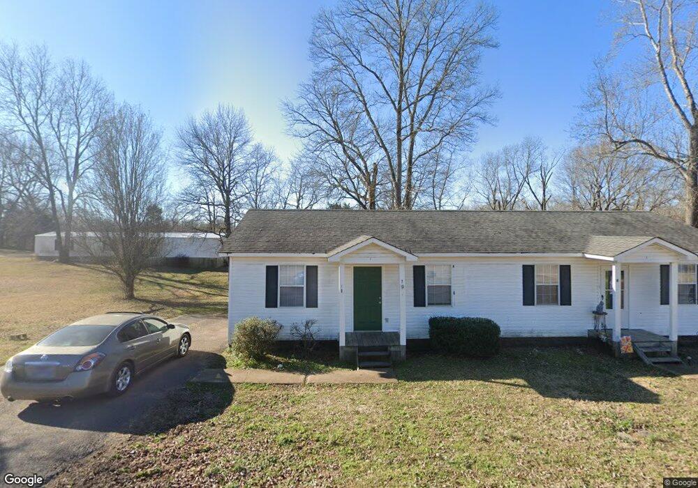
355 Roy Crunk Ln Unit 363 Savannah, TN 38372
Estimated Value: $61,000 - $155,000
--
Bed
2
Baths
1,296
Sq Ft
$83/Sq Ft
Est. Value
About This Home
This home is located at 355 Roy Crunk Ln Unit 363, Savannah, TN 38372 and is currently estimated at $108,000, approximately $83 per square foot. 355 Roy Crunk Ln Unit 363 is a home located in Hardin County with nearby schools including Hardin County High School.
Ownership History
Date
Name
Owned For
Owner Type
Purchase Details
Closed on
May 23, 2024
Sold by
Hunt John C and Hunt Anita E
Bought by
Haggard Tristen and Camden Floyd
Current Estimated Value
Home Financials for this Owner
Home Financials are based on the most recent Mortgage that was taken out on this home.
Original Mortgage
$1,200,000
Outstanding Balance
$1,013,538
Interest Rate
6.88%
Mortgage Type
Credit Line Revolving
Estimated Equity
-$905,538
Purchase Details
Closed on
Feb 28, 2005
Sold by
Reeves Allen G
Bought by
John Junt
Purchase Details
Closed on
Jun 20, 1996
Sold by
Coln Bobby D and Coln B
Bought by
B & G Housing
Purchase Details
Closed on
Jan 5, 1993
Bought by
Coln Bobby & D/B/A B & G Housing
Purchase Details
Closed on
Mar 16, 1992
Bought by
Crunk Carolyn G
Purchase Details
Closed on
Dec 31, 1986
Bought by
Crunk Roy & B & G Cont Co
Purchase Details
Closed on
Apr 28, 1981
Create a Home Valuation Report for This Property
The Home Valuation Report is an in-depth analysis detailing your home's value as well as a comparison with similar homes in the area
Home Values in the Area
Average Home Value in this Area
Purchase History
| Date | Buyer | Sale Price | Title Company |
|---|---|---|---|
| Haggard Tristen | -- | None Listed On Document | |
| John Junt | $52,500 | -- | |
| B & G Housing | -- | -- | |
| Coln Bobby & D/B/A B & G Housing | $12,500 | -- | |
| Crunk Carolyn G | -- | -- | |
| Crunk Roy & B & G Cont Co | -- | -- | |
| -- | -- | -- |
Source: Public Records
Mortgage History
| Date | Status | Borrower | Loan Amount |
|---|---|---|---|
| Open | Haggard Tristen | $1,200,000 |
Source: Public Records
Tax History Compared to Growth
Tax History
| Year | Tax Paid | Tax Assessment Tax Assessment Total Assessment is a certain percentage of the fair market value that is determined by local assessors to be the total taxable value of land and additions on the property. | Land | Improvement |
|---|---|---|---|---|
| 2024 | $604 | $34,520 | $2,240 | $32,280 |
| 2023 | $604 | $34,520 | $2,240 | $32,280 |
| 2022 | $496 | $24,080 | $1,840 | $22,240 |
| 2021 | $496 | $24,080 | $1,840 | $22,240 |
| 2020 | $496 | $24,080 | $1,840 | $22,240 |
| 2019 | $496 | $24,080 | $1,840 | $22,240 |
| 2018 | $480 | $24,080 | $1,840 | $22,240 |
| 2017 | $500 | $24,040 | $1,840 | $22,200 |
| 2016 | $500 | $24,040 | $1,840 | $22,200 |
| 2015 | $438 | $24,040 | $1,840 | $22,200 |
| 2014 | $438 | $24,040 | $1,840 | $22,200 |
Source: Public Records
Map
Nearby Homes
- 0 Cordova Cove
- 0 Cordova Cove
- LOT 17 Cordova Cove
- LOT 34 Cordova Cove
- 225 Cordova Cove
- 95 Cedar Cove Ln
- 850 Cordova Cove
- 5115 Tennessee 226
- 1820 Pinhook Rd
- 134 Horse Creek Rd
- 470 Olivet Dr
- 41 Bartley Dr
- 00 Squaw St
- 6170 Tennessee 226
- 280 Meadowlane Dr
- 295 Claybrook Dr
- 134 Vine St
- 70 Red Fern Cove
- 145 Tom Way
- 210 Trinity Cir
- 375 Roy Crunk Ln Unit 385
- 350 Roy Crunk Ln Unit 356
- 335 Roy Crunk Ln
- 395 Roy Crunk Ln Unit 405
- 390 Roy Crunk Ln Unit 400
- 415 Roy Crunk Ln Unit 421
- 295 Roy Crunk Ln Unit 305
- 410 Roy Crunk Ln Unit 420
- 435 Roy Crunk Ln Unit 441
- 290 Roy Crunk Ln Unit 300
- 170 Wildflower Ridge Ln
- 285 Roy Crunk Ln Unit 275
- 280 Roy Crunk Ln
- 256 Roy Crunk Ln
- 317 Allison Ln
- 405 Allison Ln
- 365 Allison Ln
- 245 Roy Crunk Ln
- 496 Roy Crunk Ln
- 215 Roy Crunk Ln Unit 225