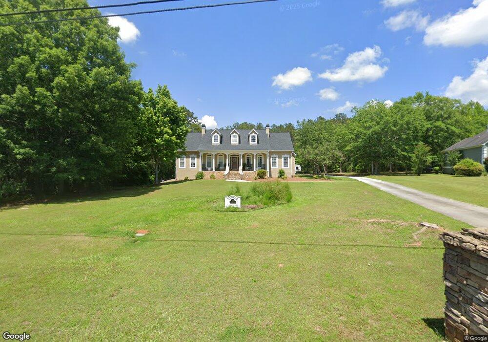
355 Saint Andrews Dr Jackson, GA 30233
Estimated Value: $538,000 - $625,963
Studio
3
Baths
3,409
Sq Ft
$169/Sq Ft
Est. Value
About This Home
This home is located at 355 Saint Andrews Dr, Jackson, GA 30233 and is currently estimated at $577,741, approximately $169 per square foot. 355 Saint Andrews Dr is a home located in Butts County with nearby schools including Jackson High School.
Ownership History
Date
Name
Owned For
Owner Type
Purchase Details
Closed on
Apr 14, 2025
Sold by
Johnson Lisa
Bought by
Johnson James Bradley and Johnson Lisa N
Current Estimated Value
Purchase Details
Closed on
Jul 16, 2007
Sold by
Deutsche Bank National Tru
Bought by
Johnson Lisa
Home Financials for this Owner
Home Financials are based on the most recent Mortgage that was taken out on this home.
Original Mortgage
$275,469
Interest Rate
6.71%
Mortgage Type
New Conventional
Purchase Details
Closed on
Jan 2, 2007
Sold by
Not Provided
Bought by
Johnson Lisa and Johnson James B
Create a Home Valuation Report for This Property
The Home Valuation Report is an in-depth analysis detailing your home's value as well as a comparison with similar homes in the area
Home Values in the Area
Average Home Value in this Area
Purchase History
| Date | Buyer | Sale Price | Title Company |
|---|---|---|---|
| Johnson James Bradley | -- | -- | |
| Johnson Lisa | $255,700 | -- | |
| Johnson Lisa | -- | -- |
Source: Public Records
Mortgage History
| Date | Status | Borrower | Loan Amount |
|---|---|---|---|
| Previous Owner | Johnson Lisa | $275,469 |
Source: Public Records
Tax History
| Year | Tax Paid | Tax Assessment Tax Assessment Total Assessment is a certain percentage of the fair market value that is determined by local assessors to be the total taxable value of land and additions on the property. | Land | Improvement |
|---|---|---|---|---|
| 2025 | $5,746 | $252,440 | $15,960 | $236,480 |
| 2024 | $6,295 | $252,440 | $15,960 | $236,480 |
| 2023 | $6,590 | $244,853 | $15,960 | $228,893 |
| 2022 | $5,481 | $203,981 | $12,000 | $191,981 |
| 2021 | $5,446 | $189,498 | $12,000 | $177,498 |
| 2020 | $5,460 | $182,973 | $12,000 | $170,973 |
| 2019 | $4,236 | $147,212 | $12,000 | $135,212 |
| 2018 | $4,070 | $135,753 | $12,000 | $123,753 |
| 2017 | $3,608 | $118,488 | $12,000 | $106,488 |
| 2016 | $3,650 | $116,888 | $10,400 | $106,488 |
| 2015 | $3,265 | $116,888 | $10,400 | $106,488 |
| 2014 | $3,159 | $100,254 | $10,400 | $89,854 |
Source: Public Records
Map
Nearby Homes
- 480 Hickory Ridge Rd
- 330 James Moore Cir
- 1375 Highway 42 S
- 14 Weaver St
- 908 Nelson St
- 124 Harper St
- 347 Ww Carr Ave
- 544 Franklin St
- 144 Blake Ave
- 321 Kirts Ridge
- 193 Brownlee Rd
- 478 Grand Magnolia St
- 476 Grand Magnolia St
- 474 Grand Magnolia St
- 472 Grand Magnolia St
- 504 Grand Magnolia St
- 466 Grand Magnolia St
- 475 Grand Magnolia St
- 473 Grand Magnolia St
- 333 Saint Andrews Dr
- 456 Briarcliff Rd
- 412 Briarcliff Rd
- 393 Saint Andrews Dr
- 366 St Andrews Dr
- 366 Saint Andrews Dr
- 295 Saint Andrews Dr
- 295 St Andrews Dr
- 478 Briarcliff Rd
- 876 Park Place Dr
- 416 Saint Andrews Dr
- 298 Saint Andrews Dr
- 416 St Andrews Dr
- 415 Briarcliff Rd
- 251 Saint Andrews Dr
- 251 St Andrews Dr
- 336 Briarcliff Rd
- 111 Thornbury Ct
- 848 Park Place Dr
- 465 Saint Andrews Dr Unit 12
Your Personal Tour Guide
Ask me questions while you tour the home.