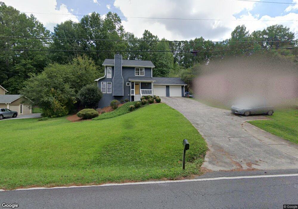
3552 Bryant Ln Marietta, GA 30066
Sandy Plains NeighborhoodEstimated Value: $414,195 - $459,000
3
Beds
3
Baths
1,696
Sq Ft
$260/Sq Ft
Est. Value
About This Home
This home is located at 3552 Bryant Ln, Marietta, GA 30066 and is currently estimated at $440,299, approximately $259 per square foot. 3552 Bryant Ln is a home located in Cobb County with nearby schools including Rocky Mount Elementary School, Simpson Middle School, and Lassiter High School.
Ownership History
Date
Name
Owned For
Owner Type
Purchase Details
Closed on
Sep 8, 2005
Sold by
Adkins Robert G and Adkins Beverly S
Bought by
Cottrell Dustin and Cottrell Adrienne
Current Estimated Value
Home Financials for this Owner
Home Financials are based on the most recent Mortgage that was taken out on this home.
Original Mortgage
$128,000
Outstanding Balance
$67,715
Interest Rate
5.77%
Mortgage Type
New Conventional
Estimated Equity
$372,584
Purchase Details
Closed on
Dec 20, 2002
Sold by
Adkins Robert G
Bought by
Adkins Robert G and Adkins Beverly S
Home Financials for this Owner
Home Financials are based on the most recent Mortgage that was taken out on this home.
Original Mortgage
$76,500
Interest Rate
5.99%
Mortgage Type
New Conventional
Create a Home Valuation Report for This Property
The Home Valuation Report is an in-depth analysis detailing your home's value as well as a comparison with similar homes in the area
Home Values in the Area
Average Home Value in this Area
Purchase History
| Date | Buyer | Sale Price | Title Company |
|---|---|---|---|
| Cottrell Dustin | $160,000 | -- | |
| Adkins Robert G | -- | -- |
Source: Public Records
Mortgage History
| Date | Status | Borrower | Loan Amount |
|---|---|---|---|
| Open | Cottrell Dustin | $128,000 | |
| Previous Owner | Adkins Robert G | $76,500 |
Source: Public Records
Tax History Compared to Growth
Tax History
| Year | Tax Paid | Tax Assessment Tax Assessment Total Assessment is a certain percentage of the fair market value that is determined by local assessors to be the total taxable value of land and additions on the property. | Land | Improvement |
|---|---|---|---|---|
| 2025 | $3,330 | $140,556 | $34,000 | $106,556 |
| 2024 | $3,333 | $140,556 | $34,000 | $106,556 |
| 2023 | $2,790 | $140,556 | $34,000 | $106,556 |
| 2022 | $3,049 | $126,392 | $20,000 | $106,392 |
| 2021 | $2,264 | $90,528 | $18,000 | $72,528 |
| 2020 | $2,264 | $90,528 | $18,000 | $72,528 |
| 2019 | $2,264 | $90,528 | $18,000 | $72,528 |
| 2018 | $2,264 | $90,528 | $18,000 | $72,528 |
| 2017 | $1,887 | $77,292 | $18,000 | $59,292 |
| 2016 | $1,632 | $65,668 | $16,800 | $48,868 |
| 2015 | $1,674 | $65,668 | $16,800 | $48,868 |
| 2014 | $1,689 | $65,668 | $0 | $0 |
Source: Public Records
Map
Nearby Homes
- 3663 Heatherwood Dr NE
- 3851 Trickum Rd NE
- 2477 Bobbie Dr
- 3634 Stonehenge Way NE
- 3287 Allegheny Dr
- 3835 Rockhaven Ct
- 3465 Staci Ct NE
- 3812 Havenrock Dr
- 3816 Havenrock Dr
- 2403 Wistful Way
- 2415 Wistful Way
- 1984 Credence Ct NE
- 3844 Havenrock
- 2124 Lassiter Field Dr NE
- 1833 Lake Ebenezer Trail NE
- 1810 Ebenezer Farm Cir
- 4050 Idlewilde Meadows Dr NE
- 2011 Shadowwood Dr
- 3150 Trickum Rd NE Unit LOT 1
- 3150 Trickum Rd NE
- 3542 Bryant Ln
- 3562 Bryant Ln
- 3532 Bryant Ln
- 3559 Ulster Ln NE
- 3549 Ulster Ln NE
- 3569 Ulster Ln NE
- 3596 Downing St
- 3598 Downing St
- 3594 Downing St
- 3539 Ulster Ln NE
- 3600 Downing St
- 2250 Sims Dr NE
- 3522 Bryant Ln
- 2213 Sims Dr NE
- 3592 Downing St Unit 1
- 0 Downing St Unit 3278324
- 0 Downing St Unit 3207290
- 0 Downing St Unit 8810452
- 0 Downing St Unit 8557949
- 0 Downing St Unit 8551373